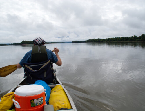
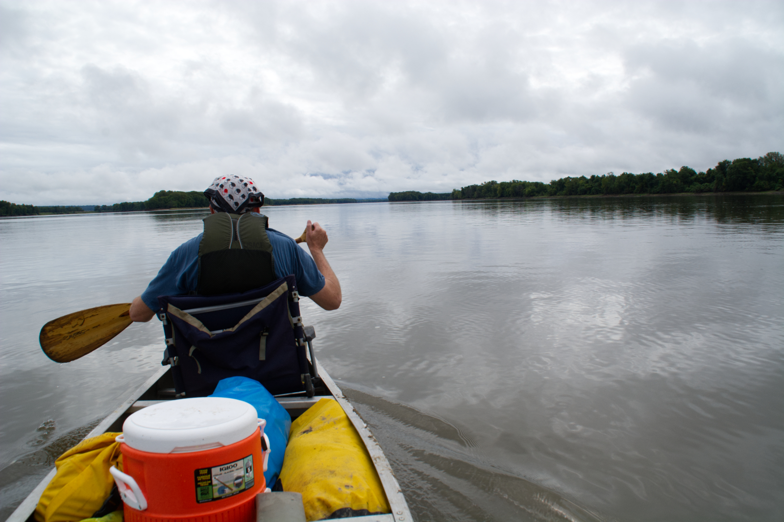
Maybe you’re like most people in that you enjoy paddling, but you stick to lakes and small rivers. Maybe, though, you’re ready for a new experience. Maybe you’re ready to join the growing number of paddlers who are discovering the pleasure of taking their canoes, kayaks, and stand-up paddleboards (SUPs) on the Mississippi and other big rivers. The Mississippi offers a variety of paddling experiences, so you can find a route that will match your skill and experience level, plus you still get quality time out in the wilderness.
For paddlers with little experience, the best places to start are the backwater trails of the Upper Mississippi River and the Mississippi above the Twin Cities. I probably don’t need to state this, but I will: if you are inexperienced, go paddling with someone who knows their way around a canoe, kayak, or SUP. For seasoned paddlers, the big waters and wild miles of the Lower and Middle Mississippi offer a good challenge with plenty of rewards. If your experience falls between these two levels, you’re in luck, too: there are a whole bunch of routes that will be challenging and satisfying.
The risks of paddling on the Mississippi are often overstated. Yes, it can be dangerous and people drown in the river every year. But if you respect the power of the river and prepare for what it can throw your way, there’s no need to be afraid. Honestly, most of the risks are of human origin: structures in the water like wing dams that were built to narrow the channel and commercial traffic that can kick up big waves. Learn how to deal with the hazards and your paddling experience will be much better.
Here are a few tips to keep in mind to prepare for your paddle the Mississippi:
- Always wear a personal flotation device. Always.
- Bring plenty of sunscreen; wear a hat and sunglasses. Out on the river, there’s no place to hide from the sun. You’ll burn quickly if you aren’t prepared.
- Bring plenty of drinking water.
- If you’re paddling in spring or early summer, the water can be surprisingly cold. If you fall in the river, hypothermia is a real possibility. Consider wearing a wetsuit if the water temperature is below 60°. If you fall in the water, the wetsuit will buy you valuable time.
- Take your time. If you’re not in a rush, you’ll see more of the river and its wildlife, plus it’ll be easier to spot potential hazards.
- Check the weather report before you leave. Getting caught on the river in a big storm isn’t just inconvenient, it’s dangerous.
- If the forecast calls for strong winds (anything above 10-15 mph), especially strong headwinds, the paddling will be tough going and the whitecaps can swamp your boat. You might want to pick a calmer day to paddle, especially if you are new at this.
- Navigation maps are readily available for most of the river; you can download electronic copies for free of the Upper Mississippi and Lower Mississippi. Look at the maps for the route you’d like to follow, so you can see if there might be any potential barriers, like closing dams and wing dams.
- Paddle with a friend. If you paddle alone, let someone know where you plan on paddling and when.
- If you don’t have a boat of your own, rent one from one these outfitters. On the Middle or Lower Mississippi, you can rent boats or book a guided tour with Big Muddy Adventures or the Quapaw Canoe Company.
- The Mississippi is a major commercial highway and the barges have priority. Scan through this guide for tips on how to paddle safely and respectfully around the bigger boats.
- The Upper Mississippi has a series of locks and dams. If you plan on traveling a distance greater than 20 or 30 miles, you’ll have to go through a lock to continue on your trip. It’s free, and you can read instructions here, but it can significantly slow your progress. You could portage around the locks, but that might not be much fun if you have a heavy boat or a lot of gear. Most paddlers will probably want to stick to an area between the dams.
Below is a list of the officially designated water trails along the Mississippi. Many of these are signed to help you navigate your way through; most have multiple access points so you can customize the length you want to paddle. Keep in mind, though, that you can paddle anywhere on the Mississippi—its’s everyone’s river; you don’t have to stick to a designated water trail. If you decide to paddle a route that isn’t an official water trail, though, I strongly recommend that you consult the navigation charts referenced above before you set out.
- Mississippi River State Water Trail: 665 miles.
The entire Mississippi River in Minnesota from Itasca State Park to the Iowa border is a designated water trail; you can find detailed maps for any portion of the river at the above link. The paddling is excellent and varied and appropriate for a variety of skill levels. You can paddle through thick marshes or a small winding Headwaters stream. The Mississippi River passes through some big lakes in the Headwaters region; day paddlers will probably want to skip these. In the Headwaters area, day paddlers will have a better experience if they put in a few miles downriver of Lake Itasca, as the very early stretches of the river are often too shallow to paddle. Coffee Pot Landing and Iron Bridge Landing would be good places to start a day paddle. There are a number of dams upriver of the Twin Cities that paddlers have to portage around, so look out for those when you plan your trip.
The Mississippi River through the Twin Cities is a designated federal recreation area. While it passes through an urban area, it’s often easy to forget that you’re in the middle of a heavily populated region. Highlights on this part of the river include St. Anthony Falls (you must portage around it), the only gorge on the Mississippi, Minnehaha Falls, and the confluence of the Mississippi and Minnesota Rivers. The lock and dam system begins here, as well. While paddlers must portage around the Upper St. Anthony Locks (and should continue the portage past the Lower St. Anthony Locks, too), they can lock through the others.
After the Twin Cities, there are several short water trails that run through the backwaters of the Upper Mississippi. You can get a complete list with links to maps and driving directions to access points through the Upper Mississippi River National Wildlife and Fish Refuge. Here’s a summary.
- Chippewa River Water Trail: 6.8 miles.
A loop that begins and ends on the Chippewa River, with a couple of miles on the Mississippi upriver of Wabasha, Minnesota. The return trip up Government Light Slough may take some effort as it is often against a current, especially if the water is high.
- Nelson-Trevino Trail: 4.5 miles.
A mostly easy paddle through the maze of backwaters at the confluence of the Chippewa and Mississippi Rivers near Nelson, Wisconsin.
- Finger Lakes Trail: 6.1 miles.
There’s an easy one-mile loop through the backwaters below lock and dam #4, and a longer five-mile route that requires a portage unless the river is high. Put in at Pioneer Landing east of Kellogg, Minnesota.
- Halfmoon Trail: 5.1 miles.
A somewhat challenging loop, especially in late summer when the vegetation is thick or when the wind is kicking up. Put in at Halfmoon Landing, which is a few miles south of Kellogg, Minnesota.
- Verchota Trail: 11.3 miles.
A nice challenge if you do the whole loop, since the first part of it is upstream. For an easier paddle, put in at Bass Camp and paddle downriver to Verchota Landing, which is near the Minnesota City Boat Club on Prairie Island Road.
- Aghaming Trail: 6.7 miles.
The trail begins on the main channel from Latsch Island at Winona, Minnesota, then loops back through a backwater channel.
- Voyageurs Canoe Trail: 3.4 miles.
An easy paddle in a backwater area within Perrot State Park at Trempealeau, Wisconsin.
- Long Lake Trail: 5 miles.
An easy loop paddle through the backwaters below Trempealeau, Wisconsin.
- Brown’s Marsh Canoe Area: No distance noted.
An easy backwaters paddle most of the time, although it can be shallow and covered with plants later in summer. This area is not signed. Put in at Lytle’s Landing at the end of County Road Z near Brice Prairie.
- Lake Onalaska Trail: 11 miles.
From Lytle’s Landing, you can also take an easy paddle down the Black River to Mosey Landing in the Mississippi/Black River confluence backwaters.
- Goose Island Trail: 7 miles.
A fairly easy loop paddle through the backwaters below La Crosse at Goose Island County Park; part of the loop requires upstream paddling.
- Reno Bottoms Trail: up to 14 miles.
A downriver paddle through the lush backwaters near Reno, Minnesota, an area with a few pairs of nesting bald eagles. There are several places to put in, so you can create a paddle as short as three miles; if you paddle the entire trail from the spillway to New Albin, Iowa, the distance is fourteen miles.
- Blue Heron Canoe Trail: up to 10 miles.
The trip from the New Albin, Iowa, boat landing to Big Slough Landing is ten-mile trip, with some of that time in the main channel. However, you can take out at Blackhawk Park for a shorter paddle (three miles).
- Ambro Slough Canoe Area: No distance noted.
An easy paddle through a backwater lake; late summer vegetation and shallow water can make the paddle a little more difficult. Put in at the ramp on Ambro Road, which is off County K north of Prairie du Chien.
- Wyalusing State Park Canoe Trail: 6.2 miles.
A signed route through the backwaters near the boat ramp at Wyalusing State Park in Wisconsin. Head upstream from the boat ramp, then loop around via the main channel before heading back upriver via a backwater channel.
- Johnson Slough Canoe Trail: 6.1 miles.
A loop that starts at the Sny Magil Access off County Highway X56 south of Pikes Peak State Park in Iowa; the trail goes upstream through a backwater channel and then downstream on the main channel for about three miles.
- Spring Lake Canoe Area: No distance noted.
A backwater lake south of Savanna, Illinois, off Highway 84; there is no signed route and the area is closed from October 1 until waterfowl hunting season ends.
- Rock Creek Canoe Loop Trail/Lost Lake Canoe Trail: 5.3 miles/3 miles.
An easy paddle through the backwaters beginning at Rock Creek Park south of Camanche, Iowa. The Lost Lake Canoe Trail begins at the same area; it is an easy three-mile paddle.
- Wapsipinicon River Trail: 10 miles.
This route follows the Wapsipinicon River from the Highway 67 access to the Mississippi River, then goes upstream to Rock Creek Park. Not a good trail for beginners.
- Dubuque Water Trail: 11 miles.
A down river paddle of up to eleven miles that starts at the A.Y. McDonald boat ramp just below lock and dam #11 in Dubuque, Iowa, and ends at Massey Marina. The paddle includes eight miles on the Mississippi; you can take a three-mile detour up Catfish Creek.
- Quad Cities Water Trails: up to 45 miles.
There are several possible routes along the Mississippi River between Princeton/Cordova and Buffalo/Andalusia. Before the lock system was built, this stretch of river had a series of rapids that challenged commercial navigation. You won’t notice any rapids now. This is an urban paddle but there are a number of wild places to explore, like around Sylvan Slough and Credit Island. You can do an easy paddle, like the two miles around Sylvan Slough, or challenge yourself with the entire forty-five mile route. If you paddle the whole distance, you’ll have to lock through, or portage around, two locks.
- Odessa Water Trail: up to 16.8 miles.
The Odessa Water Trail is several different routes through the Port Louisa National Wildlife Refuge, a dense backwater complex full of life. The northernmost point for the water trail is the Port Louisa boat ramp (river mile 441) south of Muscatine, Iowa; you can put in there and paddle down the channel about 6 ½ miles to the Toolesboro landing (this requires passing through lock and dam 17), where you can either take out or do a short portage to the South Trail and work your way back upriver through the backwaters (6.7 miles). Other paddling routes are as short as three miles.
- Mississippi River Water Trail: 121 miles.
The Mississippi River Water Trail runs from Saverton, Missouri to St. Louis, passing a lot of islands and backwater complexes that are a pleasure to explore. To complete the entire trail, you would have to pass through three locks and over (or around) the Chain of Rocks rapids. Many paddlers will prefer to stick to an area between dams. Highlights along the route include the previously mentioned islands and backwaters, the historic villages of Louisiana and Clarksville, the confluence of the Mississippi and Missouri Rivers, the Lewis and Clark State Historic Site, and the Chain of Rocks. If you are considering paddling over the Chain of Rocks, you should read this first.
- Middle and Lower Mississippi Water Trail: 1155 miles.
The granddaddy of water trails, the Middle and Lower Mississippi Water Trail follows a thousand miles of free-flowing river and wilderness through the heart of the lower US. The trail begins at the confluence of the Mississippi and Missouri Rivers and ends at the Gulf of Mexico. This is not the trail to start with if you’ve never paddled before. The bigger river requires advanced paddling skills, something you’ll understand clearly when you see the size of the boats that ply this part of the river. If you don’t have a lot of experience paddling on big water, you can still experience this part of the Mississippi in a canoe by booking a guided trip with Big Muddy Adventures in St. Louis or the Quapaw Canoe Company (based in Clarksdale, Mississippi but with satellite facilities in Vicksburg and Natchez, plus Helena, Arkansas).
Paddlers interested in this section of the Mississippi will find all the information they need at Rivergator.org. There are, of course, many highlights for a thousand-mile route, but a few of the more memorable ones include the Chickasaw Bluffs; Big Island and the vast wilderness where the White, Arkansas, and Mississippi Rivers meet; cypress swamps; and lots of solitude. The route also passes by the major cities of St. Louis, Memphis, Baton Rouge, and New Orleans. If you are paddling all the way to the Gulf of Mexico, you can stick to the busy main channel of the Mississippi or veer off down the wilder Atchafalaya River, a distributary of the Mississippi.
Have you paddled any of these routes? If so, leave a comment below and tell us about your experiences.
©Dean Klinkenberg, 2017
