Population for the Village of Fort Ripley (2010)
69
Introduction
Between Brainerd and Little Falls, an old frontier fort still lends its name to a small village on the Mississippi River and a National Guard training facility.
Visitor Information
Direct your questions to the Little Falls Convention and Visitors Bureau (320.616.4961).
History
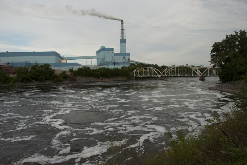
Fort Ripley
In 1848, members of the Ho Chunk (Winnebago) nation were moved from a reservation in Iowa to a new reservation in northern Minnesota to live on a strip of land between feuding Ojibwe and Dakota Indians, to act as a buffer, US authorities hoped. The US military opened a fort in the area in 1849 to keep an eye on everyone, eventually landing on the name Fort Ripley (its third name in two years), in honor of General Eleazar W. Ripley, a veteran of the War of 1812.
A space was cleared in the dense pine forest where the fort was built, a simple square design that faced the Mississippi on one side and had a blockhouse at each corner. The first soldiers moved in on May 13, 1849. Samuel Baldwin Olmstead lived across the Mississippi River from the fort where he logged and supplied the soldiers with meat and veggies but the nearest community of any size was seven miles upriver at Crow Wing or fifteen miles downriver at Little Falls.
The military established a large reservation on both sides of the Mississippi River. Most of the land, some 57,000 acres, was on the east side of the river and set aside for activities to support and supply the fort, like logging and farming. By 1857, other land in northern Minnesota became available to white settlers after land cessions by the Ojibwe and after the Ho Chunk had been moved again (to land along the Minnesota River this time). The military then decided to sell its 57,000 acres east of the Mississippi River, keeping just the one square mile on the west bank where the fort was located. The government divided the land into 40 acre sections and listed them at $1.25 an acre.
A few individuals were given permission to buy land directly, before the auction, primarily because they had land claims that pre-dated the arrival of the military. They registered and paid for their claims the day before the auction on October 19. The rest of the land was auctioned off the next day but lots sold for far less than the asking price: between one and twenty-five cents per acre. Some of the winners got certificates while others were told to wait until the report was submitted and approved. On November 11, 1857, the sales were cancelled by the Secretary of War, John Floyd, because the prices were too low.
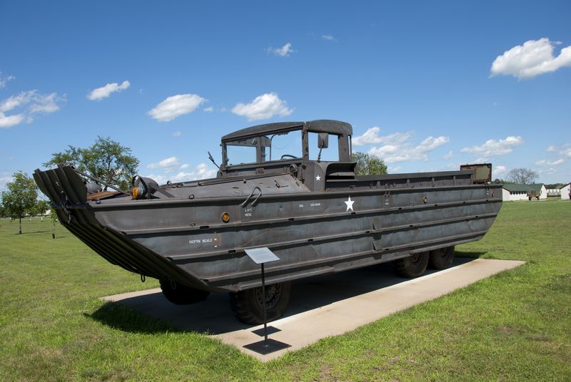
Outside the Minnesota Military Museum
Floyd’s actions set off a legal battle that lasted twenty years. All of the bidders had paid for their claims but none were refunded. Some claimants were awarded certificates of ownership but were left wondering if those certificates meant anything. The military retained control of the land but pressure kept growing to dispose of it. Congress authorized sale of the military reservation in 1873 but the process moved slowly and not much happened until 1877 when the fort itself was badly damaged by a fire. At that time, the military decided to abandon the fort and prepare to sell the land, but again the wheels turned slowly. In 1880, Congress finally passed a bill that transferred the land from the military to the Department of the Interior, which finally got the land on the market, minus portions set aside for a railroad and for squatters.
Back in 1857 when the military was first trying to sell off the reservation on the east side of the river, they had also decided to close the fort. On July 8, 1857 the troops were pulled out and reassigned. Unfortunately, trouble between the Ojibwe and new Europeans in the area soon broke out and threatened to evolve into a major fight, so the military had to re-garrison the fort. By early September, just two months after shutting it down, a new detachment arrived to occupy Fort Ripley.
The following summer (1858) was an unusually cool one, with plant-killing frosts on June 11, July 12, and August 28. On the plus side, that cold weather probably did a fine job of keeping the mosquito population in check. The fort was pretty quiet most of the time but did see increased activity during the Dakota Conflict of 1862, then a little later as a staging area for troops sent to fight Indians in 1863-64. The fire that badly damaged the fort erupted in January 1877; the fort was entirely abandoned within a year.
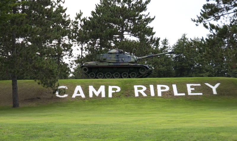
Camp Ripley
Soldiers train at Camp Ripley
Long after Fort Ripley closed, the Minnesota National Guard was looking for a new home to replace a base at Lake City that it had outgrown. In 1931, they bought 12,000 acres along the Mississippi River near the site of the old Fort Ripley. Out of respect for the old fort, the new camp took its name. Camp Ripley would later expand to over 50,000 acres with facilities to house 12,000 troops at any given point in time. From 1934-1942, men employed by the Works Progress Administration built the impressive stone entrance gate, towers, walls, and a building called Valhalla, the place the governor stays when he visits.
The Village of Fort Ripley
Besides the old fort and the National Guard camp, there is a small village called Fort Ripley that was first inhabited by Europeans in 1880; it was a stop along the new railroad to Brainerd. The village wouldn’t be much without the efforts of the Tucker family. John Tucker ran the depot for 34 years; his son, Claude, served as postmaster for 35 years. Fort Ripley had a grain elevator and was home to potato wholesalers in the early 1900s, which was most of its industry. Local folks incorporated as a city in 1927, although the place never attracted that many residents. In 2010, the official population was just 69, down from 92 residents twenty years earlier.
Exploring the Area
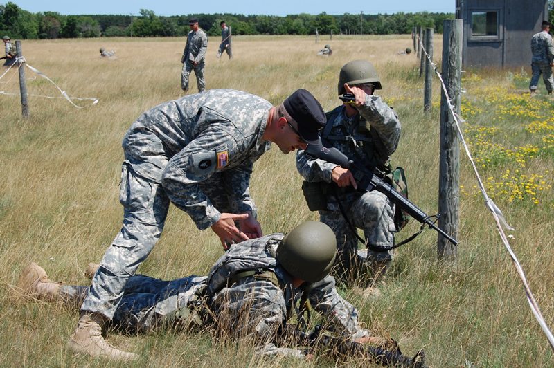
Everyone in your vehicle will need to show a valid ID to enter Camp Ripley. Once you are through security, visit the Minnesota Military Museum (15000 Highway 115; 320.616.6050), which has a good collection of guns (machine guns, Lugers, rifles, grenade launchers), war memorials, and outdoor exhibits with heavy equipment like tanks, helicopters, and troop movers.
The Minnesota State Veteran’s Cemetery (State Highway 115) is just east of the main entrance to Camp Ripley.
Just northwest of Camp Ripley, the Ripley Esker snakes across the landscape for about 7 miles. An esker is a remnant of the glacial era, a ridge built up from sand and gravel deposited by a stream beneath a glacier. You can walk across a ¾ mile segment at Ripley Esker State Natural Area (County Road 282; 651.259.5800); there are no maintained trails, but there is an old footpath you can follow. The views are best in spring and fall. From Camp Ripley, go north on State Highway 371 and exit at County Highway 48; after 0.7 miles, turn north on County Road 282. The parking area is about 1½ miles on the east side of the road.
**The Ripleys are covered in Road Tripping Along the Great River Road, Vol. 1. Click the link above for more. Disclosure: This website may be compensated for linking to other sites or for sales of products we link to.
Where to Go Next
Next stop downriver: Belle Prairie.
Next stop upriver: Baxter.
Community-supported writing
If you like the content at the Mississippi Valley Traveler, please consider showing your support by making a one-time contribution or by subscribing through Patreon. Book sales don’t fully cover my costs, and I don’t have deep corporate pockets bankrolling my work. I’m a freelance writer bringing you stories about life along the Mississippi River. I need your help to keep this going. Every dollar you contribute makes it possible for me to continue sharing stories about America’s Greatest River!
©Dean Klinkenberg, 2015