Over 3,000 years ago, a community of people who lived off the land constructed a remarkable group of earthworks that includes mounds, a plaza, and a series of C-shaped rings where they probably built houses. In this episode, I talk with Dr. Diana Greenlee about this amazing place, Poverty Point World Heritage Site. We talk about the various earthworks that make up the site, how they were built, and what we know about the people who built them. Dr. Greenlee patiently corrects my misunderstandings about the site, and clearly explains what we know about it. In the Mississippi Minute, I’m reminded about a piece of river history that can give us hope today.
Show Notes
Poverty Point World Heritage Site website
Follow Poverty Point on Facebook
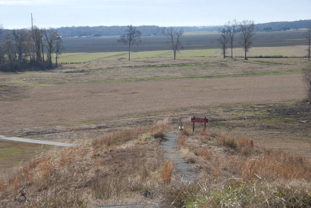
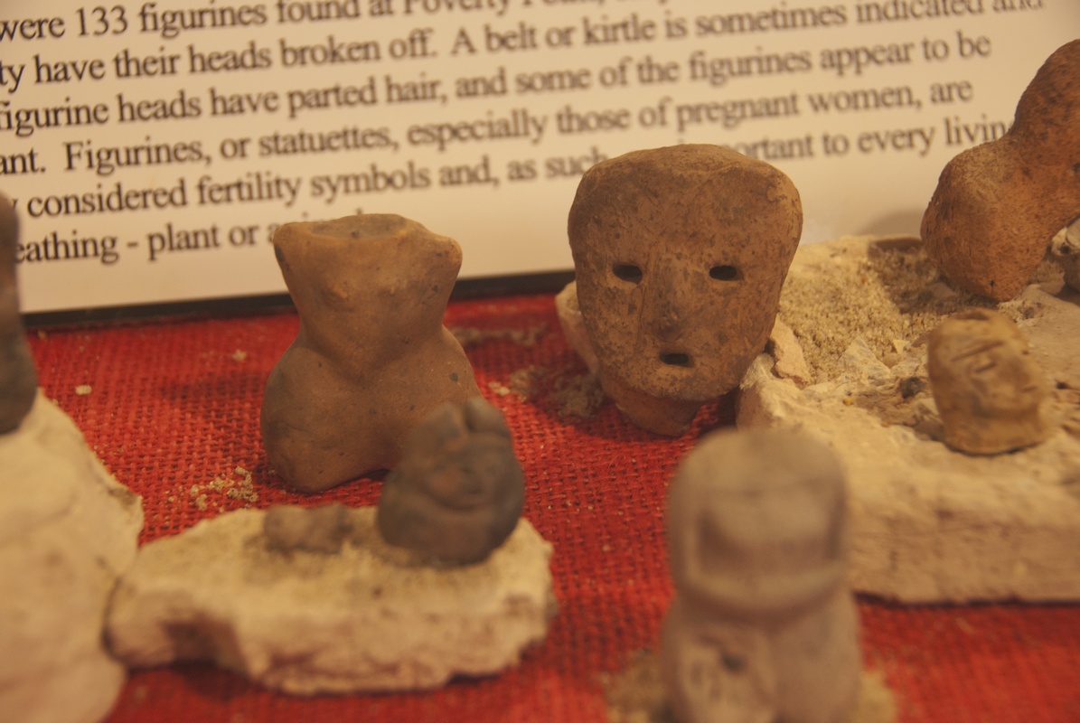
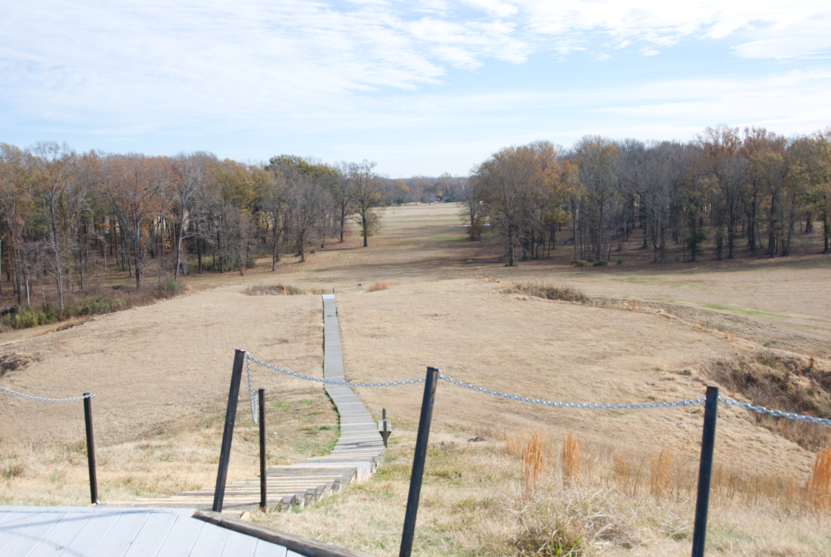
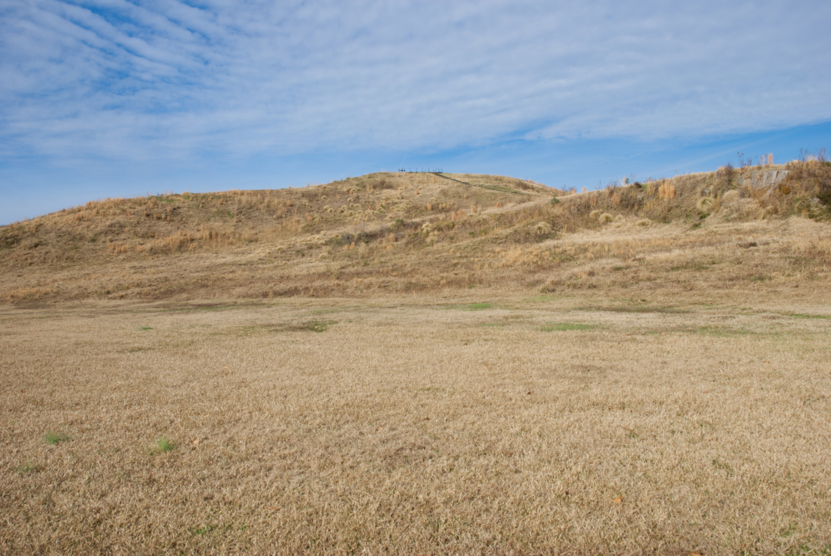
Below are a few photos from Poverty Point.
Support the Show
If you are enjoying the podcast, please consider showing your support by making a one-time contribution or by supporting as a regular contributor through Patreon. Every dollar you contribute makes it possible for me to continue sharing stories about America’s Greatest River.
Don’t want to deal with Patreon? No worries. You can show some love by buying me a coffee (which I drink a lot of!). Just click on the link below.
Transcript
Mon, Nov 27, 2023 5:50PM • 58:04
SUMMARY KEYWORDS
people, river, mound, site, ridge, mississippi, archaeologists, mounds, built, poverty, pretty, basket, dirt, earthworks, years, places, podcast, artifacts, mississippi river, watson
SPEAKERS
Dean Klinkenberg, Dr. Diana Greenlee
Dr. Diana Greenlee 00:00
It’s every time I set out to do a little bit of research to you know, look at one particular question, it just opens up so many more questions.
Dean Klinkenberg 00:29
Welcome to the Mississippi Valley Traveler Podcast. I’m Dean Klinkenberg and I’ve been exploring the deep history and rich culture of the people and places along America’s greatest river, the Mississippi, since 2007. Join me as I go deep into the characters and places along the river and occasionally wander into other stories from the Midwest and other rivers. Read the episode show notes and get more information on the Mississippi at MississippiValleyTraveler.com. Let’s get going.
Dean Klinkenberg 00:59
Welcome to Episode 14 of the Mississippi Valley Traveler Podcast. Today we’re going to take a step back into the past. Going back over 3000 years in fact to talk about a community that built some of the most impressive earthworks in North America. Although they aren’t the oldest or the biggest earthworks. More of you probably know about Cahokia Mounds near St. Louis than this particular place, which is known as Poverty Point World Heritage Site. It’s in northeast Louisiana, about 15 miles west of the Mississippi River, atop a narrow ridge of high ground known as Mason Ridge, about 130 miles long, that snakes its way through swamps and floodplain forests that the Mississippi River used to flood seasonally. In this episode, we’ll talk about the different elements of the sites. The mounds and plazas. How we think these earthworks were built. The significance of the site. So these were earthworks built by people we classify as hunter-gatherers, that we didn’t previously believe were capable of organizing the labor to build architecture on this scale. We speculate a little bit about why they might have built this particular site. It’s a really entertaining conversation. Diana Greenlee is the station archaeologist at Poverty Point. And she very politely corrects many of my misunderstandings about the site. It’s a good reminder that no matter how much I read, there is always more to read to fill out my my understanding of these things. And she’s very cautious with her interpretations as a good scientist is, and I think you’ll find that she explains very clearly the rationale for the interpretations that she’s comfortable making. She essentially just lets the site speak for itself rather than interpreting too far beyond what the artifacts and the site has to say. I’ll drop some photos in the show notes so you can check those out. Thanks to the patreon supporters once again, you helped make this podcast possible. If you’re interested in contributing to the podcast, you can go to my website MississippiValleyTraveler.com/podcast, where you can make a one time donation to help pay for my coffee habit, or you can become a patreon subscriber. Now let’s get on to the interview.
Dean Klinkenberg 03:27
Dr. Diana Greenlee is a station archaeologist at Poverty Point World Heritage Site and adjunct professor of archaeology in the School of Sciences at the University of Louisiana at Monroe. She is also co-author of the book “Poverty Point: Revealing the Forgotten City”, which she wrote with Jenny Ellerbe. Welcome to the podcast, Diana.
Dr. Diana Greenlee 04:00
Oh, thank you. I’m happy to be here.
Dean Klinkenberg 04:05
It’s a pleasure to talk with you today. I think maybe the place that we should start is can you just give us a quick little description of what exactly the Poverty Point World Heritage site is?
Dr. Diana Greenlee 04:19
Poverty Point World Heritage site is a monumental earthworks site that was built by Native Americans, hunters and gatherers about roughly 3400 years ago. Which is really amazing because for a long time, archaeologists didn’t think that people who lived through hunting and fishing and gathering could construct monumental architecture like the mounds and and ridges that we have here. The other really amazing thing about Poverty Point is that many tons of stone were brought here to create their tools and ornaments because there’s no naturally occurring stone at this location. So it’s just an awesome site.
Dean Klinkenberg 05:11
So not everything was built all at once. And I think of all the features, Mound A is one of the more interesting ones, if I’ve got the right mound. Is it, if I remember right, it might be the second largest earthworks in North America?
Dr. Diana Greenlee 05:27
Yeah, that’s, that’s right, by volume. It would be the second largest mountain in North America and, you know, some 1800 to 2000 years older than the largest one. So yeah, it’s pretty cool.
Dean Klinkenberg 05:42
What do we think we know about how that mound was built?
Dr. Diana Greenlee 05:48
Um, well, it appears to have been built in sort of three separate stages. The first being, so you have to envision the mound, some people have called it The Bird Mound because it’s kind of T-shaped. And so you would have this, what we would call the cone or the wings was built first, followed rapidly or even at the same time, by the, what would be the tail of the bird, what we would call the platform. And then at some point after that, a ramp that connects the two because the the platform is much lower than the the cone or wings part. What’s really interesting is that the dirt that was used to build that cone or wing is quite different from the dirt that was used to build the platform. So in the cone part, this first construction, the dirt is pretty homogeneous. I mean, you know, it doesn’t vary a whole lot. You can’t, in the cores, can’t identify different basket loads. It all looks like heavily weathered dirt that was piled up. When you look at the platform, you can identify individual basket loads, and those basket loads have dirt that would have come from different depths, or different locations on the site in terms of the drainage. And so you have your dark topsoil, your A horizon material, you’ve got what we call an E horizon, which is a gray silty dirt that forms in areas where you have a depression where water sits for long periods of time and essentially washes the color out and washes the clays out. So it’s very silty and gray. And then you have the B horizon, which is generally underneath that, which is kind of a brown, sometimes going to sort of yellowish brown or reddish brown. And so you look at a basket load and you just have lumps of these different colors. It’s, it’s really quite pretty. If you like your dirt, I guess
Dean Klinkenberg 08:26
And who doesn’t?
Dr. Diana Greenlee 08:28
Well, I have yet to find somebody who doesn’t like dirt.
Dean Klinkenberg 08:33
So it sounds like they must have been excavating fairly deep then to get soil from that far down using stone tools of some kind, or what do we think about that?
Dr. Diana Greenlee 08:47
Could have been stone tools. Could have been digging sticks or, you know, later time periods used scapula, deer scapula or whatever, you know, bones. They wouldn’t have had to go super deep. I mean, we’re we’re talking maybe, you know, two or three feet, something like that, to get that. One of the pretty amazing things is that Dr. Kidder and his colleagues did was to look for evidence of any pauses during the construction of this mountain because it’s huge. It’s you know, 238,000 cubic meters of dirt, which is like if you think of it in terms of basket loads, like 50 pound basket loads of dirt. It’s like 15 and a half million basket loads. This is a giant mound. And to get back to what I was saying, they they could not find any evidence in their excavation, or their cores, to suggest that once they started, that they stopped until they were essentially done. And they couldn’t find evidence for significant rainfall over that time period. And, you know, the record at the time in northeast Louisiana was probably, you know, a month without a good rainfall. Now, I think it’s probably a little longer. But they being sort of conservative, or I guess that’s the way you’d look at it. They said, “Well, you know, it must have been done in let’s say, three months time.” So 90 days or less for the construction of this mound is it is quite remarkable.
Dean Klinkenberg 10:46
And I think I know the answer to this, but alas, do, we have a ballpark guess as to how many people it would take to build a mound of that size and volume in 90 days?
Dr. Diana Greenlee 10:57
Well, they did do some calculations based on, I guess, ethnographic observations of how much dirt a person could move in a day. And, you know, so then how many days dividing it all up, and I think they’re saying, you know, less than 10,000 total people. So that includes not only the people who are moving the dirt every day, but the people who are, you know, repairing the baskets, the people who are preparing the food, looking after the kids, you know, going for water, doing whatever needed to be done. So it would have been a big community project, larger than just, you know, people who were living at the site.
Dean Klinkenberg 11:52
When you think about just the simple logistical challenges to pull that off, to coordinate that many people, to feed that many people, you know, as you said, to have the baskets and the tools to move it. Somebody has to be paying attention to getting the dirt laid correctly, and the progress of the mound, that that’s a remarkable effort for people of any era, really. But this was a group of people who previously we assumed did not engage in that level of a coordinated construction, right?
Dr. Diana Greenlee 12:24
Oh, yeah, for sure. For sure. You know, and the other thing you have to think about is, okay, so, you know, in the platform, when you have this dirt that’s gotta be from, you know, at least some different locations, they couldn’t just dig a single hole and take that dirt and pile it up. I mean, it looks like the basket loads, like there was almost a recipe. You have some of this, and some of that, and some of that. And so thinking about the logistics of that, and are you carrying your basket from place to place. Was the dirt already in place and ready? So that means they moved it twice? You know? You know, the logistics, when you really start thinking about it are pretty remarkable. And I know it’s a project I wouldn’t want to take on.
Dean Klinkenberg 13:20
No, I couldn’t imagine even what it would take to plan it myself. So that’s, it’s extraordinary, though. The other feature of the site that’s really unique, would be that semi-elliptical plaza or the terraces. Can you describe that a little bit, please?
Dr. Diana Greenlee 13:36
So we have a series of six, think of them as C-shaped earthen ridges with a swale or a sort of a ditch in between each of them. And they surround a large like a 40, roughly 47 acre plaza. So, and of course, get progressively larger because they’re nested. So I think the diameter of the outermost ridge is almost three quarters of a mile north to south. So they’re, they’re laid out C-shaped and there are, I always umm… where there is a gap, so that each “C”, each ridge, has different segments to it. So there are four known aisle ways that sort of cut through these from the plaza out beyond the ridges.
Dean Klinkenberg 14:46
And do we think they had housing along these elliptical terraces?
Dr. Diana Greenlee 14:53
So that is our assumption. That’s where most of the artifact are found. That’s where we find the hearths and the earth ovens, the cooking features. There are plenty of postholes. We just have not yet identified structures on those. And it could be that, you know, if they were on that uppermost surface, they would have been destroyed by farming. So there is, we are working in one area where an archaeologist back in 1991 thought that he had uncovered a couple of structure floors. And so we have re-excavated his unit so that we could look at the profile walls that he saw. And we can sample and do analyses that weren’t available back in 1991. So we’re still working on that. So I don’t have an answer for you.
Dean Klinkenberg 16:04
So I don’t get to break that here.
Dr. Diana Greenlee 16:07
No, sorry.
Dean Klinkenberg 16:08
So I was trying to decide whether to ask this question now or save it to the end. But let’s just jump into it now. Like this is an extraordinary amount of effort. So,I know we’ll probably never know the answer to this with a high degree of certainty, but what are…why do we think this site exists? Why do we think that people went to such extraordinary lengths to build these mounds and terraces?
Dr. Diana Greenlee 16:34
Well, you know, there are probably, you know, there are as many ideas about that as there are archaeologists who would talk to you about it. So, you know, there are are some who will say, you know, it was a demonstration of the power and the resource availability of this group. And it was essentially signaling to people, you know, their neighbors, “hey, you know, you should join with us, don’t, you know, try to take us on because look what we can do.” For other archaeologists, it was essentially sort of a community building project in the sense of bringing people in, and they share information, and they cooperate. And they cooperate on this, this public construction. But at the same time, they’re generating or creating alliances, and, you know, finding out about resources. Just sharing, generally sharing information. And then there are people who think that, you know, it was a site of pilgrimage, that there was something so special about this location. And you know, I don’t know that that explains why they built the earthworks. But, you know, it explains how you could draw people in.
Dean Klinkenberg 18:11
So many possibilities. Do you lean in one direction or another?
Dr. Diana Greenlee 18:17
Um, well, you know, I used to lean more in sort of the competition and signaling camp. But, you know, I think that there is definitely, there are some points to be made by the cooperation and sharing of information. So, yeah, I guess I haven’t made up my mind yet. Waiting for more information.
Dean Klinkenberg 18:54
And I suppose some of those reasons are not necessarily mutually exclusive either.
Dr. Diana Greenlee 19:00
Oh, for sure. Yeah.
Dean Klinkenberg 19:03
So one of the things I was curious about is I did read in a couple of places, and again, I don’t know how widely embraced this idea is, that there was a sense that this was a community that was fairly egalitarian. And there wasn’t exactly like a central leader who was directing construction of this. Is that something that we we know with some confidence? Was that just speculative?
Dr. Diana Greenlee 19:33
Well, you know, when we look at the distribution of what we call the exotic materials. So the stone that would have been expensive and pretty fancy. And when we look at the distribution of artifacts made from those, we don’t see that they’re concentrated in a you know, one particular area or one particular either ridge or a segment of a ridge. Which we would expect if, you know, there were some people who were leaders and recognized as leaders, they usually get the good stuff. And so we don’t see that, which leads us to conclude that they were fairly egalitarian. Now, people have made the argument, you could have situational leaders, in which, you know, for certain projects, or certain periods of time, there are people who, you know, stepped up and and, you know, helped guide the construction.
Dean Klinkenberg 20:45
All right. That’s fascinating. Another thing I was curious about is, it seemed like I was reading somewhat conflicting ideas about whether people live there permanently, or whether they kind of came and went. So where are we at with that?
Dr. Diana Greenlee 21:03
Oh, I would say there are still conflicting ideas on that. So I tend to think that the artifacts, first off, they seem to represent the entire tool kit. That it doesn’t look like there are things that would have been used in some seasons and not another seasons that would suggest that people weren’t there full-time. We see the whole toolkit, which to me suggests that there was a permanent population there. The density of artifacts is so incredible. That you would, it is hard to imagine that just, you know, a seasonal occupation of people, a seasonal coming together of people could leave that much stuff. There are places where the midden is just dark and rich and greasy. And so I tend to fall into the camp that there probably was a full time population. If Dr. Kidder is right in his estimate that at times there were 10,000 people there, I don’t think there were 1000s of people full-time there, but I think you probably had a full-time, much smaller community.
Dean Klinkenberg 22:43
As I recall, there are mound sites. I don’t know this area very well, so I’m certainly not an expert in this, but I remember visiting a mound site in Arkansas where there was a similar pattern. Where there was a small population that lived around the mound site permanently. I think the speculation was maybe they were spiritual or religious leaders. And then certain times of the year more people would come together. So that wouldn’t be the first time, I guess, it wouldn’t be unusual.
Dr. Diana Greenlee 23:16
Yeah, yeah. I mean, I don’t think it’s, I guess, you know, for this time period and what most people were doing, you know, 3500 years ago, it is perhaps a little unusual. But in the big scheme of things, not so much.
Dean Klinkenberg 23:38
So, let’s step back for just a second. I kind of wanted to also just touch briefly on what the environmental context was like. Can you describe what we know about the setting where this area is. What it would have been like 3600 years ago?
Dr. Diana Greenlee 23:56
Okay, well, so Poverty Point is located on Mason Ridge, which is an elevated ridge that looks over the Mississippi floodplain. It’s about seven to nine meters above the level of the floodplain. So you know, it’s elevated out of flood zones but it is right next to a really rich and diverse environment. You know, without the levees that we have created, there would have been back swamps and streams and bayous. It would have just been a very productive environment on the floodplain there. With easy access to water, relatively easy access to the river system, which would have been the, you know, their highway system for transporting stuff. But would have been very rich in terms of the fish and the waterfowl and the turtles and frogs and the plants. But then you also had the ridge where they were, which would have been would have been somewhat drier. So a lot of acorns and hickory nuts and pecans and you know, all of that. Deer, all these sort of more uplandy, although not true uplands, but at least a drier situation. And so this sort of ecotone setting is, is perfect, because a bad year for one thing is going to be a good year for something else. So it would have been pretty reliable, and pretty productive.
Dean Klinkenberg 26:06
So when we use the…when we describe hunters and gatherers, as I understand it. It’s people that largely didn’t have domesticated crops and they forage for food for the most part, forged and hunted. Is that a fairly reasonable explanation?
Dr. Diana Greenlee 26:26
Sure. I mean, it they probably were fishing and hunting and collecting, you know, nuts and tubers, and berries and all that stuff. Yes.
Dean Klinkenberg 26:40
So if that is how you get your food, this sounds like a pretty terrific place to set down roots. You’ve got food all around you.
Dr. Diana Greenlee 26:50
Yeah, one of one of my colleagues used to describe the area as just being like a prehistoric grocery store.
Dean Klinkenberg 27:00
Yeah. And if I remember right, they also developed some nets and weights to make fishing more efficient.
Dr. Diana Greenlee 27:13
Yeah, and well, presumably. So yes. The weights that you’re mentioning are the teardrop shape weights we call plummets. And there is some controversy about how much those were or how likely it was that they were net weights as opposed to being used for other other things. You know, these are made out of magnetite and hematite. A lot of them are just so smooth and beautifully shaped, which would have taken a lot of work. And so you’re going to tie it onto a net and toss it out into the swamp. Yeah, I don’t know. There have been archaeologists who have made a, you know, are starting to build the case that these were actually weights used either on looms for making textiles, or, and this is kind of the camp I’m in, is that I think they were used in making baskets. I’ve seen ethnographic drawings of people weaving baskets where they’re using weights to hold hold their wefts or their …., I think wefts, I can’t remember straight. And since they needed so many baskets for dirt moving and everything else, to me, that makes a lot of sense.
Dean Klinkenberg 28:52
What were they making the baskets from? Do we think?
Dr. Diana Greenlee 28:57
River cane is one strong possibility. I suppose they could have been using cat tail or other fibers there. I think cane is the number one – is our leading idea.
Dean Klinkenberg 29:20
And there’s certainly a lot of historical continuity with that. The Native Americans for centuries were using that for baskets. Okay, so I know there’s not going to be like a single clear answer to this, but I just want to have fun with this. Like, if you are going to imagine what like a day in the life would be if you were living in this community 3400 years ago. Do you have a sense for what the daily routine might look like?
Dr. Diana Greenlee 29:56
I mean, I suppose I imagine that you know, people sort of had their jobs or, you know, laid out the kinds of things that they would do to probably depending on, you know, what, what your skill set was. You know, we always for many years, and a lot of people still have this idea, that hunting and gathering is a really sort of a struggle. And that they spent all their time in the search for food. And we kind of know that that’s really not the case. I mean, people knew their environment. So they knew very well where to get things, at what time of the year. And so, you know, I’m sure there was some time spent in food getting and food preparation, and, you know, repairing baskets, or working on making tools or ornaments or preparing repairing them. You know, I’m sure it was a pretty diverse activity set that they were involved in. It wasn’t the same directory all the time. But, you know, that’s just my guess. But, you know, I would be too wimpy for that because, you know, mosquitoes and dirt. And I mean, I don’t mind dirt, but I like to shower at the end of the day.
Dean Klinkenberg 31:36
Absolutely, and boy, I can only imagine, but, you know, the mosquitoes and flies and all that. There’s not a lot of places to hide from it either. And you kind of mentioned this, but so staple foods would have been fish, deer, on the meat side. Nuts and berries. What else might have been part of the diet of somebody at that time?
Dr. Diana Greenlee 32:02
I’m sure you know, waterfowl because this is right on the flyway, I believe. And, you know, frogs and tubers and yeah, seeds. We do find some some evidence that they were collecting grass seeds, cereals, essentially. So these were, they don’t appear at least so far, to be of the cultivated variety. But things like little barley and chenopodium, things like that.
Dean Klinkenberg 32:54
And they had connections to other people. I think this is the other thing we tend to not think so much about, but you kind of alluded to this earlier, that there were stones from different parts of the middle part of the U.S. in the southeast. Can you say a little bit about, you know, the trade networks we think might have been there. Their connections to other people beyond Poverty Point.
Dr. Diana Greenlee 33:21
Well, that’s actually another one of these areas where we really don’t quite have it figured out. So we, you know, can identify places where that stone came from. So, you know, we can, you know, using sort of chemical fingerprinting type techniques, we can figure out exactly where different kinds of stone came from. But what we don’t know is, did people from Poverty Point go up to those places and get it and bring it back? Did people from those locations bring it down here and trade it? It doesn’t appear to be sort of a down the line trading where, you know, it sort of moved from group to group to group to end up here. One of the things I do know, I think I know, is that when we look at the the kinds of tools that were made and we look at the styles for example, the point styles and things like that, they don’t necessarily look like the styles that would have been made where the stone came from. So it looks like the stone came in and they made their sort of local styles here. So yeah, it’s really sort of an unsettled question.
Dean Klinkenberg 34:56
Right. It’s difficult to figure out how that all happened. So I understand there’s also perfectly understandable reasons to be very cautious in drawing conclusions about these things. But just sort of give me a sense, can you give me a sense of the geographic range of objects that have been found at Poverty Point? Where their origins where they came from.
Dr. Diana Greenlee 35:20
So we have steatite or soapstone bowls that came from, would be western Georgia or eastern Alabama, that area. These are pretty big vessels. And that’s one of the few artifacts that I think we can say with some certainty actually came pre-made. Simply because it’s a lot easier to transport a bowl than it is a block of rock. We do have some pottery that looks like it may have come from Florida. May have come from the Tennessee Valley. We have galena, which is a lead ore that came from Missouri and Iowa. We have hematite and magnetite and quartz crystal and novaculite, which is a very fine kind of chert. Came from Arkansas. And we’ve got other kinds of chert that would have come from Tennessee, some potentially up as far as Illinois, maybe. So let’s see some quartzite from Mississippi. So they really got around the mid south, I would say.
Dean Klinkenberg 37:04
Yeah, that’s pretty far and wide for those objects. And I know it’s sometimes hard for us to imagine this now with the way we’ve altered rivers so much, leveed them, and we’ve dammed them up so much, we’ve changed some courses. But 3600 years ago, you could get in a boat at what we call Poverty Point and you could travel up to the Missouri Ozarks. You could travel to the Shawnee Hills in Illinois. You could travel far into the southeast, just on water routes.
Dr. Diana Greenlee 37:34
Yes. And that probably was the main way to do it. Because otherwise, you know, trying to go over land, except for those few places where there probably were trails. You know, it would be a bit of a chore. And especially if you’re, you know, carrying a bunch of rock?
Dean Klinkenberg 37:55
Yes, Do we have any best guesses about what the watercraft might have looked like?
Dr. Diana Greenlee 38:03
Um, no, I guess we sort of assumed that they were P rows, sort of like, I don’t know if you’re familiar with the one that was recently, well, a couple of years ago found on the Red River. You know, pretty long cypress crafts, that we assume was probably something like that. But, you know, we really don’t have any preserved watercraft from this time period.
Dean Klinkenberg 38:36
I forgot, how old was the P row they found on the Red River?
Dr. Diana Greenlee 38:42
I want to say dated to maybe like 1300 A.D., I think, don’t quote me on that.
Dean Klinkenberg 38:54
Well, it’s probably a safe bet that they were using dugouts of one kind or another, I would assume. And those don’t hold up very well over a couple 1000 years I imagine.
Dr. Diana Greenlee 39:09
Well, you know, cypress if it’s you know, in the water, holds up pretty well. Just have to find the right situation where it’s anaerobic, you know, down in the muck, kept wet, instead of being you know, wet and then dry, wet and dry. Those kinds of conditions can do pretty well for preserving, things like that.
Dean Klinkenberg 39:38
So all things come to an end eventually, at some point. People no longer went to or lived at Poverty Point. About when do we think people kind of left and what’s the speculation about why?
Dr. Diana Greenlee 39:56
So that was probably sometime around 3100 years ago. At least the radiocarbon dates seem to suggest there’s not a whole lot going on here after that. Why they left is also one of those sorts of unsettled things. You know, some archaeologists suggest that climate change, increased flooding, disrupted their food sources, and also would have played havoc with the, you know, their acquisition of raw materials and, you know, cooperating with their allies if there is a lot of flooding on the Mississippi River. Others think that, you know, the site appears to have been sort of functioning for about 600 years, and at some point, you know, people break apart. They no longer see things the same way. They no longer have the same goals and ideals and stuff just happens.
Dean Klinkenberg 41:22
Sometimes people just grow apart, right?
Dr. Diana Greenlee 41:24
Yes, that’s a good way to say it.
Dean Klinkenberg 41:29
So, I don’t know. I wasn’t gonna I don’t want to spend a lot of time on this, but this is not even the oldest earthworks site. Not even in Louisiana, for that matter. There’s a site called Watson Break that’s even older than Poverty Point. Can you just give us like a quick overview about the time period for that and what we know about Watson Break?
Dr. Diana Greenlee 41:50
Watson Break is one of 13 mound sites in Louisiana that dates to the Middle Archaic time period. So it’s about 1000 years before Poverty Point. Anyhow, Watson Break is a multi mound site, I think there are 11 mounds in sort of an oval around a flat plaza area that appears to be natural. And those mounds many of them appear to be connected by a ridge. It you know, was also built by hunter-gatherers. Does not seem to have the same degree of of permanence of occupation. So Dr. Saunders, Joe Saunders, who worked there, said there was evidence for people being there during all seasons, but he didn’t think it was a permanent occupation there. And like I said, there are several mound sites in Louisiana, and I think two or three in Mississippi that date to that same time period.
Dean Klinkenberg 43:18
Just for context, the earliest earthworks then at Watson Break, predate the construction of the first pyramid in Egypt, if I remember right.
Dr. Diana Greenlee 43:28
That is, that’s correct. Yes.
Dean Klinkenberg 43:31
And also from, I believe, like, from what we can tell, there doesn’t seem to be a connection we can find between the people who built Watson Break and the people who built Poverty Point.
Dr. Diana Greenlee 43:45
Well, I mean, I don’t know. I don’t know that I would say that. I would tend to think that the the people who built Watson Break and those other Middle Archaic mounds are ancestral to the people who built Poverty Point. Dr. Saunders thought that he could see some level of continuity in stone tool manufacturing they actually created, whereas Poverty Point has the shaped, what we call Poverty Point objects that were used for cooking. Some people call them cooking balls. At Watson Break, they had cubes and other geometric shaped earthen objects that were fired. They made beads. Some of them were zoomorphic beads, but some of them were also tubular beads like what we have at Poverty Point. They used a similar blade technology, and had blade cores that are quite similar to what we find at Poverty Point. So there are some similarities. It’s just there’s this 1000 year gap between the end of Watson Break and the beginning of Poverty Point that is still, I guess, we’re a little unsettled on what was going on.
Dean Klinkenberg 45:30
I love it when I’m wrong about this stuff. You know, maybe after all those centuries of building mounds, they decided to take a few centuries off to relax before they started on the next round. So the mounds from the Watson Break era, those are, if I remember, right, those are pretty much on private land right now?
Dr. Diana Greenlee 45:57
Speaking of Watson Break, the state owns half of the site, and the other half is privately owned.
Dean Klinkenberg 46:06
Does the state make that area open for the public at this point, or is not open to the public?
Dr. Diana Greenlee 46:13
It is not open to the public, yet.
Dean Klinkenberg 46:19
But stay tuned.
Dr. Diana Greenlee 46:21
Yeah, at some point, I have hopes. I think, you know, one of the issues is going to be figuring out how, I mean, there’s not really any infrastructure there for people, you know, restrooms or an easy way to get there. So there are things that have to be worked out.
Dean Klinkenberg 46:47
On the other hand, Poverty Point is a World Heritage Site and is open to the public, probably just about every day of the year, except maybe on major holidays. Tell us if I’m gonna go by Poverty Point, and I went once, but I would love to go back. How would you…what would you tell a visitor to do to sort of make the most out of absorbing the experience of being there?
Dr. Diana Greenlee 47:15
So I would say, come when it’s not too hot. You know, there’s a museum and an introductory video. I, my preference, if you can do it, is to do the walk. So we have a hiking trail, essentially, and, and there is a guide, a written guide. And also, the state just created a virtual reality app that you can take with you on the walk, and it can provide additional information at certain waypoints along the way. But it’s really in the walk, you really get to understand the landscape. More than you do by either, you know, riding the tram, or driving your car through the site, because you know, you’re walking it. You can really, yeah, you really just get a better picture of the site. And you do get to go to some, some places or see some places that you can’t really see from the road. So I would say to do that, you know, watch the Parks Facebook page, because they often have special events, you know. Ranger guided hikes or they’ll have earth oven cooking demonstrations, or, you know, sometimes we’ll have an archeological screening demonstration. And people can come in and get their hands dirty, and, you know, be an archaeologist for a little while. So, you know, you can plan it that way.
Dean Klinkenberg 49:15
That’s fantastic. I imagine you really get a sense too for the immensity of the site, if you walk the perimeter. That three quarter mile loop or half loop around the edge of the terraces too that would give you a good sense of the scale of what they built.
Dr. Diana Greenlee 49:33
Yeah, I suppose it would. You know, parts of it are going to be kind of tough because some parts are still kind of in trees and so I’d say stick to the hiking trail. But you’ll get it there because it winds in and around the ridges and outside and you know, don’t forget to climb up to the top of Mound A because that is is just absolutely stunning. And even on the hottest day, it seems like there’s always a little breeze up there.
Dean Klinkenberg 50:07
Nice. So for you what’s what’s something that you find really remarkable about this this place?
Dr. Diana Greenlee 50:17
You know, I can’t think of anything that I don’t find remarkable. It’s every time I set out to do a little bit of research to, you know, look at one particular question, it just opens up so many more questions that, you know, right now, one of my research focuses with some of my colleagues is on the plaza. You know, you look at the that plaza, the interior of those C-shaped ridges, and it’s flat and pretty unremarkable. But it’s actually a constructed earthwork. So it’s not just the natural ground there. It was actually, you know, they stripped away a lot of the natural topsoil, upper levels of soil, and then they brought in fill, and built it up, but buried underneath that fill, there also are a lot of features. And, and, you know, we have uncovered traces of some, I think it’s 36 circles of big timber posts, cypress posts, that were set in the ground and then they pulled those posts up and filled the holes. And then, you know, sometimes reset the posts, right, you know, close to where they were before. Just a lot of rebuilding and that in itself is a monumental effort. It’s just almost hard to comprehend just how much work went into it, and you don’t even really see it. Now, anyhow.
Dean Klinkenberg 52:00
Right, it’s, I think one of the blessings or one of the advantages of being an archaeologist is you get those windows into the past in ways that the rest of us don’t.
Dr. Diana Greenlee 52:15
Well, that’s why we try to share a little peek through our windows. So people can also appreciate the kinds of things that we find out.
Dean Klinkenberg 52:27
Fantastic. So Poverty Point is a World Heritage Site, and it is operated by the State of Louisiana, correct?
Dr. Diana Greenlee 52:36
Yeah.
Dean Klinkenberg 52:37
What would be the best way to keep up with what’s going on in Poverty Point? You mentioned Facebook. Are their social media outlets that the site would post regular updates to?
Dr. Diana Greenlee 52:50
I think probably the most regular updates are on the the Parks Facebook page. I’m not sure. They may also do Instagram. I’m not positive though. As the station archaeologists, so I work for ULM, so I’m not always in tune with everything that the park is doing. But I know on Facebook, they do post when they’re going to be offering something or when there’s something going on.
Dean Klinkenberg 53:23
Well, fantastic. Thank you so much for taking the time to correct my misperceptions about the site and to share your knowledge about Poverty Point. This is one of those I think greatly underappreciated sites in North America and I hope more people will stop by and spend some time learning about the site. Thanks for your for sharing the time with us.
Dr. Diana Greenlee 53:48
Thank you had a great time.
Dean Klinkenberg 53:49
If you want to know more about the Mississippi River, check out my books. I write the Mississippi Valley Traveler guide books for people who want to get to know the Mississippi better. I also write the Frank Dodge mystery series that is set in places along the Mississippi. My newest book, “Mississippi River Mayhem”, details some of the disasters and tragedies that have happened along Old Man River. Find any of them wherever books are sold.
Dean Klinkenberg 54:24
And now it’s time for the Mississippi Minute. In August 1926, a survey of the 37 miles of the Mississippi River from St. Paul to Hastings found just one living fish. Meatpacking plants and other industries had been dumping raw waste into the Mississippi for years, rendering it uninhabitable for almost everything. Ferry operators sometimes had to dodge decaying animal carcasses thrown into the river from those meatpacking plants. In 1926, Albert Tousley passed through this area in a canoe as part of his trip down the length of the river. He wrote, “We reached South St. Paul and scurried past. Neither the Swift nor the Armor packing plants were running, but the shore near the plants was lined with blood and refuse. The great problem of engineers of tomorrow is not building bridges or dams, but sanitary engineering, prevention of pollution of our inland waterways. We were told that the river purifies itself every 30 miles but when sewage of large cities and packing plants is dumped into the streams in increasing quantities, this becomes impossible.” I was reminded of this story when I read another traveler’s account of floating down the Mississippi. In 1933, brothers Paul and Hans Krusa built a raft and floated down a portion of the river. South of St. Paul they encountered that famous dead zone. They wrote about that experience, “At present, the cargo seems to be mostly sewage and the refuse from nearby packing plants. Never saw such filth in a river, but hoped to be out of it soon.” There was no real attempt to clean up that area until the dam was built at Hastings when the sewage could no longer just flow down river and become someone else’s problem. Tousley alluded to the old adage that the solution to pollution is dilution, which is only true to a point. If one person takes a leak in a river the water will easily dilute and carry it away without harm. But when an entire city’s sewage is dumped into a river, even a big river, the sewage collects and festers into a toxic mess. Even big rivers have their limits. Reading the Krusa brothers story about rafting the Mississippi in 1933 reminded me of this infamous stretch of the river. It also reminded me that even though we are constantly bombarded with bad news from all quarters, there are reasons to be hopeful. We cleaned up that stretch of the Mississippi and most of the rest of the river. It took a while and sure we still have occasional problems with raw sewage discharges. And yeah, industrial farming has dumped too much fertilizer runoff in the river. But the Mississippi is much cleaner today than it was a generation earlier. We can do good things and we can do them on a big scale. Let’s appreciate that fact, even as our work continues to improve the river’s health.
Dean Klinkenberg 57:17
Thanks for listening. I offer the podcast for free but when you support the show with a few bucks through patreon you help keep the program going. Just go to patreon.com/DeanKlinkenberg. I’d be grateful if you’d leave a review on iTunes or your preferred podcast app. Each review makes a difference and helps other fans of the Mississippi River and the Midwest find this show. The Mississippi Valley Traveler podcast is written and produced by me, Dean Klinkenberg. Original Music by Noah Fence. See you next time.
