Today, we all know—assume—that the Mississippi River begins at Lake Itasca in northern Minnesota. How did we figure this out? Why does it matter? In this episode, I dig into the history of how European and American explorers searched the swamps and forests of Minnesota trying to figure out exactly where the Mississippi River springs to life, as well as what motivated their searches. Henry Schoolcraft is usually credited as the person who figured it out, but he had a lot of help, wasn’t even the first Euro-American to visit the lake, and doubters continued to challenge his claim for another 60 years. I finish by asking what exactly we mean by a river’s “source” and wondering if it’s time to think much more broadly about how and where rivers begin.
Show Notes
Can you see how Veritas Caput became Itasca? Look to the middle…
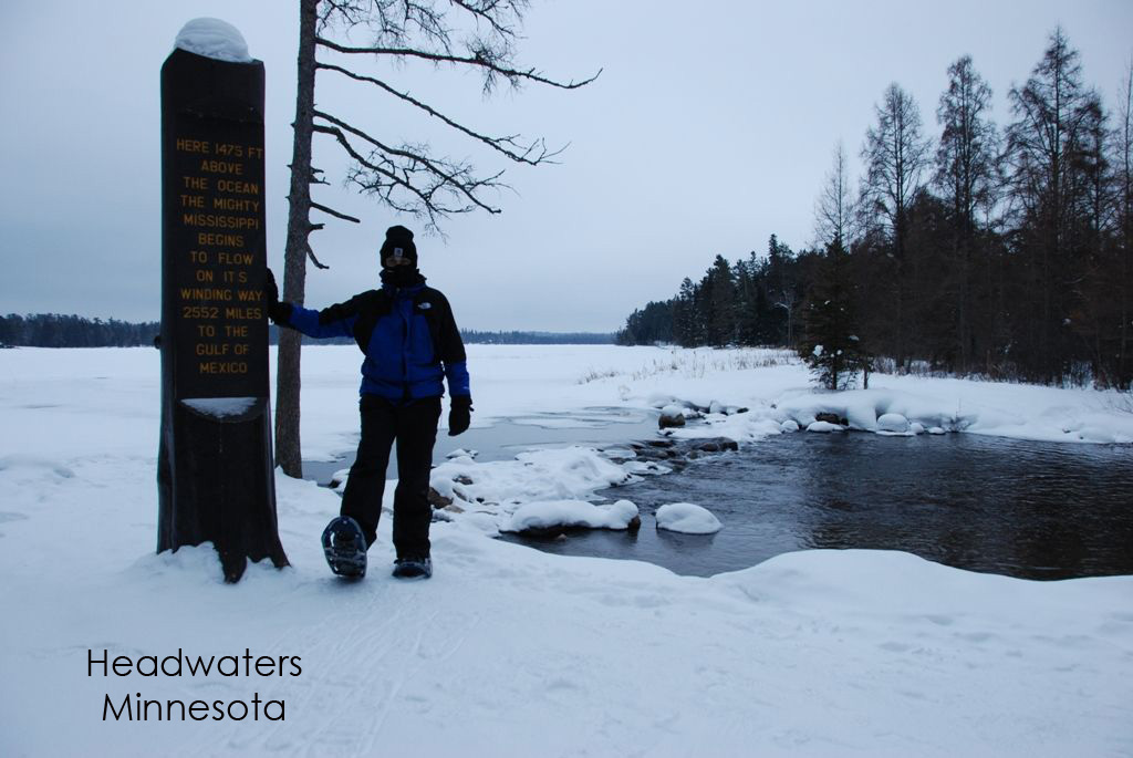
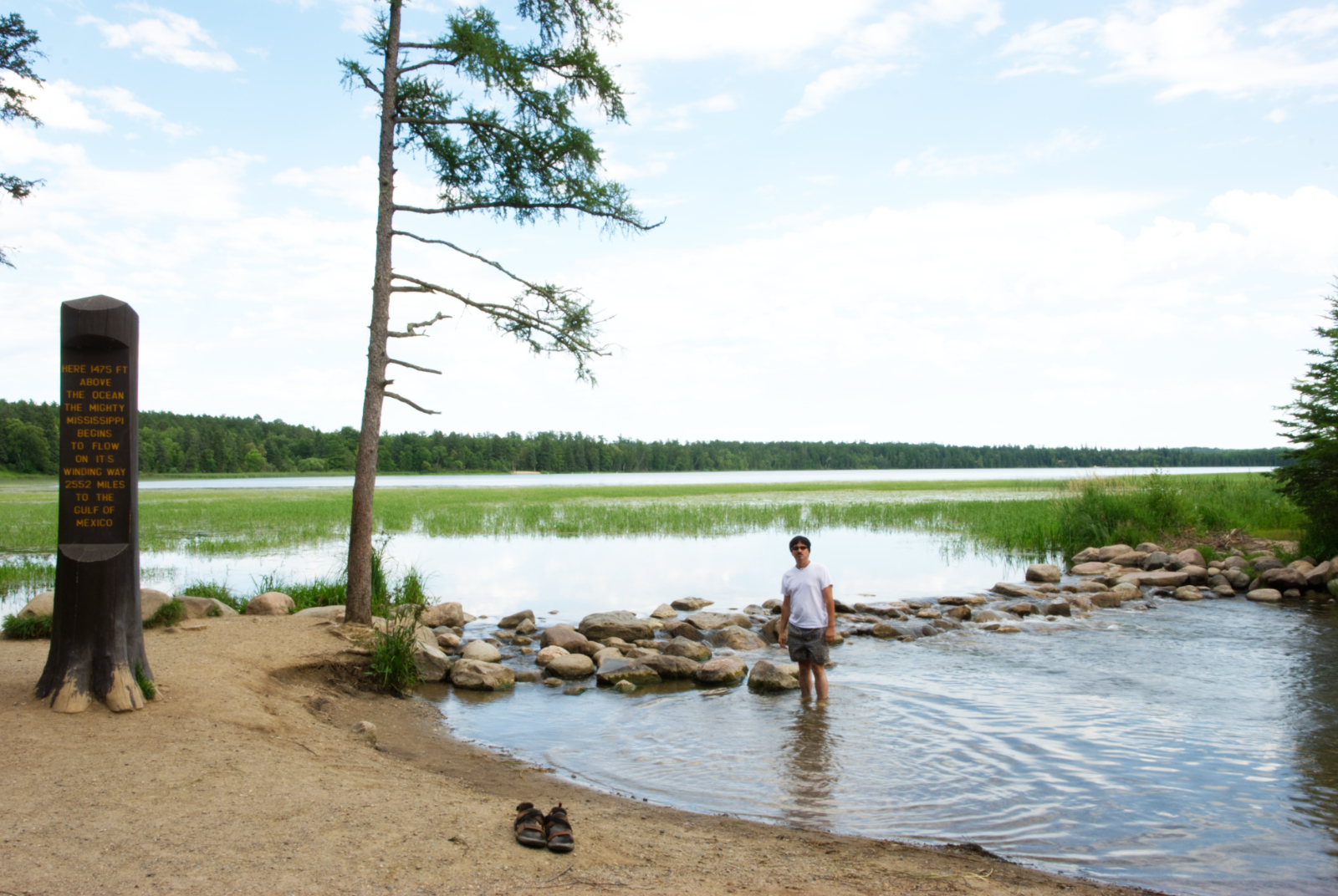
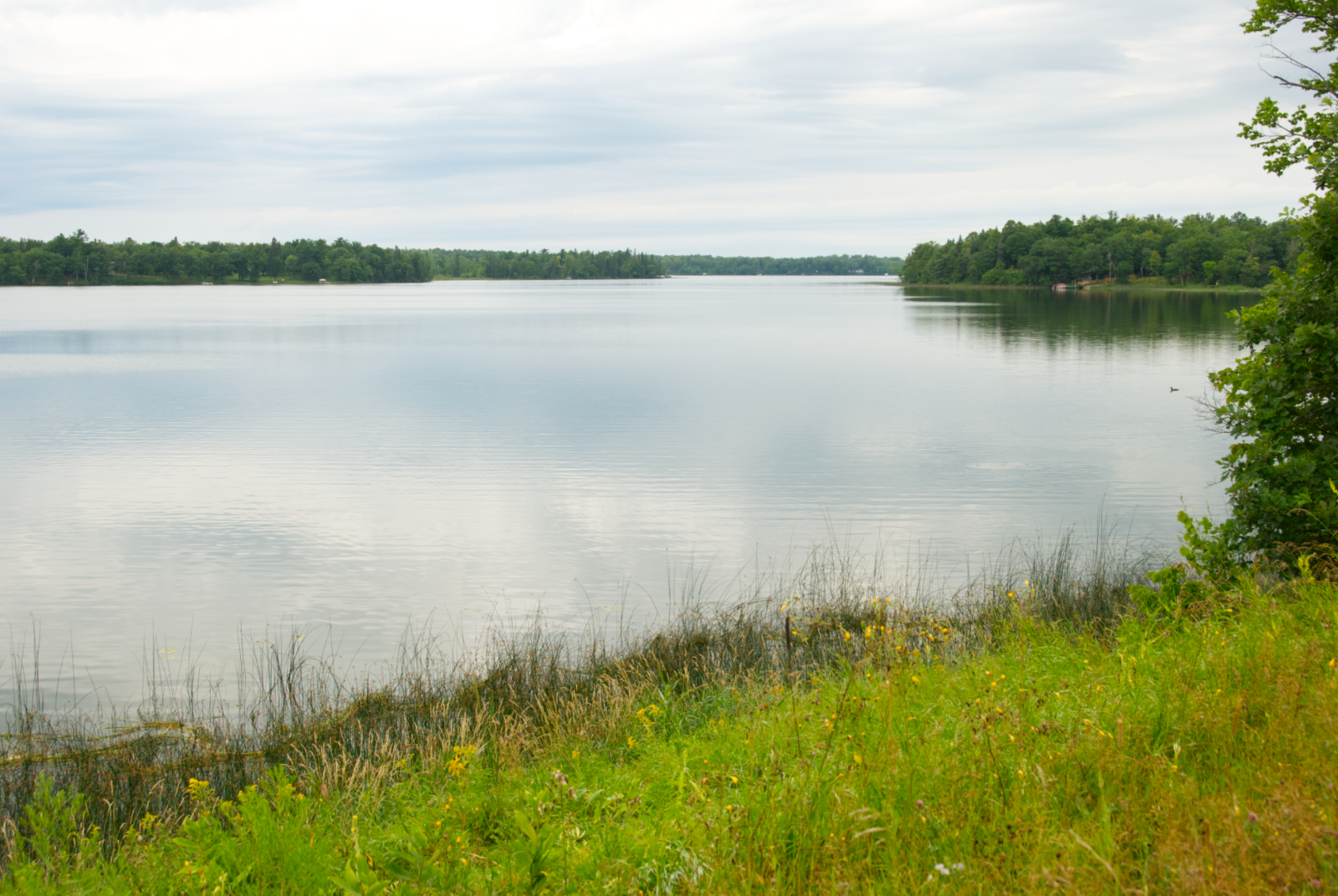
Below are photos of me (Dean Klinkenberg) at the Mississippi River Headwaters at Itasca State Park, plus a picture of Beltrami’s Lake Julia.
Support the Show
If you are enjoying the podcast, please consider showing your support by making a one-time contribution or by supporting as a regular contributor through Patreon. Every dollar you contribute makes it possible for me to continue sharing stories about America’s Greatest River.
Don’t want to deal with Patreon? No worries. You can show some love by buying me a coffee (which I drink a lot of!). Just click on the link below.
Transcript
Sun, Sep 08, 2024 4:32PM • 35:49
SUMMARY KEYWORDS
mississippi, lake, river, source, mississippi river, wrote, claim, headwaters, years, boundary, stream, glazier, cass, long, turned, part, surveyors, mississippi valley, places, minnesota
SPEAKERS
Dean Klinkenberg
Dean Klinkenberg 00:00
We debate how to define a source for a river, because it’s a social construction, something we invented, not some objective truth that exists in nature. Folks still argue today about the exact source of the Amazon and Nile rivers, but we like to tell stories, and stories need a beginning, middle and end. Welcome to the Mississippi Valley Traveler Podcast. I’m Dean Klinkenberg, and I’ve been exploring the deep history and rich culture of the people and places along America’s greatest river, the Mississippi, since 2007. Join me as I go deep into the characters and places along the river, and occasionally wander into other stories from the Midwest and other rivers, read the episode show notes and get more information on the Mississippi at MississippiValleyTraveler.com. Let’s get going. Welcome to Episode 48 of the Mississippi Valley Traveler Podcast. I’ve got a solo episode for you today. I thought it’d be fun to take you through the long, complicated, and let’s say overwrought history of the search for the source of the Mississippi River. So in this episode, I’m going to take you through some of the various expeditions and people who took it upon themselves to figure out the exact spot where the Mississippi River begins. What criteria they even use to figure out what the source the river is and some of the implications of that. So stick around for that solo episode. Couple of quick notes as well. I’m going to be speaking at the library in Washington, Missouri, on Thursday, September 12, 2024. That’ll be at 6:30, so if you’re in the area, come on by, and I’ll be talking about the natural history of the Mississippi. I also want to point you to an event coming up on Saturday, September 21 a big fun paddling event called the Great River Rendezvous, sponsored in part by the Mississippi River Water Trail Association. I will post a link to that in the show notes. I’m on the board of that organization, and we’re going to have three different lengths for routes that you can paddle on that day. The whole event is really just an excuse to come out on the river and spend some time paddling on a very scenic stretch of the Mississippi. When you’re done paddling, you can spend some time in Alton at the Earthtones festival that’ll be going on right there next to the river as well. So I hope you can join us great river rendezvous, September 21 as always. Thanks to those of you who show me some love through Patreon. Your support keeps this podcast alive and makes me feel good. You can join the Patreon community for as little as $1 a month, and with that, you get early access to the podcast and maybe some other benefits down the road. We’ll see how it goes. If you don’t really want to join the Patreon community, but you want to show some support, well, you can buy me a coffee. Go to MississippiValleyTraveler.com/podcast and there you can find out how to join the Patreon community or how to buy me a coffee if that’s your preference, at that same website address, MississippiValleyTraveler.com/podcast. You’ll also find the show notes for each of the episodes. You can also at that same link, listen to all 47 of the previous episodes of the Mississippi Valley Traveler Podcast. So dig in, enjoy and let me know what you think. And now on with the episode. If you aren’t familiar with the shape of the state of Minnesota, take a quick look at a map, you’ll notice a small part roughly in the shape of a chimney or a partially squashed top hat that extends farther north than the rest of the state. That area is known as the Northwest Angle, and it is part of Minnesota because of a mistaken belief in the 18th century that the Mississippi River extended much farther north than it actually does. In the 1783 Treaty of Paris, the treaty that ended the Revolutionary War the US and England defined the western boundary between Canada and the US as roughly from Grand Portage Minnesota up the Pigeon River through Rainy Lake and Rainy River to the far northwest corner of the Lake of the Woods, then by a straight line to the west to connect with the northern point of the Mississippi River. Those boundaries were based on a map published in 1775 John Mitchell’s A Map of the British Colonies in North America. Mitchell, who was not a cartographer and had never visited the area extended the Mississippi River about 200 miles too far north. By 1790 it was clear to most folks that this boundary was bogus. So the US and Canada would argue over the exact boundary line for decades. They sent surveyors prowling over lakes and through the woods. Diplomats sat at tables arguing over treaty language to define the boundary line while they agreed that the 49th parallel would serve as the international border, the language in that pesky Treaty of 1783 still complicated the boundary through the Lake of the Woods, a very large lake in a remote part of the country. Surveyors understandably had a rough time completing the job. They had to map nearly every island, large and small, while avoiding the hazards presented by rocky, irregular shorelines and unpredictable, often life threatening weather. It wasn’t until 1872 that they successfully defined the point at the far northwest corner of Lake of the Woods. But that didn’t finish the job. The US and an independent Canada did not reach final agreement on the exact boundary until 1925 just 142 years after that initial treaty. So that’s one reason Americans wanted to find the exact spot where the Mississippi River began, because an international boundary depended upon it. But that wasn’t the only reason for some successfully identifying a river’s source promised fame and recognition. It also served as a way for the new Americans to cement their claims over the land while brushing aside indigenous history and the people who had lived there before. As Europeans and Americans spread across North America, they raced to figure out where some of the biggest rivers began, generally ignoring the long history of indigenous people and places they visited, except when their assistance would help a white guy take credit for finding something. Jonathon Carver was one of the first Europeans to speculate on the Mississippi source. He explored the upper part of the river beginning in 1766, and concluded that the river’s source was Lake Peppin. He was only off by a few 100 miles. The task of finding the source, it turned out, wasn’t quite as simple as some expected, because the area where the Mississippi begins was a vast and wild area of lakes and streams that all seem connected to each other, which they are more or less. As you follow the Mississippi it enters some lakes, some of which have more than one inlet or outlet that made it tricky trying to decide which of those inlets and outlets should properly be labeled Mississippi River. In 1798, the British Canadian fur trader turned geographer, David Thompson was one of the surveyors sent to determine that boundary line between the US and Canada. He took time out from his work in April of that year to dip a bit south in an 18 foot birch bark canoe to look for the source of the Mississippi. His progress was swift, initially, as he floated down rivers filled with snowmelt, but painfully slow at other times, as he had to haul gear over long portages or make his way across partially frozen lakes. He wrote, “The lake being covered with ice and patches of water at places we paddled the canoe and where the ice was firm, made a rude sledge on which we placed the canoe and baggage and hauled it over the ice to a patch of water. And thus continued for 17 miles, a laborious work and always wet the weather, frequent showers of rain and sleet and then clear weather.” He determined that the source of the Mississippi River was Turtle Lake, which is a small lake north of Bemidji, which was quite a bit closer than Carver’s guess. Thompson wrote, “This is the source of the famous Mississippi River in the most direct line, all the other little sources are reckoned to be subordinate to this as they are longer in forming so considerable a stream. The brook that furnishes water to this lake comes in on the right hand from the south bay of the Turtle Lake.” Thompson’s report didn’t settle the issue, though, the US government sent 26 year old Zebulon Pike on a mission in 1805 to among other things, recommend sites for forts, take notes on the flora and fauna and note locations of Native American villages. One of his additional tasks was locating the source of the Mississippi. His expedition left St Louis in August, 1805 in a 70 foot keelboat, then later bogged down in northern Minnesota by very cold temperatures in October, as they foraged through St. Anthony Falls, Pike wrote quote, “After four hours work, we became so benumbed with cold that our limbs were perfectly useless.” Pike’s group had some success hunting, but not enough to keep them well fed, as they switched to traveling, mostly by land, alternating snowfalls and thaws made traveling arduous. By the time they reached the Northwest Fur Company trading post at Sandy Lake in mid January, they were hungry, cold and exhausted. The British traders treated them well and fed them delicacies such as beaver tail and boiled moose head. After that, they trudged on to Leech Lake, which pike declared the source of the Mississippi quote, I will not attempt to describe my feelings on the accomplishment of my voyage, for this is the main source of the Mississippi. They crossed the lake and found another post of the British Northwest Fur Trading Company. Again, they were treated well and given food and a chance to warm up. But before they left, Pike rose the American flag over the post, then ordered his soldiers and Native American guides to shoot down the English flag that flew above it, thanks for the hospitality. They traveled on to Red Cedar Lake, which is now called Cass Lake, which pike called, quote, the upper source of the Mississippi after that, they turned around and made it back to the St Louis area, reaching Portage des Sioux on April 30 of 1806. A few years later, in 1820, Lewis Cass led another expedition to what was then the western reaches of Michigan Territory. Their goals included surveying the topography, impressing Native Americans with American military might and once again, finding the source of the Mississippi River. So I guess no one really thought Pike had settled the issue. Cass, who was Governor of Michigan Territory at the time, led a group of 42 men, which included 10 Native Americans hired to guide and hunt, 10 Canadian voyagers and 10 US soldiers as escorts, plus a handful of scientists and bureaucrats. They left Detroit on May 24 and traveled across the northern Great Lakes. In northern Minnesota, they split in two, with half continuing up the St Louis River, and the other half led by Henry Schoolcraft, traveling overland toward Sandy Lake. Schoolcraft’s groups slogged through thick mud and swamps, but still got to Sandy Lake two days before the other group. From Sandy lake, the scientists continued up the Mississippi River to Red Cedar Lake, which they reached on July 21. They stopped and looked around, surveying the lake for each inlet and outlet. Schoolcraft later wrote that the lake, quote, receives four tributaries, Turtle Portage River, Round Lake River, Thornberry River, and an inlet from the southwest, which being somewhat larger than the others, preserves the name of the Mississippi. Cass and his scientists agreed that the lake was the Mississippi source, and predictably, they changed the name from Red Cedar Lake, the name used by generations of indigenous people, to Cass Lake. In his narrative description of the Cass expedition, Schoolcraft makes it clear that the ambiguous international boundary was on their minds. He wrote quote, There is no part of the Mississippi River which originates in the territories of British America. The northern boundary line of the United States will probably run 100 miles north of its extreme source. But this is a point which still remains unsettled between the two governments, and some difficulties it has apprehended may prevent a ready adjustment of this line. The Treaty of 1783 which designates the limits of the United States, fixes the northern boundary as a line drawn through the great chain of lakes of the head of Lake Superior thence by the most practical, practicable water communication to the Lake of the Woods and from its most Northwestern extremity due west of the Mississippi. It is well ascertained that a line drawn due west from the northwestern extremity of the Lake of the Woods would not strike the sources of the Mississippi. Just three years after the Cass expedition, the eccentric traveler and Italian native Giacomo Beltrami took it upon himself to solve the problem that two previous groups had already claimed to solve. He was born in Bergamo in Italy’s Lombardy region around 1779. He had ventured around Europe and landed a job in France during Napoleon’s rule, then went back to Italy, where he befriended, maybe fell in love with, Giulia Spada de Medici. When she died in 1820 she was 39 years of age, and he was 41 Beltrami, distraught and possibly heartbroken, left Europe driven by grief, but also by pesky investigations into those years he worked in France. He traveled on to the US, where he met Lawrence Taliaferro, a well known Indian agent, and Stephen H Long, an accomplished civil engineer and explorer. He tagged along with him to Fort Snelling, Minnesota. They got to Fort Snelling by boarding a boat in St Louis that was heading north a steamboat, The Virginia, which became the first steamboat to successfully navigate the Upper Mississippi. Beltrami had a knack for being in the right place at the right time. They continued together to the Red River of the North, but had a falling out in Pembina. Beltrami left them accompanied by Ojibwe guides, who later also tired of him and left him to fend for himself. Fortunately for him, he hired some new help along the way. Beltrami had a flare for the dramatic in his prose. Here’s just a little sample, “I write to you from the midst of deserts under the vault of heaven a large Maple is the only roof which shelters the only closet which secludes me, the solitude, the deep silence around me is interrupted only by unknown birds of strange and savaged beasts. In this remote and central wilderness, my heart and mind are filled with the most delightful emotions, like another colossus of roads I can almost touch with either foot, two of the most interesting spots on the surface of the globe. I find myself in a place which has been the object of so many researches, but which has till now, never been pressed by the foot of civilized man. This moment next to that which taught me to appreciate the treasure of friendship that I have lost is the finest of my life.” Beltrami, like most of the others searching for the headwaters, had a gift for self promotion and a talent for overstatement. In August of 1823, he believed he had found a lake that was not only the source of the Mississippi, but also of the Red River, he wrote, “the sources of the river filtrate in direct line from the north bank of the lake on the right of the center and descending towards the north. They are the sources of Bloody River, the Red River. On the other side, towards the south, and equally, at the foot of the hill, other sources form a beautiful little basin of about 80 feet in circumference. These waters likewise filtrate from the lake towards its southwestern extremity. And these sources are the actual sources of the Mississippi. This lake therefore supplies the most southern sources of red or as I shall call it in the future by its truer name, Bloody River and the most northern sources of the Mississippi, sources, till now, unknown of both.” “The famous Mississippi, whose course is said to be 1200 leagues, and which bears navies on its bosom and steamboats superior in size to frigates, is at its source merely a petty stream of crystalline water concealing itself among reeds and wild rice, which seemed to insult over its humble birth.” Apparently overwhelmed with emotion at his discovery, Beltrami christened the lake with the only name that seemed worthy to him. He wrote, “I have given it the name of the respectable lady whose life to use the language of her illustrious friend, the Countess of Albany, was one undeviating course of moral rectitude, and whose death was a calamity to all who had the happiness of knowing her and the recollection of whom is incessantly connected with veneration and grief by all who can properly appreciate beneficence and virtue. I have called the lake accordingly, Lake Julia. And the sources of the two rivers, the Julian sources of bloody River and the Julian sources of the Mississippi, which, in the Algonquin language means the father of rivers, (Dean: actually it doesn’t). Oh! What were the thoughts which passed through my mind at this most happy and brilliant moment of my life? The Shades of Marco Polo of Columbus, of Americus, Vespucius of the Cabots, of Verazani, of the Zenos and various others appeared present and joyfully assisting at this high and solemn ceremony and congratulating themselves on one of their countrymen, having by new and successful researches, brought back to the recollection of the world the inestimable services which they had themselves conferred on it by their own peculiar discoveries, by their talents, achievements and virtues.” Like I said, he had a flair for the dramatic and desire for being seen as an explorer that exceeded his devotion to the detail work to prove his claims his inferences were wrong, according to the folks who decide these things, the Red River begins at the confluence of the Bois de Sioux and Otter Tail Rivers on the Minnesota, North Dakota border, not at Lake Julia. You probably also know already that we don’t consider Lake Julia the source of the Mississippi. But he got his lasting fame. While Monteleone, Torrigiani and Antonelli didn’t stick to the lakes he named. Lake Julia is still Lake Julia. Beltrami Lake isn’t far away either, and the county that contains both lakes as well as Bemidji is today known as Beltrami County. And he earned lasting fame for a completely different reason. During his travels, he bought or traded for a lot of objects from Native American communities. One of those items, a flute, is the oldest known Native American flute in existence. If you visit Bergamo, Italy, you’ll find it in the museum there today. After making his discoveries, Beltrami traveled around the US and Europe for a few more years, then finally found its way back home in 1855. He died at home in Filottrano, Italy, and I’m sure I pronounced that wrong. Hey, Dean Klinkenberg here, interrupting myself, just wanted to remind you that if you’d like to know more about the Mississippi River, check out my books. I write the Mississippi Valley Traveler guidebooks for people who want to get to know the Mississippi better. I also write the Frank Dodge mystery series that is set in places along the Mississippi. My newest book, The Wild Mississippi, goes deep into the world of Old Man River. Learn about the varied and complex ecosystem supported by the Mississippi, the plant and animal life that depends on them, and where you can go to experience it all. Find any of these wherever books are sold. The debate about the Mississippi’s source was finally settled in 1832 mostly. Henry Schoolcraft had been on Cass’ 1820 expedition. During that trip, he’d noticed a small stream that emptied into Red Cedar / Cass Lake on the west side. When he returned to northern Minnesota in 1832 he hired a native guide, an Ojibwe man named Ozaawindib, to help guide him to the source of that stream. The stream led to a lake the Ojibwe people knew as Elk Lake. Schoolcraft probably wouldn’t have made it there on his own, but Ozaawindib knew exactly where to go, because, well, he lived there. Still, Schoolcraft got pretty excited about being there. On July 13, he wrote in his journal, “What had been long sought at last appeared suddenly on turning out of a thicket into a small, weedy opening, the cheering sight of a transparent body of water burst upon our view. It was Itasca lake, the source of the Mississippi.” Schoolcraft didn’t have much time to stick around, though, discovering the source of the Mississippi wasn’t the purpose of that trip. He relied on the word of traders and Native Americans that the lake was the Mississippi source, and he observed that the lake occupied a bowl shaped area with no other streams coming or going. In his three and a half hour visit, he jotted down a few notes about the lake, its shape and wildlife, much of which he got wrong. He had the scientific rigor of Beltrami then turned around and returned to Fort Snelling. Lieutenant James Allen, who was part of that group, later wrote an account of the expedition. About that day they reached Elk Lake, he recalled, “We left Lac La Biche (Elk Lake) from its northern Bay, having coasted nearly its whole circumference and found the Mississippi at its very egress from the lake a respectable stream. Its channel being 20 feet broad and two feet deep and current two miles per hour. Its course was northwest, and soon ran through a chain of high pine hills where the channel contracted very much and numerous rapids occurred, a very great, great fall over boulders of primitive rock the river running for the distance in a deep ravine.” It’s hard to make a claim of discovery when a place already has a name it’s known by. So Schoolcraft later asked his compatriot William Boutwell for some help. A few years later, when asked about this, Boutwell recalled, “As we were coasting along the south shore of Lake Superior one beautiful morning, the lake is calm and smooth as a mirror. Mr. Schoolcraft turned to me with this question. Mr. Boutwell, can you give to me a word in Greek or Latin that will express true head or source? After a moment’s reflection, I replied, I cannot, but I can give you two words. I gave to him veritas caput. He wrote out the two words, and shortly after turning to me, said, with animation, I have it then and there I first heard the word Itasca.” Well, surely, after all that, the issue must have been settled, right? Well, not exactly. Just four years after Schoolcraft’s trip, Joseph Nicollet visited the area and found a small creek that flowed into Lake Itasca. He called this creek the, “infant Mississippi.” We now call it Nicollet Creek. This creek would prove troublesome for some folks who believe that the lake it emerged from what later became known as Elk Lake, not to be confused with the Elk Lake that was Lake Itasca to Ojibwe people the area came to believe that this Elk Lake was really the source of the Mississippi and not Lake Itasca. People who believed this included Julius Chambers, who said as much in 1872 and the US surveyor Edwin Hall who did the same in 1875. It also left some room for another one of those self promoting attention seekers to slip in and try to stake a new claim for discovering the real source of the Mississippi. In the late 1800s, Willard Glazier sold a lot of books, a memoir about his civil war service and adventure stories that almost certainly exaggerated the amount of real adventure he undertook. In 1881 he turned his attention to the Mississippi. He believed that the real source of the Mississippi had been misidentified, and he was intent on proving his case. He traveled to Lake Itasca, where he found a stream that entered the lake from somewhere else. He and his party followed that stream and found what they were looking for. Glazier wrote on pulling and pushing our way through a network of rushes similar to the one encountered on leaving Itasca, the cheering sight of a transparent body of water burst upon our view. It was a beautiful lake, the source of the father of waters. We paddled slowly across one of the most pure and tranquil bodies of water of which it is possible to conceive. He and his search party gathered on the shores of the lake and fired a volley of shots in celebration. Then, according to Glazier’s account, the party surprised him, “When the firing ceased, Paine gave me a surprise by stepping to the front and proposing that the newly discovered Lake be named Glazier in honor of the leader of the expedition. The proposition was seconded by Moses Lagard, the interpreter, and carried by acclamation.” Willard’s claim sparked outrage in Minnesota, especially at the Minnesota Historical Society. They asked General James Baker, the state surveyor general, to look into Glazier’s claim. Baker issued a scathing report, calling Glazier, “Pretentious, stupid beyond belief, a fraud, a plagiarist,” and those were some of the less insulting things he said. In February of 1887 the Minnesota Historical Society hosted a meeting to review Baker’s report. Two former governors attended. People saw this as that important. Baker asserted that Glazier had admitted to plagiarizing some of Schoolcraft’s work, and he had also admitted lying about the rigor of his research when he was in the Lake Itasca basin, specifically that in spite of writing otherwise, he really hadn’t searched Elk Lake for any other inlets or outlets. In the end, the Minnesota Historical Society adopted a resolution reaffirming Lake Itasca as the source of the Mississippi. Interestingly, Baker did not refute the claims by Glacier and others that a stream connects Elk Lake and Lake Itasca. Nor did he deny that there are other small streams that also enter Lake Itasca. Baker also wiped a little smudge on some of the shine of Schoolcraft’s claim as the sole discoverer of the source of the Mississippi by acknowledging that other people had been there before him. Baker, for example, noted that the lake had been known as Lac La Biche, which is the French translation of the Ojibwe name Elk Lake. So it was obvious that French traders already knew about the lake. Baker also noted that trader William Morrison claimed to have been to the lake in 1804. Finally in 1888 Jacob Brower stepped in to finally, once and for all, for all eternity, settle the matter of where exactly the Mississippi starts. He conducted a detailed survey of the basin around Lake Itasca, and determined that the lake was indeed the true source. He concluded that the two inlets that had caused such confusion in the past, but we now call Nicollet and Chambers Creeks usually dried up in the summer, so they couldn’t be considered permanent channels that were part of the Mississippi case settled, right? Well, almost. Some hydrologists today consider the true source of the Mississippi to be Hernando de Soto Lake, which is due south of Lake Itasca; The two bodies of water are apparently connected by an underground aquifer. Schoolcraft and everyone who followed him had only been looking for observable sources that were above ground. That was, in fact, part of the definition used to identify the source of a river in the 19th century, an observable, unbroken and continuous flow above ground. Who’d have thought that figuring out where a river begins would be so complicated? I have a hard time getting too excited about this argument. Frankly, the criteria we use to define the source are, in reality, arbitrary and have changed over time. Here are a couple of common definitions from the past. For one, it was the most distant point upstream that carries the largest volume of water. This is problematic in part because water volume fluctuates so much, especially seasonally. Someone following a river at one time of year might choose a different path than if she went at a different time of year to do it right, we’d need data for several years to get a reliable average flow. In the past, people had basically just eyeballed it. Another definition that was used was the farthest point upstream on the longest tributary of the river. Before rivers were more thoroughly mapped, though this wasn’t always known so people, so people tended to fall back on volume. Besides that, the longest tributary today can be the second or third longest tomorrow, because rivers often cut through meanders and shorten themselves. Brower was well aware of the arbitrary nature of this endeavor, he wrote to proceed upon the basis that the source of a river is at the particular spot most remote from its mouth, where the water first commences. Its flowage upon the surface, in an unbroken channel to the sea, would force upon the student of geographical explorations a narrow and limited rule, resulting in discovery of an inferior point dependent entirely upon subsidiary channels, yet ignoring the existence of the real source from which the water may be or is drawn. Brower also acknowledged that the traditional definitions pose a problem for the Mississippi as it could require a name change at the confluence of the two largest rivers that the main channel would probably have to go west to the Rocky Mountains, rather than North to the pine forests. He rejected this idea, writing simply, “We have always considered the Mississippi the river that goes north to Minnesota.” Hydraulic hydrologists today look at the issue through an entirely different lens. Rivers collect water from throughout their basin. Hundreds of streams feed into the Mississippi, for example, the starting point for each one could be considered the headwaters or source of the Mississippi. We debate how to define a source for a river, because it’s social construction, something we invented, not some objective truth that exists in nature. Folks still argue today about the exact source of the Amazon and Nile rivers, but we like to tell stories, and stories need a beginning, middle and end, picking one place as the Mississippi source completed the narrative as we already knew, the middle and ending bits. But we also like neat, easy to grasp stories, and the chapter about the Mississippi’s Headwaters still needed more editing. In 1933, the superintendent of Itasca State Park wrote, “At this time, I am sorry to say, that the established source of our great river is a swampy, muddy and dirty sight. Since the water is sluggish at this point, all the debris and wild grasses form there. This is indeed a site that is not becoming to such a great river.” For the next eight years, workers from the Depression era, Civilian Conservation Corps, worked to turn that messy, muddy marsh into a site that people could appreciate and worship. They dug a new channel for the first 2000 feet of the river’s path, filled in the swamp, planted trees, and erected a 44 foot dam at the outlet. On top of the dam, they placed rocks two and a quarter feet tall to make it look natural. In 2020 Itasca State Park, once again, renovated the Headwaters. They repaired the dam and placed the rocks to make them look a bit more natural than the original arrangement, and stabilized the banks with new plantings that completed the story, and that’s the Mississippi Headwaters we see today. Thanks for listening. If you enjoyed this episode, subscribe to the series on your favorite podcast app so you don’t miss out on future episodes. I offer the podcast for free. But when you support the show with a few bucks through Patreon to help keep the program going, just go to patreon.com/DeanKlinkenberg. If you want to know more about the Mississippi River, check out my books. I write the Mississippi Valley Traveler guide books for people who want to get to know the Mississippi better. I also write the Frank Dodge mystery series that’s set in places along the river. Find them wherever books are sold. The Mississippi Valley Traveler podcast is written and produced by me Dean Klinkenberg. Original Music by Noah Fence. See you next time you
