Picture of the Day: Thebes Gap

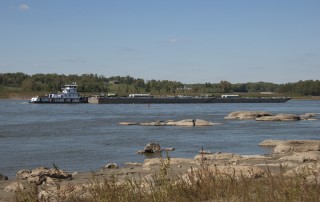
Just south of Cape Girardeau (Missouri), the Mississippi River cuts a seven-mile gorge through the thick limestone of the Shawneetown Ridge. The gorge, known as the Thebes Gap or the Grand Chain, is as narrow as 3,000 feet in places and was notoriously difficult to navigate, at least until the Army Corps of Engineers began blasting
By |2016-10-21T15:28:44-05:00October 24th, 2012|Photo of the Day|2 Comments

Destination of the Day: Trail of Tears State Park

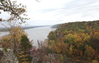
View of Mississippi River from Trail of Tears State Park (Missouri) In 1838-39, thousands of Cherokees and other Indian nations on the east coast were forced to leave their homelands and relocate to lands west of the Mississippi River. En route, hundreds died of starvation, disease, and exposure. Many of the Cherokee crossed

By |2016-10-21T15:28:44-05:00October 22nd, 2012|Destination of the Day|Comments Off on Destination of the Day: Trail of Tears State Park

Picture of the Day: Winfield Ferry

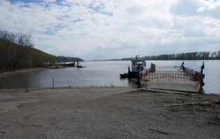
There are still places along the Mississippi where your best bet to get from one side to another is to ride a ferry, but some of those throwbacks have had a hard time in recent years. The ferry that shuttled cars and people between between Winfield, Missouri and Calhoun County, Illinois shut down about two

By |2016-10-21T15:28:57-05:00April 18th, 2012|Photo of the Day|Comments Off on Picture of the Day: Winfield Ferry
Go to Top