
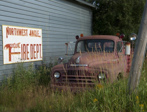
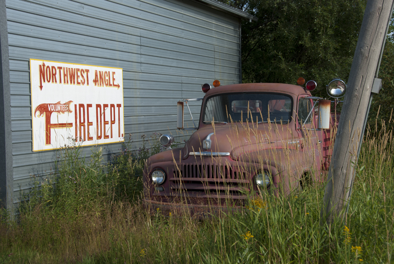
Minnesota
If don’t remember the shape of the State of Minnesota, glance at the map I posted and look at the very top. You’ll notice a small part, roughly in the shape of a chimney or a partly smashed top hat, that extends farther north than the rest of Minnesota, which is known as the Northwest Angle.
The Northwest Angle might seem like an odd place for the Mississippi Valley Traveler to write about, but there is a connection to the river. The deformed top hat that extends above the rest of Minnesota exists because of a mistaken belief in the 18th century that the Mississippi River extended much farther north than it actually does.
In the 1783 Treaty of Paris that ended the Revolutionary War, the US and England defined the western boundary between Canada and the US with the following language:
Thence through Lake Superior, northwest of the Isle Royale and Phelipeaux, to the long lake and the water communication between it and Lake of the Woods, to the said Lake of the Woods; thence through the said lake to the most northwestern-most point thereof, and from thence on a due west course to the river Mississippi; then by a line to be drawn along the middle of said river Mississippi until it shall intersect the northernmost part of the thirty-first degree of north latitude.
Translating the treaty language, the boundary was supposed to go from roughly Grand Portage (Minnesota), up the Pigeon River, through Rainy Lake and Rainy River to the far northwest corner of the Lake of the Woods, then by a straight line to the west to connect with the northern point of the Mississippi.
The boundaries were based on John Mitchell’s A Map of the British Colonies in North America, published in 1775. Mitchell, who was not a cartographer and had never visited the area, extended the Mississippi River about 200 miles farther north than it actually runs. (The Mississippi was the boundary line between the US and Spain’s territory in North America.)
By 1797, it was clear to most folks that this boundary was bogus. During negotiations of the 1803 King-Hawkesbury Convention, the English suggested setting the boundary as the shortest line from the northwest spot to the Mississippi River, but the Louisiana Purchase changed the dynamics of the treaty negotiations, as the Mississippi River was no longer the western boundary of the US.
For the next century, the US and England, then the US and Canada continued to negotiate ways to establish a clear boundary. In an 1818 treaty, England and the US essentially adopted the language in the 1713 Treaty of Utrecht in which the boundary between Louisiana and Canada had been established at the 49th parallel. With the 49th parallel set as the border from central Minnesota through the western US, the map makers still had to deal with the language of the 1783 treaty that mucked up the boundary that ran through the Lake of the Woods.
The 1818 treaty began to deal with the issue by adopting language that clarified the reality that the Mississippi didn’t go as far north as previously thought:
As agreed that a line drawn from the most northwestern point of Lake of the Woods, along the 49th parallel of north latitude, or, if said point shall not be in the 49th parallel of north latitude, then, that a line drawn from said point due north or south as the case may be until said line shall intersect said parallel of north latitude, and from the point of that intersection due west…
I’d like to stay that the issue ended there, but it didn’t. The border terrain is a challenging mix of large and small granite islands with rocky, irregular shorelines rising out of a very large lake in a remote part of the continent. It took another century of surveys and negotiations to determine exactly where the boundary line would fall and which islands would belong to which country.
In 1841, the English hired astronomer Dr. IL Tiarks to determine the northwest-most point; he did and a line was dropped due south to the 49th parallel, thereby creating the Northwest Angle. The next year, Daniel Webster and Lord Ashburton figured out the boundary line from Lake Superior to Rainy Lake. The US and Canada (now independent from England) did not reach final agreement on the exact boundary until 1925, just 142 years after the initial treaty. It wasn’t until 1872, however, that the far northwest point of Lake of the Woods was precisely defined as 49° 23’ 04.1″ north latitude (+49.384472) and 95° 09’ 12.2″ west longitude (-95.153389).
While this may seem like an amusing little anecdote about a boundary dispute in an area that matters little, the consequences have been extraordinary. At one time, the English proposed a border that would have run from Lake Superior due west to the Mississippi. The US rejected that proposal, perhaps in part because of Ben Franklin. Franklin was a party to the 1783 Treaty of Paris, and there is growing evidence that he was not only aware that the map was wrong, but that he may also have heard that there could be mineral deposits in the area just northwest of Lake Superior.
A century after the Treaty of Paris, prospectors discovered iron ore in Minnesota’s Vermillion Range in the Arrowhead region of Minnesota, and later exploration found even more extensive deposits just southwest of there in the Mesabi Range. Both of these rich veins of iron ore were just northwest of the boundary line that the English had at one time proposed. Had that boundary been used, millions of tons of iron ore would have belonged to Canada instead of the US. Just one of those mines in the Mesabi Range, the Hull-Rust-Mahoning Mine at Hibbing, extracted one-quarter of the domestic iron ore that fueled the production of steel for our war machine in World War II.
In part 2, I’ll tell you a little bit about life in Minnesota’s remote Northwest Angle.
© Dean Klinkenberg, 2011
Community-supported writing
If you like the content at the Mississippi Valley Traveler, please consider showing your support by making a one-time contribution or by subscribing through Patreon. Book sales don’t fully cover my costs, and I don’t have deep corporate pockets bankrolling my work. I’m a freelance writer bringing you stories about life along the Mississippi River. I need your help to keep this going. Every dollar you contribute makes it possible for me to continue sharing stories about America’s Greatest River!
Dean,
Great piece. I’ve sent it on to a few folks here in GR. Thanks for pursuing these interesting parts of our past that get forgotten.
–Anne