Introduction
It’s as far south as you can go and still call it the Upper Mississippi River, and you’ll notice some big changes. The air is getting warmer and thicker. The bluffs begin to give way to the delta plains, and the culture starts to feel more Southern. Cape Girardeau sits on the edge of these changes, a growing small city with a long history, much of it tied directly to the big river.
Visitor Information
Get your questions answered from the helpful folks at Visit Cape Girardeau (573.335.1631).
History
A city was bound to rise where Cape Girardeau is today. The river makes a big turn here, throwing the force of its current near the base of a prominent formation known as Cape Rock. That makes for an easy-to-spot landmark and a good place to land a boat. It also helped that the views from the top of the rock were expansive; a person could see for miles up and down the river.
The origin of the city’s name is a bit of a mystery, but it probably comes from a soldier, Jean Baptiste Girardot, who set up a trading camp at this point around the middle of the 18th century. He apparently didn’t stick around all that long, but other people must have grown accustomed to calling the place after him, so the name stuck.
It wasn’t until 1793 that an effort was made to establish a more permanent European settlement. Don Louis Larimier got permission from the area’s Spanish commander to set up a trading post. Located near the El Camino Real, a road that connected the Spanish settlements of St. Louis and New Madrid, the post was established to set up trading relationships with American Indians in the area.
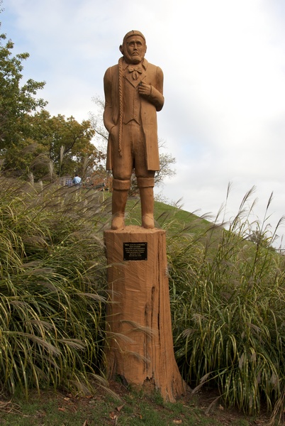
Lorimier was born near Montreal in 1748. A gifted polyglot, he worked in the Indian trade most of his life and married a Shawnee Indian woman, Charlotte. He wasn’t too fond of the Americans he met. In 1778, during the American Revolution, he led a raid that resulted in the capture of Daniel Boone. The Americans eventually caught up to him at Vincennes and drove him across the Mississippi River into Spanish territory.
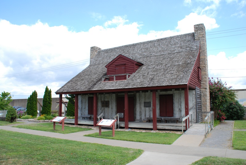
The Spanish authorities soon discovered his language skills, so they put him to work as a translator and mediator. Grateful for the help, the Spanish Governor Baron de Carondelet gave Lorimier 6,000 acres, which included present-day Cape Girardeau. He built a home known as the “Red House” that served as his trading post and a gathering place for the small community.
On the eve of the Louisiana Purchase, a census of the entire district counted 545 white men, 481 white women, 90 male slaves, and 80 female slaves. When the territory joined the US in 1804, he donated four acres for the construction of a Common Pleas Court House and got a temporary appointment as a judge.
In 1806, Lorimier’s secretary, Barthelemi Cousin, laid out a village. Only a few lots were sold, in part because Lorimier was reluctant to part with much of his land. As a result, people who moved into the area generally staked out claims in the surrounding countryside. Lorimier died in 1812 and left behind a lot of confusion about who owned what. The US government had initially refused to recognize his Spanish land grants, which clouded titles; the government didn’t formally recognize his land claims until 1826. As a result, the county seat moved to Jackson and the town didn’t grow much until the 1830s. In 1818, the town had just two stores and about fifty houses.
Around 1820, an expedition led by Major Stephen Long passed through the area:
The town comprises at this time about twenty log cabins, several of them in ruins, a log jail no longer occupied, a large unfinished brick dwelling falling rapidly into decay and a small one finished and occupied, it stands on the slope and part of the summit of a broad hill elevated about 150 feet above the Mississippi and having a deep primary soil resting on a strata of compact and sparry limestone. Near the place where boats usually land is a point of white rock jutting into the river and at very low stage of water producing a perceptible rapid…The streets of Cape Girardeau are marked out with form of regularity intersecting each other at right angles but they are in some parts so gullied and torn by the rains as to be impassable; others overgrown with such thickets of gigantic vernonias and urticlas as to resemble small forests.
By the 1830s, steamboat traffic was growing and would provide a big economic boost for the city, enough to spur other developments. In 1838, the Congregation of the Mission (better known as the Vincentians) established St. Vincent’s Male Academy, which would later become St. Vincent’s College. While the campus included a seminary to train priests (it moved to St. Louis in 1893 and renamed Kenrick Seminary), the fathers also founded a secular educational institution at a time when such schools were rare. The Vincentians owned several enslaved laborers in the school’s early years but probably began selling them to local Catholics after a decree from Pope Gregory XVI 1839 that condemned the slave trade.
By 1830, there were a thousand enslaved blacks in Cape Girardeau, but that would swell to over 1,500 by the Civil War; just twenty free blacks lived in all of Cape Girardeau County in 1850. The local powers-that-were passed a series of increasingly oppressive laws to keep the enslaved population under control, including one measure in the 1840s that authorized the formation of patrols to keep enslaved people from gathering in groups.
Cape Girardeau was a city with divided loyalties during the Civil War. Many early residents had migrated to the city from the South, but the city also had a large population of pro-Union German immigrants. The Union Army took control of the city on July 10, 1861, and never relinquished it. As a result, many of the Confederate sympathizers fled, some to join the Confederate Army.
General Ulysses S. Grant took command of the district in September 1861 and ordered construction of four forts to protect the city. Once it became clear that no Confederate attacks were imminent, the army turned to raiding the countryside to go after Confederate sympathizers.
The city’s economy picked up again after the Civil War. Industries like logging and sawmills, cement manufacturing, quarries, mills, pottery and cigar factories employed large portions of the population.
In 1873, Southeast Missouri State College was founded as a normal school (educating future teachers); it would later become Southeast Missouri State University.
Cape Girardeau began to grow quickly in the early part of the 20th century. In 1900, the city counted just under 5,000 residents, but by 1940 it was home to nearly 20,000 people. One reason was the presence of the largest factory in the International Shoe Company portfolio. The factory opened in 1907 as the Roberts, Johnson & Rand Shoe Company. By the 1950s, the plant employed nearly 1,400 people and turned out 8,000-9,000 pairs of shoes a day. The plant was later rebranded with the company’s Florsheim Shoe division, which built a new facility in 1984 but competition from international markets led to declining employment and the eventual closure of the plant at the end of 1999, at which time the remaing 300 employees were laid off.
Celeste Beatrice Stanton remembered visiting her aunt Josephine Brown, or Aunt Phene, in Cape Girardeau during the 1930s. Her aunt lived on a block of South Fountain Street that was next to a gully that had train tracks running through it. Every time a train approached, it triggered the family to close up the house to protect it from the train’s soot.
When Aunt Phene heard the train whistle blow in the near distance, she’d shoosh me into the house and everyone would hurridly slam down the open windows and shut all the doors to prevent the acrid, black soot billowing out of the train’s stack from permeating the insides of the home. Once the train passed and the soot settled, the doors and windows would be re-opened and Aunt Phene would see to it that the soot was wiped from items on the porch, and the porch and steps were swept clean.
Jazz pianist Jess Stacy grew up in Cape Girardeau. During his long and successful career, he played with Benny Goodman Orchestra and many other well-known musicians. Stacy was born in 1904 in a converted railroad box car near Bird’s Point, Missouri. One of his first jobs was working for the Illinois Central Railroad on a ferry that moved rail cars to and from Cairo, Illinois. He moved to Cape Girardeau in 1918, and two years later heard Fate Marable and Louis Armstrong play on the excursion boat St. Paul during a stop in Cape Girardeau.
A year later, he was hired as a musician on the Majestic. In 1923, he got a job playing with Tony Catalano’s Famous Iowans; one of his responsibilities was to play what he called “the damn calliope.” He was part of the Benny Goodman Band when they played Carnegie Hall in 1938, the first jazz performance in that famed venue. During that show, Stacy played a two-minute improv solo that jazz lovers still rave about today. He played with many of the greatest jazz musicians, and even worked for Al Capone and Bugs Moran at one time. Still, he had a hard time making a living as a jazz pianist. He played shows in piano bars—he hated doing it—and ended up taking a job with Max Factor in Los Angeles, delivering company mail for ten years to help pay the bills. He died in 1995.
Cape Girardeau today is still attracting new residents; it’ll probably hit 40,000 by the 2020 census. Southeast Missouri State University remains an anchor. Health care is a major employer, as is Proctor and Gamble.
Exploring the Area
Housed in a 1908-era police and fire station, Cape River Heritage Museum (538 Independence St.; 573.334.0405) hosts exhibits on American Indians who lived in the area, steamboats, and some of the famous people from the region, as well as a few rotating exhibits.
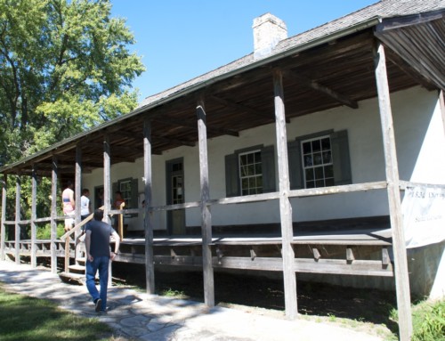
The Red House Interpretive Center (128 S. Main St.; 573.339.6340) recreates the French Colonial home and trading post of Louis Lorimier, the city’s founder. The exhibits highlight the city’s early history; it is usually open just on Saturdays.
One of the oldest churches west of the Mississippi River, the red brick edifice of St. Vincent’s Church (William St. at Main St.) has been watching over the riverfront since 1853. The church is primarily English Gothic in style. Twenty-six buttresses shore up the outside walls. The steeple was added in 1903 but was destroyed by lightning twice and rebuilt, the last time in 1912. Inside, the pews are original. Under the altar, there are relics of St. Vincent de Paul, St. Peter, St. Paul, and St. Andrew. When a new church was built in the 1970s, old St. Vincent was nearly torn down. Supporters rallied, though, and oversaw a major restoration that began in 1977. Old St. Vincent is now classified as a Chapel of Ease of St. Mary Cathedral rather than an independent parish in its own right. The church is typically open for tours on Saturday afternoons (noon-4pm) from April through October.
For a peek at life later in the city’s history, take a tour of the Glenn House (325 S. Spanish St.; 573.579.3290). Built in 1883, the original house was given a Queen Anne-style makeover a decade later; it features objects that would have been common in an upper middle-class home at the end of the 19th century.
Situated on a prominent rise on the river bank, the Common Pleas Courthouse (44 N. Lorimier St.) has stood as a landmark to river travelers since 1854. Walk the grounds and check out the Civil War memorials.
Just east of the downtown, Capaha Park (1400 Broadway)—the city’s oldest public park—features lovely rose gardens, a scenic pond, a bandshell, walking trails, and the home field for the Cape Girardeau Capahas, who have been playing games since 1894.
Parks Along the River
Cape Rock Park (10 East Cape Rock Dr.; 573.339.6340) has an overlook of the Mississippi River at the spot where Ensign Girardot founded the original trading post.
Riverfront Park has a concrete terrace where touring boats like the American Queen dock when they visit. There’s a short walking trail that follows the river. During high water, the flood gates will be closed, so this area won’t be accessible.
For another pretty view, walk to the Old Mississippi River Bridge Scenic Overlook (Morgan Oak at Spanish St.), which preserves part of the approach for Cape’s first river bridge. While you’re here, take a selfie with the state’s largest American beech tree.
During the Civil War, four imposing forts protected Cape Girardeau from attacks by the Confederate Army. The remnants of one of those, Fort D, are preserved in a city park by that name (920 W. Fort St.; 573.339.6340). Part of the earthen walls are still visible; the Depression-era Works Progress Administration built a stone house on the site in the 1930s. The park also has a good overlook of the river.
Arts & Culture
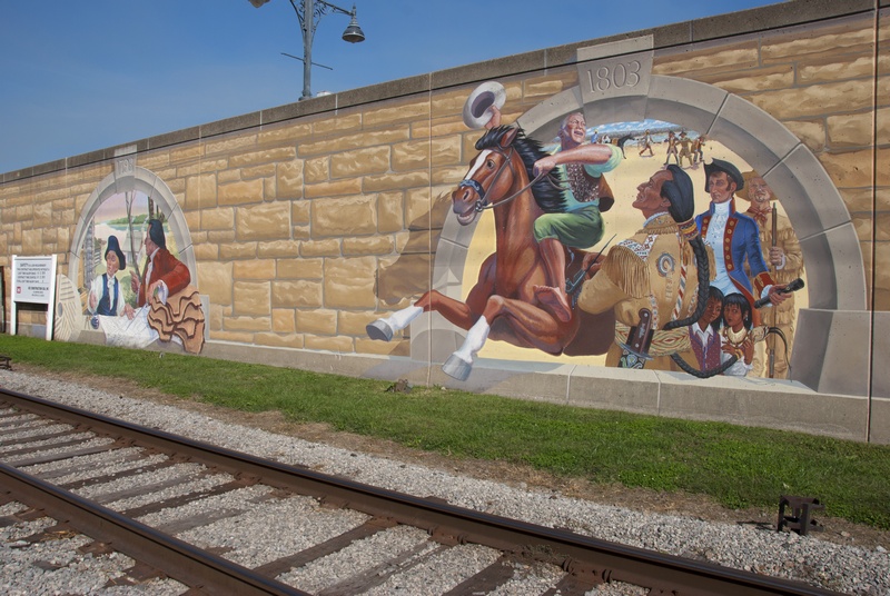
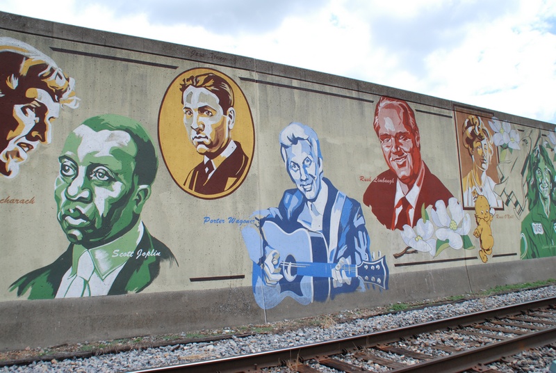
The city side of the flood wall is decorated with 24 murals that depict scenes from the city’s history. They were designed by Chicago artist Thomas Melvin and painted in 2005 with the help of local artists.
The River Campus at Southeast Missouri State University opened in 2007 on the site of the former St. Vincent’s College and Seminary. The campus hosts a variety of arts programming throughout the year. Highlights include the Crisp Museum (518 S. Fountain St.; 573.651.2260), inside the Cultural Arts Center (the building on the right if you’re facing the river), which has exhibits on the broad swath of human and geologic history in the region, plus student art exhibits.
Check the schedule for the Show Me Center (1333 N. Sprigg St.; 573.651.2297), which hosts live performances throughout the year, including many top musicians, plus college basketball games.
Sports & Recreation
Tower Rock Natural Area (County Road 460; 573.290.5730) is the best place to get a close look at an old Mississippi River landmark. The sixty-foot tall remnant of a bluff sits in the river channel, where the tricky currents around its base confounded river navigators for centuries. There’s a decent overlook just above the rock, but if the river is really low, you may be able to walk out across the rocky shelf to the rock. The site is nearly an hours-drive from Cape Girardeau. Take Interstate 55 north to US Highway 61 near Fruitland. Go north, then veer right at County Highway C, then go east on County Highway A. When you reach County Road 460 (a gravel road), go south to reach the site.
Trail of Tears State Park (429 Moccasin Springs; 573.334.1711) is one of the special places along the Mississippi River. Sprawling over 3,400 acres, the park marks one of the milestones in the involuntary exodus known as the Trail of Tears, when the US government forcibly removed Cherokee Indians from the American Southeast. Thousands of Indians died as they walked 800 miles to reservation lands in Oklahoma. Of the thirteen groups of refugees who reached the Mississippi River, nine of them crossed at this site in 1838 and 1839. The visitor center has exhibits on the Trail of Tears and its legacy.
The park is more than just a memorial, though. There are miles of hiking trails, some of which (like the Peewah trail), run through the forest and along the top of the loess-covered hills, taking you to overlooks with expansive views of the river and the Illinois floodplain. Fall is an especially good time to visit as the colors paint the hillsides. There’s also a lake with a swimming beach and two campgrounds, including one next to the Mississippi, and it’s a good area for birding and fishing. To get there from Cape Girardeau, follow Main Street north out of town (which becomes Big Bend Road and State Highway 177) for eleven miles to the park entrance.
There’s a cluster of wildlife areas next to each other just north of the city limits: Juden Creek Conservation Area, Twin Trees Park, and Kelso Sanctuary. A hiking trail cuts through them all, much of it along a ridge that is popular with birders. Follow Highway 177 north out of town (Spring Street, which becomes Big Bend) until you reach Old Route V, turn right, then right again on Cape Rock Drive; the first right after that takes you into a parking lot at the trailhead.
- TIP: Sundays in Cape Girardeau are a great time to go for a hike or a swim, because many of the town’s attractions, including museums, aren’t open.
Entertainment and Events
The Southeast Missouri District Fair has been an off and on regional affair since 1855. It’s family-friendly fun, with carnival rides, fried food, livestock judging, tractor pulls, a demolition derby, and live music. Look for it in September at the Fairgrounds at Arena Park (410 Kiwanis Dr.).
Southeast Missouri State’s River Campus hosts live shows, including theatrical performances, dance, and concerts.
The Century Casino Cape Girardeau (777 Main St.; 573.730.7624) is based near the river just north of downtown; you can pass your time at one of the 900 or so slot machines, twenty gaming tables, or four poker tables.
Farmers Market
The Cape Riverfront Market assembles on Saturday mornings from May through October on the riverfront (35 S. Spanish St.; 573.334.8085).
Festivals
In April, the Mississippi River Valley Scenic Drive (573.275.7487) highlights the sights along the Great River Road in Cape Girardeau and Perry Counties; communities roll out the red carpet for visitors, with food and craft vendors and tours of historic sites.
Cape Girardeau Heritage Days in October offers a crash course in local history, with free admission to museums and presentations on local history.
**Cape Girardeau is covered in Road Tripping Along the Great River Road, Vol. 1. Click the link above for more. Disclosure: This website may be compensated for linking to other sites or for sales of products we link to.
Where to Eat and Drink
Red Banner Coffee Roasters (1 N. Spanish St.) is a pleasant small coffee shop just off Main Street in the old part of town.
At Minglewood Brewery (121 Broadway St.; 573.803.0524), you can sip on a craft beer and pair it with a handmade pizza, sandwich, or snack.
Ebb and Flow Fermentations (11 S. Spanish St.; 573.803.1611) also offers an ever changing menu of craft beer, some of them with flavors that are bold and surprising. They also serve food.
Broussard’s Cajun Cuisine (114 N. Main St.; 573.334.7235) is a popular choice to sample a local take on the food of New Orleans.
Pagliai’s Pizza and Pasta (1129 Broadway St.; 573.335.0366) has been meeting the pizza and pasta needs of Cape Girardeau residents since 1968.
The Pilot House (3532 Perryville Rd.; 573.334.7106), what some might consider a roadhouse, has been pleasing folks since 1962. Their house specialty is a BBQ sandwich on toasted bread. The pork is delicious and moist, with a little smoke and slightly sweet. The rest of the menu is fairly standard bar food. It’s about a ten-minute drive from downtown Cape Girardeau. They aren’t too big, so you may have a short wait at times.
36 Bar and Restaurant (36 N. Main St.; 573.803.2333) offers a fine dining experience in a historic storefront downtown, with an emphasis on quality steak entrées.
Celebrations Restaurant and Bar (615 Bellevue St.; 573.334.8330) is another fine dining option housed in a uniquely adapted space downtown. Their menu features locally-sourced ingredients, so the options change with the seasons.
Where to Sleep
Camping
There are two main campgrounds at Trail of Tears State Park (Jackson,: 429 Moccasin Springs; 573.290.5268): the Mississippi River Campground is next to the river and has a few sites with full hookups and electric; the Lake Boutin Campground sits atop the bluffs and is heavily shaded but all the sites are basic.
Cape Camping & RV Park (1900 N. Kingshighway; 800.335.1178) has 90 sites with full-hookups, and WiFi throughout the campground; it also has a swimming pool and mini-golf.
Bed and Breakfasts
Neumeyer’s Bed and Breakfast (25 S. Lorimier St.; 573.225.5633) offers a two-room suite and a single room in a charming, lushly landscaped, cottage-style home.
Lodging with Walls
The Historic Kage House (636.561.4433) is a modern one-bedroom apartment in a 19th-century brick rowhouse in downtown Cape Girardeau; the back deck has great views of the river and downtown.
Getting There
Cape Girardeau Regional Airport (860 Limbaugh Dr.; 573.334.6230) is a few miles southwest of the city center.
Cape Girardeau is also served by Greyhound buses; they pick up passengers at Hucks (353 S. Kingshighway St.). Your best bet is to purchase tickets in advance.
Where to Go Next
Heading upriver? Check out Perryville.
Heading downriver? Check out Scott City.
Community-supported writing
If you like the content at the Mississippi Valley Traveler, please consider showing your support by making a one-time contribution or by subscribing through Patreon. Book sales don’t fully cover my costs, and I don’t have deep corporate pockets bankrolling my work. I’m a freelance writer bringing you stories about life along the Mississippi River. I need your help to keep this going. Every dollar you contribute makes it possible for me to continue sharing stories about America’s Greatest River!
Cape Girardeau Photographs
A Song for Cape Girardeau
Song for a Deck Hand’s Daughter from Too Long in the Wasteland by James McMurtry (1989)
©Dean Klinkenberg, 2024, 2021, 2018,2013,2011



Thanks, John! And thanks for sharing your family story, too.
A good, clear brief history of Cape maybe a little off on population at certain periods…but the best thumbnail sketch of most important people and events I’ve read, as one who lived there since 1930s and educated through college…My father was Mexican immigrant who directed the changeover to Dial telephone throughout Southeast MO and the Bootheel before the company sold to Southwestern Bell…Kudos to the aurhor…