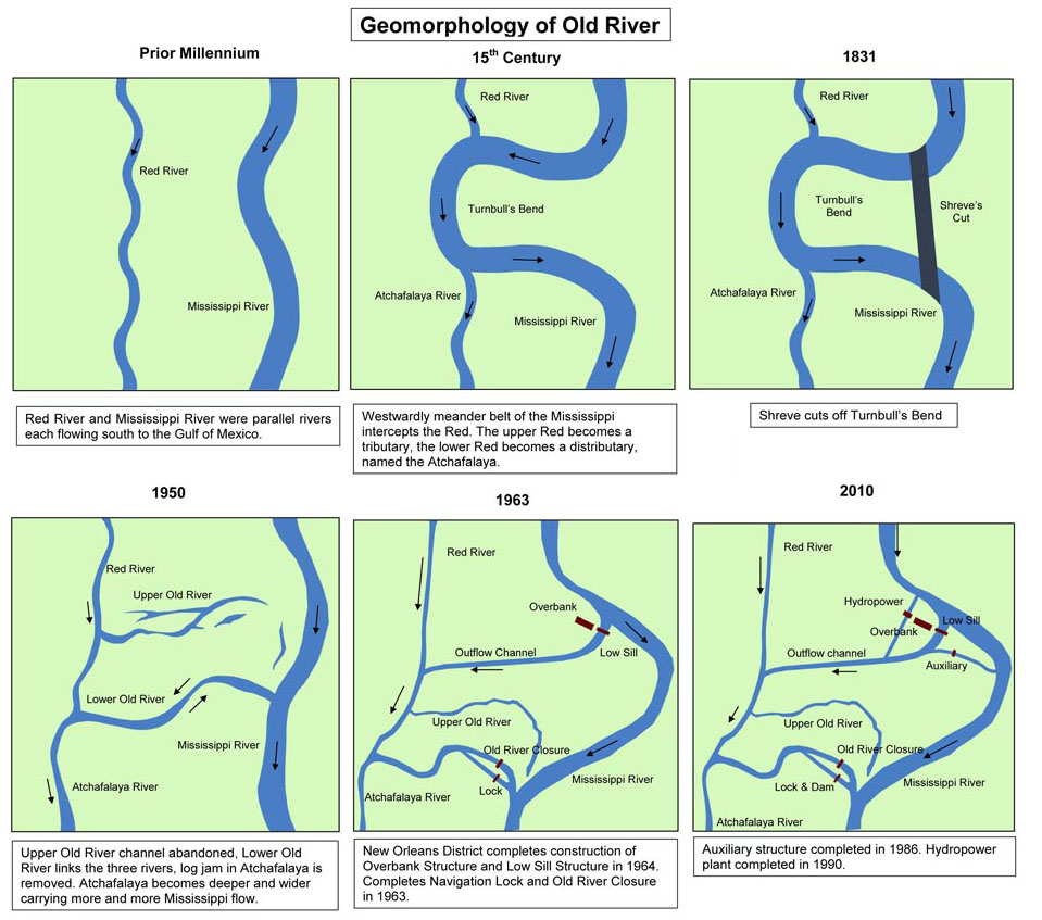
Changing channels for the Red, Mississippi, and Atchafalaya Rivers
In 1831, Henry Shreve, a riverboat captain who was always looking for ways to make it easier to navigate the Mississippi River, saw a bottleneck on the lower Mississippi and wanted to do something about it. At Turnbull’s Bend, the river made an 18-mile meander where it connected the Mississippi to the Red River to the north end of the loop and the Atchafalaya at the south. The Red River fed water into the Mississippi, while the Atchafalaya took some water out, although not all that much water moved in either direction because massive logjams blocked much of the flow of water from both rivers. Shreve made his shortcut and over time, the upper portion of the bend filled with silt, while the lower portion became the new connection with the Atchafalaya. With a straighter path, more of the Mississippi’s flow shifted down the Atchafalaya.
Those massive logjams were also a target for improvement in the 19th century. The Red River had an impressive 150-mile jam, making the 30-mile jam on the Atchafalaya seem surmountable. The logjam were so compacted that cattle could be driven across the Atchafalaya atop the logs, and, while that might be good for ranchers, it’s not so good for boats.
The State of Louisiana and the US Army Corps of Engineers therefore initiated a project to clear the logjams. It took a while, decades on the Red River, in fact, but eventually the work was finished. To make sure that the channel was deep enough, the Corps dredged the bottom of the upper Atchafalaya, but that ultimately proved unnecessary as the combination of flow from the Red River and the cleared logjam sped up the current and dug a deeper channel on its own.
By the 1940s, so much water was diverting from the Mississippi River and down the Atchafalaya that engineers and politicians got very worried. The reason for the shifting flow was simple. The path to the Gulf was shorter (by 160 miles) and a little steeper down the Atchafalaya than the course the Mississippi was already following past Baton Rouge and New Orleans and through the birdfoot’s delta of Plaquemines Parish. Water will follow the path of least resistance. If the Mississippi were to do what came naturally, New Orleans and Baton Rouge would no longer be river cites. In fact, they would, in all likelihood, cease being substantial cities, as their supply of fresh water and navigation channels evaporated.
None of this was really a surprise. There are reports from the 19th century where observers noted that the Atchafalaya River presented a very attractive alternative course for the Mississippi River to follow. As is usually the case in these situations, the people with the knowledge are ignored in favor of the people with the money.
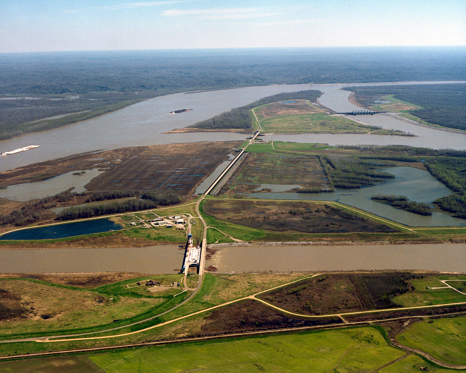
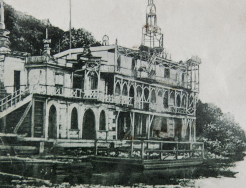
Old River Control Structures from the air
So in the 1950s, with a third of the Mississippi’s flow diverting down the Atchafalaya River, the federal government authorized a major engineering project to prevent any further shift. The Low Sill Structure and Over Bank Structure were completed in 1962 (for $86 million or $656 million in 2013 dollars). The Corps used those structures to manage the water so that 70% of the flow stayed in the Mississippi and 30% went down the Atchafalaya.
A major flood in 1973 came unnervingly close to causing those structures to fail, however, which would almost certainly have sent the Mississippi on the shorter route down the Atchafalaya. The Corps’ response was to pour more concrete, the Auxiliary Structure, that was completed in 1986 (for $206 million or $498 million today). Collectively, these are known as the Old River Control Structures. They are paid for entirely with federal tax dollars, by the way.
We built these structures as an attempt to engineer our way around engineering decisions we made earlier to remake the river for navigation and flood control. We weren’t too good about thinking through the potential consequences of our actions back then. I’m not sure we’re much better at it today.
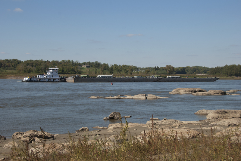
Mississippi River at Thebes, Illinois
This story came to mind when I read that the Corps is once again blasting rock from the riverbed in an area known as the Thebes Gap. The Corps plans to remove nearly three times as much rock this year (2,800 cubic yards) as during last winter when the river was very low (1,000 cubic yards). Removing those rocks from the bottom will almost certainly increase the speed of the river through that area. What might the impact be on the river through the Thebes Gap and downstream? I don’t have that answer, but I sure hope someone is thinking about this in broader terms than just making a deeper channel for barges.
If you like the content at the Mississippi Valley Traveler, please consider showing your support by making a one-time contribution or by subscribing through Patreon. Every dollar you send makes it possible for me to continue sharing stories about America’s Greatest River!
© Dean Klinkenberg, 2013
Community-supported writing
If you like the content at the Mississippi Valley Traveler, please consider showing your support by making a one-time contribution or by subscribing through Patreon. Book sales don’t fully cover my costs, and I don’t have deep corporate pockets bankrolling my work. I’m a freelance writer bringing you stories about life along the Mississippi River. I need your help to keep this going. Every dollar you contribute makes it possible for me to continue sharing stories about America’s Greatest River!
Fascinating! I know that we have messed with the River a lot, and not necessarily for the better. Interesting to see specifics.