In this episode (part one of a two-part series), we trace the first ten thousand years of human life along the Mississippi Valley: who came here, what they built, and what we think they believed about the world they were living in.
We start with ice. Glacial Lake Agassiz breaks its bank, Glacial River Warren tears a valley through Minnesota, and a waterfall the size of Niagara begins a slow retreat upriver to the spot we now call St. Anthony Falls. The first Minnesotans arrive to a landscape still reawakening, sharing it with mammoths and mastodons and this massive river.
From there we follow people down the length of the valley as they learn to live off big rivers and floodplains, domesticate their first plants, and build monuments out of soil. At Watson Brake in Louisiana, hunter-gatherers raised eleven mounds a thousand years before the first Egyptian pyramid. At Poverty Point, thousands of people assembled a massive earthwork in about ninety days — apparently without a ruler telling them to.
We also look up. The three-tiered cosmos of Upper World, Below World, and This World; the Earth Diver stories; and the Path of Souls, the star road the dead traveled — and which Hopewell builders in Ohio aligned their roads and mounds to meet.
In the next episode, we’ll go deep into Cahokia and the invasion led by Hernando de Soto.
Show Notes
Written on the Edge/WROTE Podcast
Poverty Point World Heritage Site
Effigy Mounds National Monument
Serpent Mound (Ohio)
Support the Show
If you are enjoying the podcast, please consider showing your support by making a one-time contribution or by supporting as a regular contributor through Patreon. Every dollar you contribute makes it possible for me to continue sharing stories about America’s Greatest River.
Don’t want to deal with Patreon? No worries. You can show some love by buying me a coffee (which I drink a lot of!). Just click on the link below.
Transcript
Sun, Aug 16, 2026 12:29PM • 35:05
SUMMARY KEYWORDS
Indigenous history, Mississippi River, Earthworks, Mound building, Creation stories, Dakota tradition, Glacial history, Hunter-gatherers, Plant domestication, Poverty Point, Watson Brake, Adena-Hopewell, Effigy mounds, Celestial alignment, Spiritual realm
SPEAKERS
Dean Klinkenberg
Dean Klinkenberg 00:00
Celestial objects would align in a specific way, so free souls of the dead entombed in the Newark Earthworks could begin their journey to the Realm of the Dead. This only happened on the summer solstice, when the moon reached either its maximum or minimum standstill, and the Path of Souls touched the horizon.
Dean Klinkenberg 00:40
Welcome to the Mississippi Valley Traveler podcast. I’m Dean Klinkenberg, and I’ve been exploring the deep history and rich culture of the people and places along America’s greatest river, the Mississippi, since 2007. Join me as I go deep into the characters and places along the river, and occasionally wander into other stories from the Midwest and other rivers. Read the episode show notes and get more information on the Mississippi at MississippiValleyTraveler.com.
Dean Klinkenberg 01:07
Let’s get going. Welcome to episode 82 of the Mississippi Valley Traveler podcast. Well, I’ve got something a little different for you today. A few years ago, I was doing a lot of research trying to piece together the history of indigenous communities along the Mississippi, particularly before the arrival of the first Europeans. And I went pretty deep. I read a lot of articles and some books, and where where possible, I accessed Native American historians or tribal histories, but for the most part, I think this will. The research came from anthropologists. So I spent a lot of time on this, like I said, and I pieced together a fairly lengthy description of the history of Native American communities along the Mississippi. So that’s what we’re going to do today. I ended up putting that into a book chapter that I never published anywhere. So rather than letting that wither away on a hard drive somewhere, I’m going to read you the chapter today to give you a sense of the broad history of Indigenous people along the Mississippi.
Dean Klinkenberg 02:22
A couple of notes, like I do my best with the pronunciations, so I think I got most of them pretty close. Hopefully, not embarrassingly bad, but I think they’re pretty close. And I know, like technically in Spanish, when you see a name like Hernando de Soto, you would refer to his last name as Soto. I notice some academics are doing that in their writings these days, which is technically technically correct. But you know, we’re also used to calling that man De Soto. I’m just going to continue to do that, even though I know it’s not technically correct. So pardon that veering away from from convention.
Dean Klinkenberg 02:58
Well, and I can’t help but offer one more caveat. Of course, keep in mind that everything I described is the accumulation of informed guesses. We don’t really know all the details of the lives of the people who lived along the Mississippi River before everything was written down and posted on Instagram. So keep that in mind. Some of this is prone to change and may change over time.
Dean Klinkenberg 03:26
And I also want to remind you that I have talked about poverty point in a previous episode. If you go back to episode 14, if you missed that one, I chatted with Diana Greenlee mostly about Poverty Point, but we touched a little bit on Watson Brake as well. Also, a quick note: boy, the episode ran a lot longer than I thought it was going to. It’s over, probably going to be about an hour and a half of finished narration. So I’m going to split it into two parts. So today you’ll get part one, which will cover from roughly the end of the ice age until just before Cahokia emerges. So in two weeks I’ll run part two.
Dean Klinkenberg 04:06
Also, quick update about my travel memoir, ‘Better Safe Than Sorry.’ It officially releases on August 25th. Right now, you can pre-order the ebook in most of the digital marketplaces. If you want to know more about the book, just go to deanklinkenberg.com/bettersafethansorry. You’ll find the full sales description there. On august 25, then you’ll also be able to purchase print editions of it. I have not been able to figure out how to set up pre-orders for print books as an indie author. It’s not something Amazon allows, so for now you can just order the ebook if that’s what you’re interested in. But if you think you’re going to want a physical copy, then that will go live on August 25th.
Dean Klinkenberg 04:52
I had the chance to go into some detail talking about this book with my brother on his podcast, The Messy City Podcast. So if you check that out, he’s on Spotify and Substack and a bunch of places. Just look for the Messy City podcast with Kevin Klinkenberg, and you can hear the two of us talking about that book and the idea of fear and trying to work past our fears, especially the ones that are really limiting our lives.
Dean Klinkenberg 05:21
And I also mentioned I had a chance to chat with Vance and Baz on the Written on the Edge podcast or ‘WROTE’. They’re all over the usual podcast platforms, including YouTube. I mostly talked about Murder on the Mississippi, but we also talked briefly about Better Safe Than Sorry, the new travel memoir. So check that one out too.
Dean Klinkenberg 05:41
Thanks to all of you who continue to show me some love through Patreon. I deeply appreciate the ongoing support. For as little as $1 a month, you can join the community where you get early access to all of the episodes. If you’re interested in joining, go to Patreon.com/deanklinkenberg, and you’ll find it there. If you’re not really into Patreon, you can buy me a coffee. It can help pay for my caffeine habit. That’s important as well. That caffeine fuels so much of my creativity. So I appreciate every little bit that helps me keep that going. If you want to know how to do that, go to MississippiValleyTraveler.com/podcast, and there you will find a link to buy me a coffee. And in that same place, MississippiValleyTraveler.com/podcast, you’ll find a listing of all previous 81 episodes. Click on one to listen to it or to check out the show notes. You’ll be able to access the show notes for this episode, for example, where I will have a few links to tourism sites that preserve the history of Indigenous communities along the Mississippi, and maybe one or two other things. So that’s at MississippiValleyTraveler.com/podcast for all of those previous episodes and their show notes. And now let’s get on with the podcast.
Dean Klinkenberg 07:12
Part 1: Creation.
Dean Klinkenberg 07:15
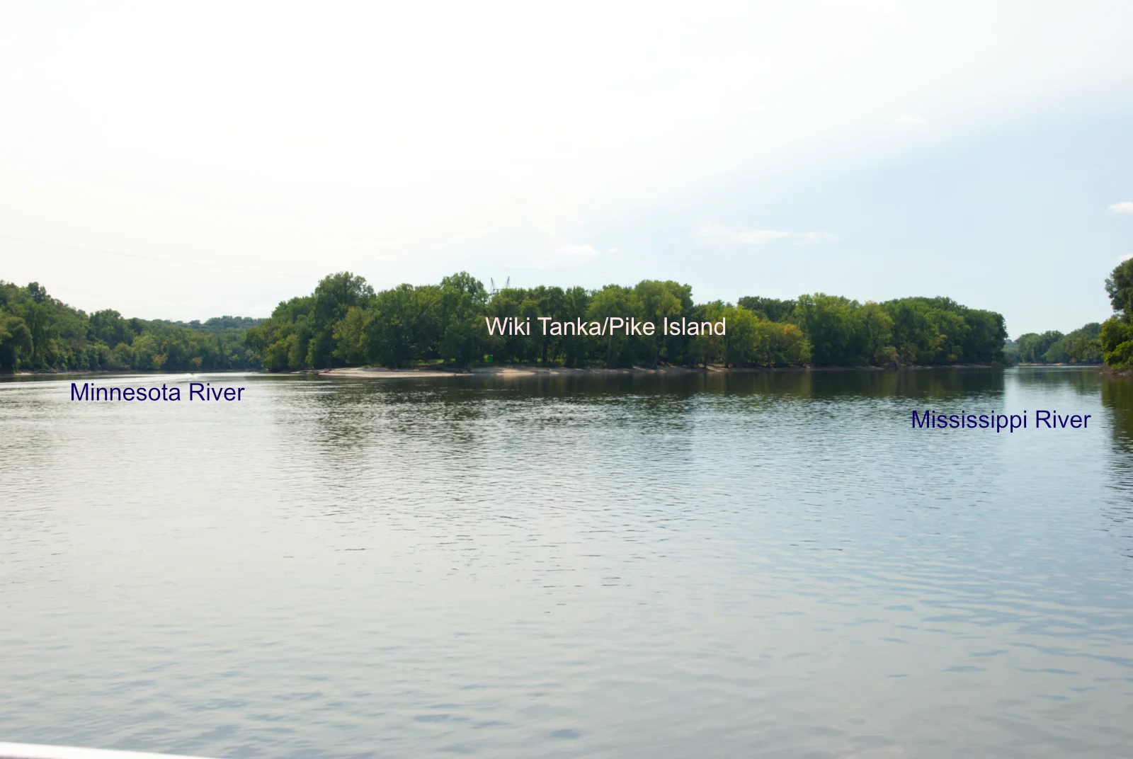
In Dakota Indian tradition, a bdote is a place where two bodies of water become one. For the Dakota people, one bdote in particular rises in importance above the rest. The place where the Minnesota and Mississippi rivers become one. This is the place where life began.
Dean Klinkenberg 07:35
Until 20,000 years ago, mountains of ice glaciers covered Bdote. As the ice melted, water filled a vast basin northwest of Bdote, forming a great body of water we now call Glacial Lake Agassiz. Water eventually overtopped a bank along the lake’s southeast corner, blasting open a hole and sending torrents of water ripping through the land, creating a river we call Glacial River Warren. This new river carved a deep valley that the Minnesota River flows through today. In central Minnesota, Glacial River Warren merged with a much smaller river, the Mississippi. Their combined flow merged into an old channel of the Mississippi River at Saint Paul, then scoured out the sediment of the old channel until it hit bedrock. This formed a great waterfall, Warren Falls, as monumental as Niagara Falls.
Dean Klinkenberg 08:32
Over time, the falls retreated from their birthplace at today’s Saint Paul, eventually splitting into two at Bdote. One branch continued up the Minnesota River for two miles before leveling out. The other branch continued up the Mississippi River to Minneapolis, where they are today, five miles above Bdote. The Dakota Indians called these falls owahmenah, and Ojibwe Indians called it kakabikah. We know it today as St. Anthony Falls, the name given them by the Belgian-born Franciscan priest Louis Hennepin in the 17th century.
Dean Klinkenberg 09:10
When the first people arrived in Minnesota, Glacial River Warren still flowed through the state. They probably stood on the banks and marveled at the big river and its great falls. The first Minnesotans arrived as the climate was warming and life was returning to areas previously buried under thousands of feet of ice. Birds circled in the sky, dropping seeds they’d carried from other places that sprouted into green plants in the sand and gravel. Wooly mammoth and mastodons roamed into the area. In a sense, life really did begin at this confluence at Bdote.
Dean Klinkenberg 09:47
Those early people were mobile, traveling in small groups of a couple dozen people, extended families in all likelihood, accompanied by a few pet dogs. They faced many obstacles as they adapted to a world reawakening. Huge lakes and rivers roaring with frigid water blocked travel routes. Emerging spruce, fir, boreal forests supported limited plant and animal life, so food could be hard to find. Megafauna like those wooly mammoth and mastodons hunted for food and hides would soon disappear.
Dean Klinkenberg 10:21
Still, the people managed. By 9000 years ago, the continental ice was a distant memory. The climate had warmed, and rains came less frequently. Prairies and savannas spread as the boreal forests retreated. The flow of the Mississippi slowed as it carried less water and dropped sediment that slowly covered bedrock and raised the channel higher. Some people moved into the Mississippi bottomlands to live, building communities on the islands that developed out of Kingston Terrace near Prairie du Chien, Wisconsin. Stone tools for activities like grinding, chopping, and cutting made the tasks of daily life easier, and the Mississippi Valley was rich in stone, especially in western Wisconsin, where people harvested rock like Cochrane chert from ridgetops.
Dean Klinkenberg 11:11
In northern Minnesota, family groups spent summers in the grasslands, then moved on in late summer to Lake Itasca, where they hunted bison with stone-tipped spears, taking advantage of the boggy soil that slowed the bison’s gallop. After the animals were butchered, the meat was smoked and dried, the hide scraped and tanned. People celebrated their success with a feast, then moved on to their winter homes in caves or forests in the region. In spring, they returned to Lake Itasca to catch fish and turtles, then moved back to the grasslands for summer.
Dean Klinkenberg 11:45
Their contemporaries further south lived in the grassy plains and savannahs of Arkansas, and near the oak and hickory forests of the lower Mississippi Valley. For generations, those people knew a Mississippi River that flowed down a braided channel that cut through a dense complex of wet and dry wilderness. As the river carried less water, its channel evolved into a restless waterway that meandered through the soft soil. The first people in the southern part of the valley were probably also small bands of hunters and gatherers. They lived off the abundant white-tailed deer rather than bison and collected nuts and berries from the forests. They were among the first to shape stone into adzes, a useful tool for sculpting wood. It’s likely that these people used adzes to carve dugout canoes to travel on the area’s waterways, maybe even on the Mississippi.
Dean Klinkenberg 12:40
Down where the river ends at the Gulf of Mexico, people lived off the rich coastal resources of the Mississippi Delta, where oysters and fish were abundant. Rising sea levels forced them to relocate occasionally. The Gulf rose 30 feet over 4000 years, until sea levels stabilized about 4000 years ago. Populations grew steadily along the Mississippi Valley, and people narrowed the world in which they lived, returning to the same places each season to hunt, eat, and raise their children. By 5000 years ago, people near the middle and lower Mississippi had generally shifted from a forest-dependent lifestyle to living off the bounties of big rivers and their floodplains. They were also learning how to domesticate plants, starting with a bottle gourd in the family Cucurbitaceae, which includes honey melon, cucumber, squash, and pumpkin. It’s possible seeds of Cucurbitaceae first reached North America by floating across the Atlantic Ocean from Africa. Not long after that, people also domesticated sunflower, marsh elder, chenapod, erect knotweed, and maygrass. Cultivating these plants provided a more reliable source of food, and enabled wanderers to spend more time in one location.
Dean Klinkenberg 13:59
Part 2: Order from Chaos.
Dean Klinkenberg 14:03
In much of North America, people believed life existed in three planes: the Upper or Sky World, where the Creator lived, along with sunwoman, thunderbirds, and falcon man. Birds and other winged creatures called it home; in the upper world, perfect order and stability ruled.
Dean Klinkenberg 14:22
The Below World existed underwater and was a chaotic place, unpredictable and prone to spawn madness. The Below World, though, balanced the order of the Upper World. The Below World was also the source of the fertility that created human life and abundant crops. The Great Serpent lorded over water creatures like frogs, snakes, fish, and lizards.
Dean Klinkenberg 14:46
In between the Upper and Lower Worlds was This World, the place where humans lived, a place they shared with animals and plants. This World floated on water or the back of a turtle, and many Native American cultures have creation stories that describe that describe how This World came to be.
Dean Klinkenberg 15:04
In Anishinabe legend, for example, infighting led the Kichi-Manitou, the Great Mystery, to purify the earth by sending a great deluge. The only human to survive was Nanaboozhoo, who shared the watery world with a few animals who were very good swimmers and fliers. Nanaboozhoo, floating on a log, was unable to find land, so he swam to the bottom to bring up a handful of mud to create new land. He couldn’t reach the bottom, though, and neither could other animals: the loon, the hell diver, the mink, the turtle. They all failed. Finally, soft-spoken Wa-zhushk, the muskrat, volunteered to try. Wa-zhushk was gone so long that he was presumed dead, which he was. When Wa-zhushk’s body floated to the surface, though Nanaboozhoo spotted a clump of mud in his paw. Wa-zhushk, muskrat, had sacrificed his life to retrieve that clump of dirt. Nanaboozhoo placed the mud on the back of a turtle. The four winds all blew at once, and a large island grew in the middle of the water that we now call North America. Other Indigenous nations tell similar stories about what has been labeled the Earth Diver. These creation stories might have been the inspiration for the earliest earthworks in North America.
Dean Klinkenberg 16:29
Indigenous people in North America built monumental structures for thousands of years. Large earthworks were once a common sight, especially near big rivers like the Mississippi. These ancient sites would be far more famous today if those early North Americans had built with stone instead of with soil.
Dean Klinkenberg 16:48
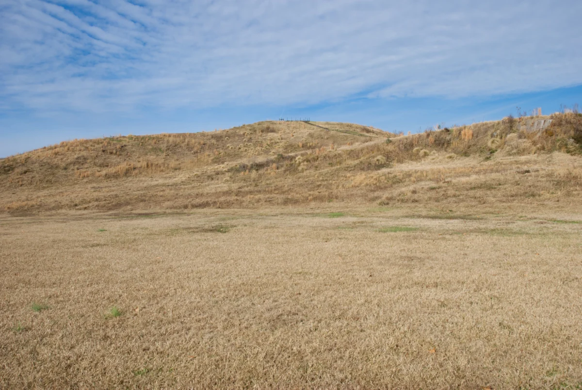
The earliest known earthworks in the Mississippi Valley were built in present-day Louisiana. At Watson Brake, early Americans built 11 mounds in an oval pattern, each connected by a low ridge. Work on the mounds began around 3,500 BCE, which stands for Before the Common Era, and continued over five centuries. Those early Americans built their first mound nearly a millennium before the first pyramid rose in Egypt, and 500 years before tribes in England moved the first rocks to create Stonehenge.
Dean Klinkenberg 17:20
Watson Brake was built on a slight rise near the Ouachita River, about 80 miles west of the Mississippi. The mounds weren’t used for burials, and while the site was used all year, it’s not clear that it was occupied year round. The mounds may have been built as a way to unify people in the area. They’re aligned with the summer and winter solstice, so they may be a place for people to come together during important times of the year to mark important seasonal transitions. Still, Archaic-era hunter-gatherers weren’t supposed to be capable of organizing the resources to build structures of that size and complexity, yet they did.
Dean Klinkenberg 18:02
There are thirteen known mound sites in Louisiana and Mississippi that date to that same period, although there are no known connections between them. In subsequent generations, though, impressive trade networks developed, much of it facilitated by travel on the Mississippi River. Copper reached the Mississippi Valley from Upper Michigan, some of which was used to create elaborate personal ornaments. Seashells flowed in from the coast, flint from North Dakota, and obsidian from Wyoming. In addition to growing trade networks, people increasingly milled grains and nuts, and formal burials became more common.
Dean Klinkenberg 18:39
After Watson Brake, mound construction ceased for several centuries. The next known earthworks were built around 1700 BCE at a place known as Poverty Point. Separated from Watson Brake by sixty miles and a thousand years, we haven’t yet found evidence that the two mound-building cultures were connected. Poverty Point sits 15 miles west of the Mississippi River, atop Mason Ridge, 130 miles of elongated high ground bordered by swamps and forests that the Mississippi River flooded seasonally. The community at Poverty Point covered a few square miles, but its influence spread throughout the lower Mississippi Valley and southeast. The earliest structures at Poverty Point included a mound and a plaza covered with a large with several large circular structures. 200 years later, the people of Poverty Point radically reshaped their physical world. That first mound was essentially abandoned, and the plaza cleared and covered. A new mound was built, followed by a series of six semi-elliptical terraces.
Dean Klinkenberg 19:45
Shortly after that, the people of Poverty Point built a massive structure called Mound A, the second-largest earthen structure in North America. Only Monk’s Mound Cahokia is larger.
Dean Klinkenberg 19:57
This massive reconstruction was completed rapidly. The terraces were built in a single generation. Even more remarkable, Mound A was probably completed in just 90 days-a feat that would have required perhaps 4,000 people to accomplish.
Dean Klinkenberg 20:14
Building these structures required the ability to organize, feed, and house a large labor force. While there’s no evidence that they grew their own food, they probably didn’t need to. The area around them was abundant with life. The waters teemed with fish, which they caught with nets.
Dean Klinkenberg 20:31
The people of Poverty Point also developed a distinctive technology for cooking. They hand molded loess, wind-blown soil, into shapes like balls or ropes, then baked them in a fire to make them solid. Most were an inch or two in diameter. They were warmed, then dropped into a fire pit, probably dozens at once, where they helped regulate heat. It’s possible that the different shapes produced slightly different heating properties. Some might have created more intense heat, for example, while others might have remained hotter for longer.
Dean Klinkenberg 21:03
The people of Poverty Point traded with other groups of people who lived hundreds of miles away, relying on the web of rivers and streams to reach them. From the bluff line along Bayou Mason, a person could have paddled to the Ouachita Mountains in central Arkansas, to the Ozarks of eastern Missouri, or to the Shawnee Hills in southern Illinois, all without a single portage. From what we can tell, their trade networks worked mostly one way. Tons of stone were imported to Poverty Point, but there is no evidence that Poverty Point was exchanging any material objects in return. They fashioned those imported stones into an impressive range of tools that they used for scraping, cutting, drilling, hunting, and for personal fashion.
Dean Klinkenberg 21:52
Why would a group of people who lived off what they could hunt and collect come together in such large numbers to build mounds and terraces? That answer has been elusive. There is no evidence that a central leader organized and dominated at Poverty Point. To the contrary, they looked like they were an egalitarian, cooperative society.
Dean Klinkenberg 22:14
In recent years, some scientists have suggested that Poverty Point was a site for collective worship, a place of pilgrimage that attracted the reverent rather than an economic center. Archeologist Tristram Kidder speculated that “the building of this earthwork represents an enactment of ritual, where the builders covered the watery chaos of precreation and erected a monument symbolizing the triumph of creation over the forces of chaos.” In other words, the act of building up, of moving and layering dirt into mounds in an area surrounded by water, was a way for those ancient people to reenact their creation story, much in the way that Catholics recreate a ritual from the Last Supper every week when they participate in communion.
Dean Klinkenberg 23:02
Archeologist John Gibson, who spent much of his career studying Poverty Point, arrived at a similar conclusion. Gibson speculated that the structures of Poverty Point may have been built to represent ancient symbols of creation in the universe. Even though people in the Southeast spoke many different languages and had their own unique cultures, they probably shared many beliefs about the spiritual realm.
Dean Klinkenberg 23:24
The geometric patterns at Poverty Point, for example, represented life as an eternal loop that connected birth and death. The rings were open to the east to welcome the Creator each morning, and closed to the west and north to block the bad spirits that came from those directions. The site was laid out carefully along a north-south axis and in alignment with solstices and other cosmic events, creating what archeologist William Romain called “a cosmic center,” a place centered around the cardinal directions where the upper and lower worlds converged, where people carefully observed the changing of the seasons, the entire place feels like it was meant to bring people together.
Dean Klinkenberg 24:07
For 200 years, people came together at Poverty Point. Then, mysteriously, they abandoned it. Again, we don’t know why, although its decline in importance may have been driven by changes in the climate. Some 300 years ago the region got significantly wetter and cooler. The Gulf Coast was probably hit by more frequent and more severe hurricanes. An increase in flood intensity and duration would have disrupted trade networks and may have made it harder to collect food. People may just have decided that life in the floodplains was no longer tenable, so they migrated out to prairies and savannas to start anew.
Dean Klinkenberg 24:49
Hey, Dean Klinkenberg here, interrupting myself. Just wanted to remind you that if you’d like to know more about the Mississippi River, check out my books. I write the. Mississippi Valley Traveler guidebooks for people who want to get to know the Mississippi better. I also wrote “The Wild Mississippi”, a guide that goes deep into the complex ecosystems supported by the Mississippi, the plant and animal life that depends on them, and where you can go to experience it all. If you like fiction, check out my Frank Dodge Mystery Series. Each book is set in places along the Mississippi River. My newest book is a travel memoir called “Better Safe Than Sorry: Slowboats, Chicken Busses, and the Radical Choice to Trust the World.” The book explores a simple question: “What happens when you stop asking ‘What if something goes wrong?’ and start asking, ‘What if everything goes right?'” Find out more at deanklinkenberg.com/bettersafethansorry.
Dean Klinkenberg 25:51
Part 3: A Path Across the Sky.
Dean Klinkenberg 25:56
In many Native American cultures, people believed that a human had at least two souls. One soul fueled life, but had no consciousness. Extinguish it, and the body died. Each person also had a soul that combined the essence of who they were, what some cultures called a free soul. When a person died, or dreamed, or was ill, the free soul could leave the body. After death, the free soul would have to complete a difficult journey to reunite with ancestors in the Realm of the Dead. The road from this world to the Realm of the Dead followed an elongated ribbon of stars that bends around the horizon that they called the Path of Souls, what we now know as the Milky Way.
Dean Klinkenberg 26:43
The journey to unite with the ancestors was long and difficult, and there was not even a guarantee that a free soul would successfully enter the Path of Souls. For many Indigenous people in the southern U.S. for example, a free soul had to travel west to where the sun set, to the edge of the earth disk, and wait for the right moment to jump onto the Path of Souls. This was only possible for a few minutes from late November through April, when stars in the shape of a hand, part of Orion, touched the horizon, which enabled the free soul to make the leap.
Dean Klinkenberg 27:19
For other Native Americans, the Path of Souls could only be entered through specific portals in this world, such as Ohio’s Sugarloaf Mountain, Trempealeau Mountain along the Upper Mississippi River, or maybe through one built specifically by the people for that purpose, such as a mound.
Dean Klinkenberg 27:37
Once on the Path of Souls, a free soul would face many obstacles, finding a way across a big river, or dodging the talons of a giant raptor, or the teeth of a vicious dog. At the end of the path, a Great Serpent, represented by the constellation Scorpio, with a red jewel in its forehead, the star Antares, guided the entrance to the Land of the Dead. Souls that successfully navigated all these hazards joined the ancestors in the Land of the Dead, a place similar to This World, except that it was perpetually pleasant and happy.
Dean Klinkenberg 28:12
I mean, who wouldn’t like to go there?
Dean Klinkenberg 28:14
Centuries ago, people knew a night sky dense with stars and groups of stars. As people got increasingly adept at domesticating plants, they settled into larger communities for longer periods of time. This probably gave them more time to ponder the meaning of those stars and to build increasingly elaborate and complex structures to represent those beliefs. Many stars and features of the sky became highly symbolic.
Dean Klinkenberg 28:42
By 1000 BCE, great pine forests were thriving across the northern Mississippi Valley, while along Lower Mississippi, the great river’s slower current began carving lazy meanders from the Gulf of Mexico to southern Missouri. While the forests weren’t great places to grow crops, the floodplains of those rivers were exceptional. People along the Mississippi and other major rivers had been practicing some form of agriculture since at least 5,000 BCE. While maize was grown in eastern North America as early as 200 BCE. it wasn’t cultivated widely until 800 CE, CE for Common Era, which is the equivalent of AD. when people created cold-hardier varieties.
Dean Klinkenberg 29:26
As people relied more on domesticated plants, they traveled shorter distances and less often for food. Along the upper part of the river, they built seasonal communities in the rich Mississippi bottomlands where they lived during the warmer months. As the weather cooled, they dispersed into smaller groups and moved to the uplands, where deer were abundant. As people returned to the same places every year, some communities grew. They produced pottery to store food and water, and around the same time, they also carved stone pipes for the first time and started to trade some of them. They also began to smoke tobacco. They also reshaped the landscape in remarkable ways to build structures that reflected their views of life, death, and the afterlife.
Dean Klinkenberg 30:13
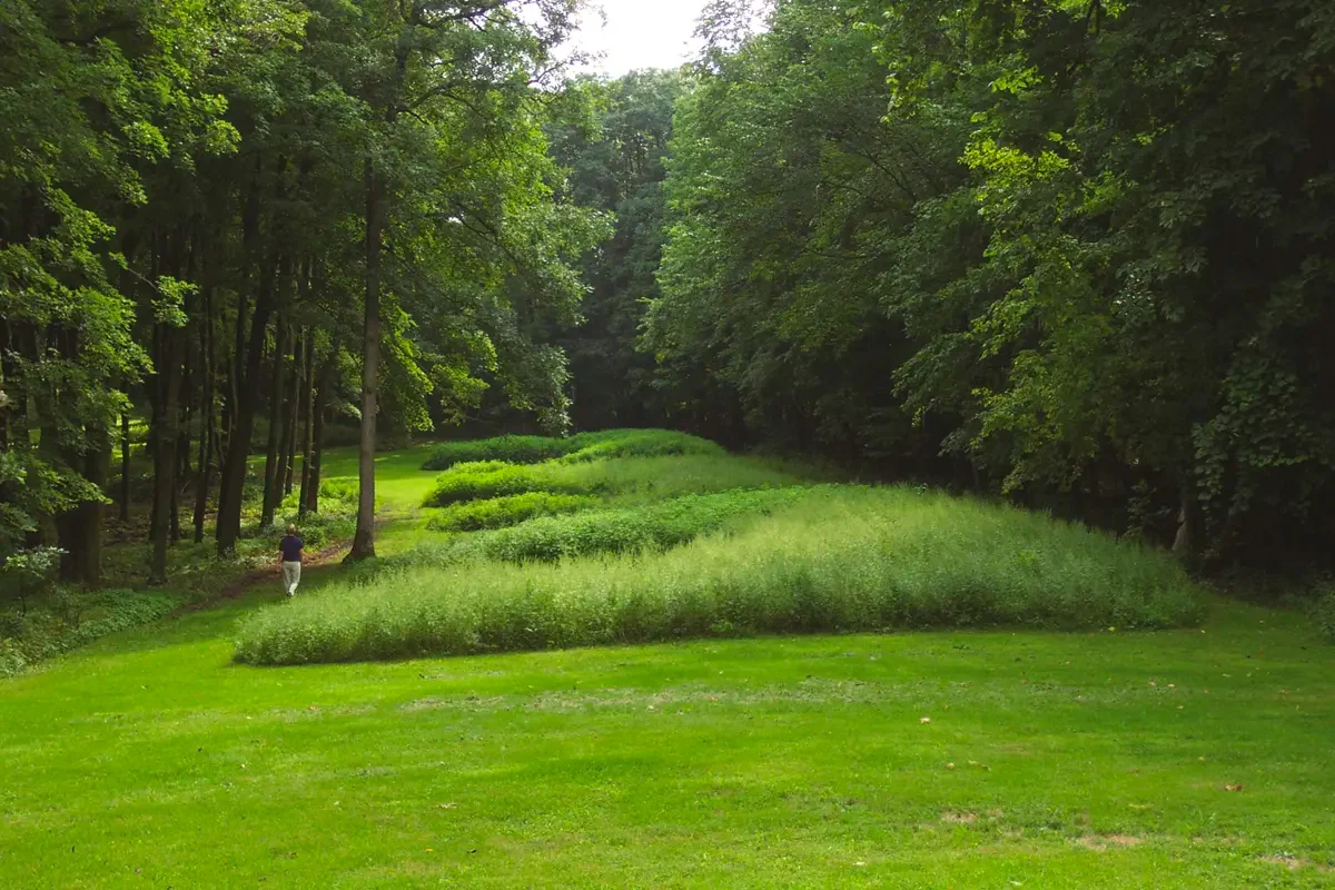
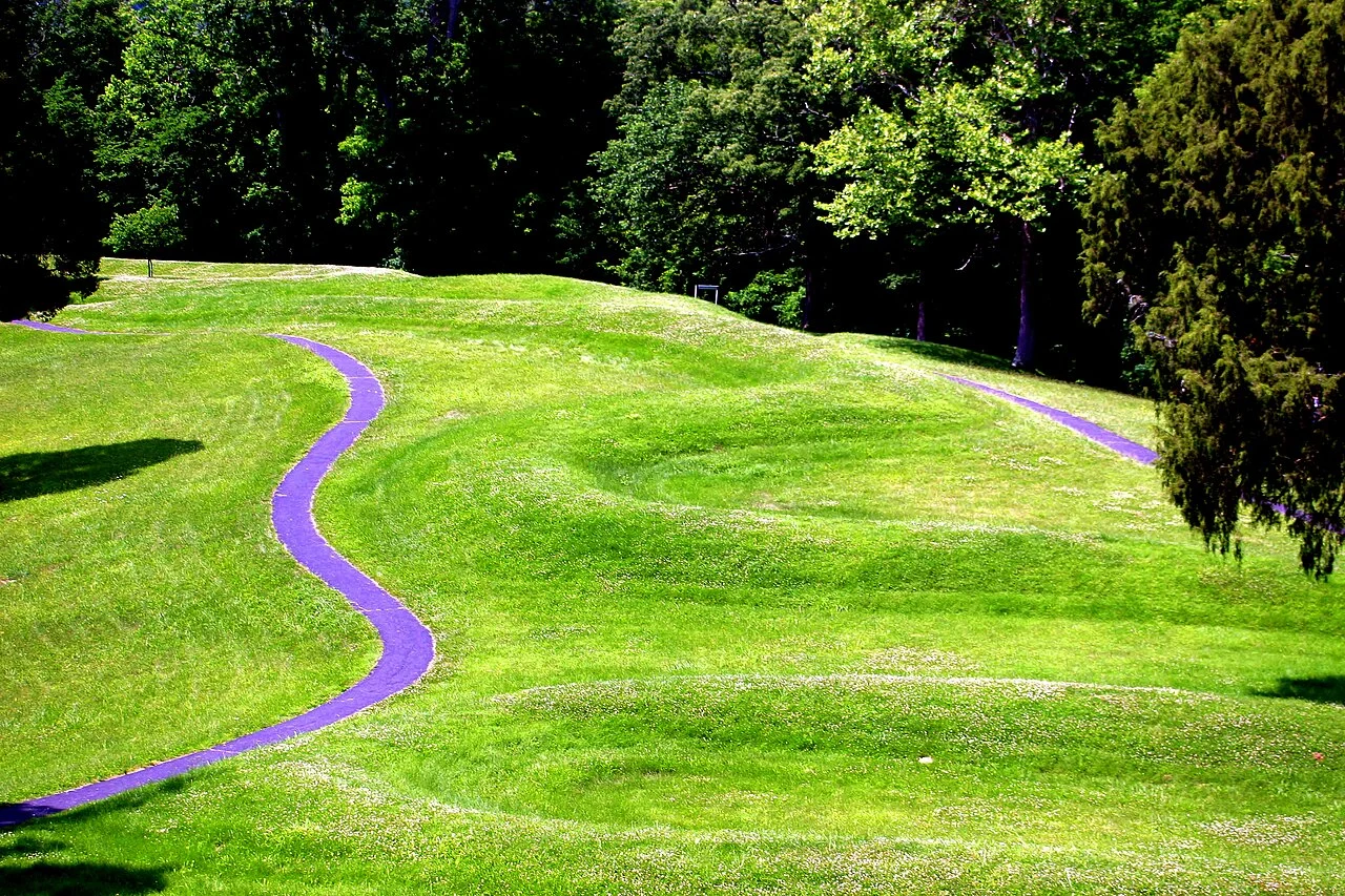
The earliest mounds in the middle and upper Mississippi Basin were built along the Ohio River by a culture that archeologists call the Adena-Hopewell tradition. There’s a similar cultural group south of the Ohio River that archeologists have labeled the Marksville tradition. Between 400 BCE and 400 CE, they built some amazing structures in South Central Ohio, including a stunning serpent mound that coils nearly 1,400 feet across the top of a hill. They also built an embanked pathway we know as the Great Hopewell Road, that stretched for several miles from the Newark Earthworks toward Sugarloaf Mountain. Investigations by William Romain revealed that the road aligns with one end of the Milky Way on the evening of the summer solstice. The alignment was almost certainly intentional. Once every nine years, celestial objects would align in a specific way, so free souls of the dead entombed in the Newark Earthworks could begin their journey to the Realm of the Dead. This only happened on the summer solstice when the moon reached either its maximum or minimum standstill, and the Path of Souls touched the horizon.
Dean Klinkenberg 31:27
At that moment, free souls could leave the tomb where their bodies had been buried and follow the Great Hopewell Road to Sugarloaf Mountain, where they would pass through the portal and enter the Path of Souls. Thirty-seven miles southwest of Sugarloaf Mountain, Serpent Mound, the twisting 1400 foot long mound, was built on an overlook above Brush Creek in a landscape dotted with sinkholes and bisected by a river, representing the other end of the Milky Way, the entrance to the Realm of the Dead.
Dean Klinkenberg 31:59
The Hopewell-Adena influence extended into the upper Mississippi Valley. People living near present-day Guttenberg, Iowa, for example, built 43 mounds atop a narrow ridge at the confluence of the Turkey and Mississippi rivers. Many of the mounds, which were built beginning around 500 BCE were burial sites, but one mound that stretched 98 feet across the top of the ridge resembles a panther. Some cultures imagine the ruler of the Lower World as an underwater panther rather than a serpent. Many Native Americans in the Midwest, such as the Osage people, believe that the Missouri and Mississippi Rivers represented the Path of Souls in this world.
Dean Klinkenberg 32:41
Mounds in the shape of animals were common along the Upper Mississippi, with construction peaking around 600 CE. There are many spectacular examples at Effigy Mounds National Monument, north of Marquette, Iowa. Dozens of animal-shaped mounds line the bluff tops overlooking the Mississippi. Most were built between 600 CE and 1150 CE. Birds are a common theme, but some mounds also shaped like turtles and bison. Perhaps most spectacular is the series of ten bears that appear to march across the landscape. While it’s not a leap to assume that the panther and serpent effigies represent the ruler of the Lower World in Native American cosmology, no one is quite sure what these other effigies might represent.
Dean Klinkenberg 33:28
Around 1000 CE another sea change was in the works, one that would reshape life for people along the Mississippi River and far beyond. It would result in some of the largest pre-European earthworks in North America, and a population explosion that created one of the continent’s great cities near the confluence of North America’s two biggest rivers.
Dean Klinkenberg 33:52
And we’re going to stop there for this episode. Come back in two weeks, and we’ll continue the story with Cahokia and De Soto’s invasion of the Southeast.
Dean Klinkenberg 34:05
Thanks for listening. If you enjoyed this episode, subscribe to the series on your favorite podcast app so you don’t miss out on future episodes.
Dean Klinkenberg 34:14
I offer the podcast for free, but when you support the show with a few bucks through Patreon, you help keep the program going. Just go to Patreon.com/deanklinkenberg. If you want to know more about the Mississippi River, check out my books. I write the Mississippi Valley Traveler guidebooks for people who want to get to know the Mississippi better. I also write the Frank Dodge Mystery Series that’s set in places along the river. Find them wherever books are sold. The Mississippi Valley Traveler podcast is written and produced by me, Dean Klinkenberg. Original music by Noah Fence. See you next time.