Introduction
The sign welcoming you to Potosi says “World’s Longest Main Street.” Maybe I’m over-thinking this, but I haven’t been able to figure out what this claim actually means. Robert Ripley (Ripley’s Believe It or Not) once said that Potosi “was the smallest town with the longest street without an intersection.” (I noticed a lot of intersections when I drove Main Street.) Locals say the proper definition is “the longest Main Street in the world that is not interrupted by a stop sign”—it’s three miles long. Or maybe it’s “the world’s longest Main Street that is not intersected by a through street,” except that Main Street is intersected by East Street, which is definitely not a dead-end. I just don’t get it. I guess “World’s Longest Main Street” wasn’t catchy enough, though, because Potosi also calls itself the Catfish Capital of the World. That’s two long nicknames for one small town. Regardless, there’s quite of bit happening in Potosi these days, so you can call it whatever you want, just stick around for a while.
Visitor Information
Direct your questions to the Potosi-Tennyson Chamber of Commerce (608.763.2912).
History
Potosi was the prototypical lead mining community. Early settlers arrived in the 1820s, before the Black Hawk War, and scoured the hollows and ravines for signs of lead. While it was known as early as 1829 that lead sulfide deposits were abundant, little mining occurred because conditions were not stable and, well, technically, Americans had no legal title to the land until after the Black Hawk War. In 1832, Willis St. John and Isaac Whitaker moved in. St. John founded a mine and got rich very quickly. He found a cave rife with lead and also with snakes, which is why the area around his cave became known as Snake Hollow. He died in 1853 a pauper, however, after losing all his money in a bank crisis. Mining took off full bore around 1835, and Snake Hollow boomed.
Separate communities grew up in different sections of the hollow. Lafayette was south of Snake Hollow on the bank of the Grant River in Grant Slough; that town was laid out in 1837. Van Buren was located in the lower portion of the hollow (near the Potosi Brewery); settlers began arriving in 1837 and the town was laid out in 1839. Van Buren had the first post office but Lafayette had the steamboat landing (the “Port of Potosi”) and ferry service to Iowa.
In 1839, these disparate communities consolidated into a single town called Potosi; businesses quickly moved toward the new center and out of Lafayette and Van Buren. By the time Potosi incorporated in 1841, the town claimed 1,300 residents and within a few years it had an economy nearly as large as Galena’s. The bulk of the town was concentrated along a three-mile hollow pierced with a single road. Rain often turned the road into a dangerous creek (it can still happen after torrential rain).
Like Galena, the decline of lead mining had a dramatic impact on the town’s economy. Between 1849 and 1852, scores of miners abandoned Potosi for the California gold rush, leaving in two waves. Potosi weathered the first wave, but the second one, fueled in part by a cholera epidemic in 1852, devastated the town. At the peak of the exodus, ferries were so busy that emigrating miners had to wait up to five days to cross the Mississippi. Another factor in Potosi’s decline was the fact that Grant Slough, the area that had the steamboat port, filled with silt because of deforestation, making steamboat landings impossible. Unable to dock at Potosi, river commerce shifted south to Dunleith (East Dubuque) and north to Cassville.
The town emptied out so quickly that incorporation was repealed in 1854. Even the town clerk’s books vanished, taking with it all official record of village life before 1854. The Chicago, Burlington, and Northern railroad reached Potosi in 1884, injecting new life back in the village. Potosi reincorporated in 1887 but by 1895 the town’s population had fallen to 454 or roughly one-quarter of what it was at its peak.
Potosi has never again experienced the economic prosperity it knew during the lead mining years, but it settled into the life of a small town with a farm-centered economy. Today, many of its residents commute to jobs in other towns, although tourism is becoming a more important part of the local economy.
Exploring the Area
The Passage Through Time Museum (104 Main St.; 608.763.2745) has modest but informative collection of local history memorabilia (such as displays about barn design, barbed wire, and the Potosi Brewery), as well as Native American artifacts from a local collector.
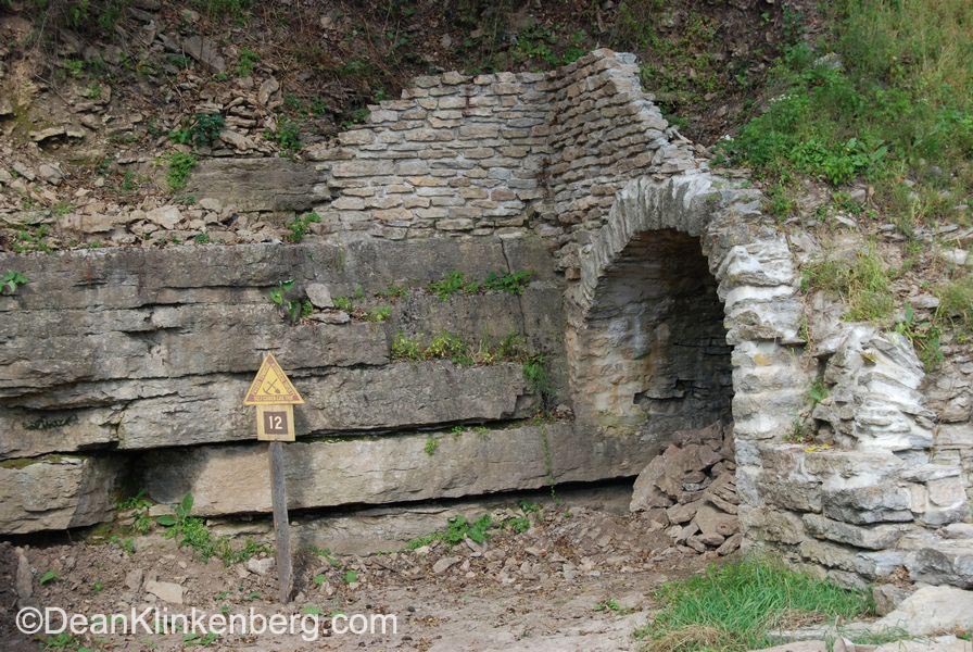
Hike the Badger Hut Trail across the road from the old St. John Mine and search for relics of the lead mining days, like the ruins of the badger huts and the Old Irish Cemetery.
The unassuming St. Thomas Catholic Church (124 S. Main St.; 608.763.2671) was completed in 1847. The legendary Father Samuel Mazzuchelli built a frame church here in 1838, and some believe he also designed this brick church.
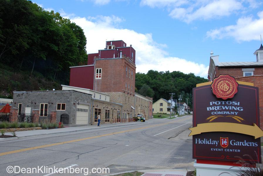
The hottest attraction in town is one of the oldest: the Potosi Brewery (209 S. Main St.; 608.763.4002). The Potosi Brewery was founded in 1852 by Germans Gabriel Hail and John Alrecht. Albrecht later sold his share, and Gabriel ran it until his death in 1878. John Hail, Gabriel’s brother, ran the brewery for a few years until he killed himself in 1881. The brewery struggled for a few years, even closing at one point, until Adam Schumacher purchased it in 1886. Three generations of Schumachers operated the Potosi Brewery until it closed in 1972. The building sat empty for three decades until a massive restoration effort spearheaded by several members of the local community was finished in 2008. They formed a non-profit corporation (all of the profits are funneled back to support the business or donated for other local projects) and completed a restoration that includes a brewpub (see below) and two museums. The National Brewery Museum fills several rooms with beer industry memorabilia like neon signs, advertising posters, glasses, and mugs. Also on site is the Potosi Brewing Company Transportation Museum, which highlights ways that the old brewery distributed its product around the area. Don’t forget to visit the gift shop and the Great River Road information center.
Across the street from the brewery, woodworker extraordinaire Gary David maintains a showroom where you can buy his artfully crafted furniture; David was also one of the people responsible for bringing the Potosi Brewery back to life.
Parks Along the Mississippi River
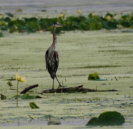
Potosi Recreation Area (608.822.3501), also known as Potosi Point, is a little strip of land that juts far into the Mississippi River. The views are magnificent, especially in spring and fall when migrating birds are passing by. In summer, water lilies carpet the shallow stretches near shore. The Point, a popular spot to fish, is south of town near the spot where State Highway 133 turns sharply to the west; go forward instead of turning north, go under the railroad trestle, and follow the road for ½ mile until it ends.
Entertainment and Events
Festivals
The event of the social season is the Potosi-Tennyson Catfish Festival (608.763.2261) usually held the second week of August.
**Potosi is covered in Road Tripping Along the Great River Road, Vol. 1. Click the link above for more. Disclosure: This website may be compensated for linking to other sites or for sales of products we link to.
Where to Eat and Drink
The Potosi Brewery (209 S. Main St.; 608.763.4002) is a high quality brewpub that has become very popular very quickly (reservations are recommended for dinner on weekends). The lunch menu is mostly sandwiches, wraps and salads; try the sweet potato fries. Dinner entrées include root beer marinated pork loin, steaks, and cedar smoked salmon. And don’t forget to sample the beer brewed on-site. The Snake Hollow IPA is my personal favorite.
If wine is more to your liking than beer, step across the street from the brewery to the Whispering Bluffs Winery (196 S. Main St.; 608.763.2468), where you can choose from an impressive selection of red and white wines. Here’s a hint: many pair quite nicely with the gourmet chocolates they carry, too.
Where to Sleep
Camping
The Grant River Recreation Area (River Lane Rd.; 309.794.4527; open early April to October 31) is a compact site wedged between railroad tracks and the river. The full-service campground has 73 sites, most of which have electric. The Old Osceola Indian Burial Grounds, known to archeologists as the Old Copper Culture Find, was located nearby. Relics from the site were washed into view during a flood in 1945. An extensive excavation of the site in 1947 unearthed thousands of artifacts, revealing that native hunters and gatherers lived at this site for at least 2000 years beginning around 2170 BCE. Most of the haul is on display at the Milwaukee Public Museum, but Potosi’s Passage Through Time Museum (see above) has items unearthed by private collectors.
Budget
The Potosi Inn (102 N. Main St.; 608.763.2269) rents three spacious, beautiful suite-size units with kitchenettes; they are a great bargain.
Cabins
Pine Point Lodge (219 S. Main St.; 608.763.2767) has four fully-stocked, modern cabins in a quiet setting on the edge of town; small cabins sleep four, while the large cabin can sleep 12.
Resources
- Post Office: 101 East St.; 608.763.2202
- Potosi Branch Library: 103 N. Main St.; 608.763.2115
Community-supported writing
If you like the content at the Mississippi Valley Traveler, please consider showing your support by making a one-time contribution or by subscribing through Patreon. Book sales don’t fully cover my costs, and I don’t have deep corporate pockets bankrolling my work. I’m a freelance writer bringing you stories about life along the Mississippi River. I need your help to keep this going. Every dollar you contribute makes it possible for me to continue sharing stories about America’s Greatest River!
Potosi Photographs
©Dean Klinkenberg, 2024, 2021, 2018,2013,2011


Thanks, Katie!
I just found this! I’m a resident of Potosi, born and raised. I stumbled upon this site while doing homework that needed some information about Potosi. This is really good and some of it I didn’t even know! Anyways, I thought I should comment because I think it’s neat that there’s a lot about my hometown that I didn’t know and found out through this site.
I’d like to update the information on Potosi to tell readers that big happenings are going on in Potosi these days! The Great River Road Museum of Contemporary Art has opened in a large airy space on Main St. (101 N. Main). It houses a beautiful collection of contemporary art from world renowned artists and also features the art work of various artists of the Great River Road. It is worth a visit. It is free! And a museum gift shop will be opening shortly.
Also new since this blog, Whispering Bluffs Winery opened across the street from the Brewery in the former Potosi Bottling Plant. It features wines developed from grapes native to the Upper Mississippi Valley. It also carries a large selection of gourmet chocolates and gift items. Gary David, a local artist and craftsman, opened a spacious showroom filled with gorgeous furniture hand made from local walnut and other woods. Beds, rocking chairs, bar stools, coffee tables, computer stands, candle sticks are all available. Unique, one of a kind items. A few months ago Blue Boy Market opened in the bottling plant and carries ice cream, baked goods and cheese. Finally, a new Saloon has come to town! Potosi has been growing by leaps and bounds and offers many new attractions. I hope that anyone with an interest in beer (don’t miss the brewery!), wine, fine hand crafted furniture, baked goods and art will come by and visit soon.
This year’s Catfish Festival is the weekend of August 13-14. Unfortunately, St. John’s Lead Mine is closed, and there are no immediate plans to reopen it. If you want to tour a different mine, consider a side trip to The Mining Museum in Platteville.
I would like to find out when Potosi is having their 2011 Catfish Festival this year. I would also like to get information on tours at St. John’s Lead Mine. I took a tour there over 15 years ago and would like to take another one. Thank You for your time.
Sincerely, Joseph Suchorski