Introduction
Minneapolis has a spirit that sets it apart from most other American cities. It’s a place with a lively downtown, a diverse arts scene, great food, nice people, and a surprising range of outdoor activities for a big city, including the best public riverfront along the Mississippi. You could spend a year here and not come close to experiencing all that the city has to offer. Alas, this is a weekend guide and one focused on the sights along the Mississippi River, so you’ll have to come back to see the rest.
**Check out the photo gallery at the end of the post.
Visitor Information
Got a question? Run it past the good folks at the Minneapolis Convention and Visitors Bureau, which has an office downtown (250 Marquette Ave. S).
History
We’re told that we’re better off not knowing how sausage and legislation are made, but maybe starting a city from scratch should be on that list, too. Before there was a Minneapolis, there was land where the Dakota nation lived, home to sacred places that included Owahmenah (“falling waters”; we know it as St. Anthony Falls). In 1806, the Dakota ceded some of this land—100,000 acres—in a treaty negotiated by Zebulon Pike. For thirty years, the only legally-sanctioned development that occurred on that land was the construction of Fort Snelling.
In 1837, the Dakota ceded all their land east of the Mississippi River (as well as the islands in the river); Dakota leaders had been lured to Washington, DC on the premise that they would be negotiating a peace treaty with rival Sauk and Mesquawki Indians but instead found themselves at a table with Secretary of War Joel Poinsett who wanted to talk about land cessions.
The treaty opened the east bank of the Mississippi River for legal settlement, sparking an influx of folks eager to get a piece of land. Officers from the fort were officially prohibited from making claims, but that didn’t stop Major Joseph Plympton and Captain Martin Scott from trying. They were out-sneaked, though, by Franklin Steele, the sutler at Fort Snelling, who crossed the river in the middle of the night and built a token cabin on the site, shooing away the officers and reminding them that it was illegal for them to make such claims.
To guard his claim, Steele hired a series of voyageurs to maintain and live in the cabin, but, even with that help, he still had to pay off a claim jumper. It all worked out in his favor in the end as he and his good friend Pierre Bottineau, a former Indian trader for the American Fur Company, gained control of the valuable land around St. Anthony Falls. Steele looked at those falls and saw a source of power for new industries. Unlike many other communities along the Mississippi River, Minneapolis therefore owes its origin along the river not to its value as a transportation route, but for its potential–through the falls, specifically–to provide power to fuel industry.
Steele didn’t have much money to develop his land, though, so in 1847, he sold 90% of the water power rights for $10,000, money he used to build a dam and a sawmill to process timber that would soon be coming down river. His mill opened in September 1848 but was plagued by a number of problems, like the fact that he built on land that had not yet been surveyed, which is less of a problem when you have political connections like he did. Once the land was surveyed, Steele quickly gained ownership of the prime lots by paying some people to make claims on his behalf and buying many other claims. He used his holdings to plat a village on the east bank of the Mississippi River that he named St. Anthony (after the falls), giving a name and shape to a community that already had nearly 300 residents, mostly settlers from Maine and other parts of New England.
St. Anthony’s early growth was haphazard and sprawling, with almost every structure built of wood (there was plenty of it, after all). In the early years, St. Paul was the more prosperous city, growing more quickly and having better transportation connections, even after St. Anthony was connected to St. Paul by stagecoach in 1850. St. Anthony tried to claim the “head of navigation” title from St. Paul but didn’t succeed, even after the development of shallow-draft boats in the early 1850s that allowed river traffic to travel north of the falls on the Mississippi River to St. Cloud. One of the early residents of St. Anthony, hotel-owner Anson Northup, tried to get the state capital moved from St. Paul to St. Anthony; he lost that argument but won the state university for St. Anthony as a consolation prize.
Milling was at the center of the city’s economy from the beginning. The first mill went into operation around 1823 to grind flour for Fort Snelling. It was a failure; the bread from the milled flour turned out to be unfit to eat. Nearly three decades later, R.C. Rogers opened the first mill since the Fort’s unfortunate experience.
By the end of the 1860s, flour mills lined both sides of the Mississippi River. Part of the boom was due to an innovation that dramatically increased the portion of the wheat grain that could be processed, leading to a highly sought-after brand of flour that Minneapolis shipped around the world; this innovation made Minneapolis the preeminent milling center in the Midwest. The mills were dangerous places, though. On May 2, 1879, the Washburn “A” Mill exploded, killing at least 18 people and igniting a fire that destroyed many neighboring buildings.
Land on the west bank of the Mississippi River developed more slowly because it was either part of the military reservation or Indian land. If the land was part of the military reservation, any claim had to be approved by officers at Fort Snelling, a situation that invited corruption–many officers charged a fee in exchange for their permission. Settlers who didn’t agree to the terms would have their claim denied, and soldiers would march in and destroy whatever work they had done to build on the land.
Many names were proposed for the settlement on the west bank. The Minnesota Pioneer suggested the name “All Saints” might be a good fit, considering the highly pious nature of early settlers, but the first name that was officially entered into the records was Albion; it was unpopular. In the November 5, 1852 edition of the St. Anthony Express, Charles Hoag, a teacher, suggested the name “Minnehapolis”, combining “Minnehaha” (“waterfall” in Dakota) with the Greek “polis”; it struck a chord, and the name was adopted, after dropping the “h.”
When the government finally decided to reduce the size of the reserve and sell lots, it first proposed to sell land at auction to the highest bidder, which was the standard practice at the time. The folks who were already living there weren’t too happy about that, so they made plans to keep the eastern speculators at bay, by intimidation, if necessary. When the planned sales were delayed, the settlers had time to send a representative to DC to plead their case. After some effort, they convinced Congress to sell them the land they already occupied for $1.25/acre, far below what the land would have actually fetched if the auction had been held. Many of those folks then quickly sold their newly legitimate claims at the higher, prevailing rate. So the west bank of Minneapolis was basically settled by folks who got special favors because they were connected or paid bribes, then those folks went to DC to stave off competition for their not-yet-legal claims and Congress gladly complied, handing handsome profits to those settlers. Bratwurst.
In 1854, that Steele guy founded the Minneapolis Bridge Company to connect the growing villages on the east (St. Anthony) and west (Minneapolis) banks. The first bridge was completed in December 1854, a single arch span with a wood plank deck supported by cables. The toll was 10 cents, paid by brave folks who walked across the temporary and loose planks that formed the deck. The bridge was re-engineered after storm damage in March 1855 and officially opened four months later on July 4. The bridge spurred development on the west bank in an area that became known as Bridge Square, at the junction of Nicollet Avenue (the road south to Fort Snelling) and Hennepin Avenue (the road to settlements north of Minneapolis). Nicollet Avenue would eventually became the retail center for the city, while Hennepin Avenue would attract offices and banks.
By 1856 both St. Anthony and Minneapolis were doing well, each having about 4,000 residents. Franklin Steele considered founding a city downriver near Fort Snelling, but the financial panic of 1857 killed his plans; he bought sheep instead.
Economic growth slowed during the Civil War, but the region still managed to build a rail connection between St. Paul and St. Anthony that opened in 1862; the connection across the Mississippi River to Minneapolis took another three years. After the war, Minneapolis and St. Anthony boomed. Local mills processed more lumber than they could use locally; much of the excess harvested timber was shipped down the Mississippi River (as far as St. Louis) for processing.
Sawmills lined the riverfront from Hennepin Avenue to Camden Place. Nearby, lumberjack restaurants around Hennepin and Washington (the City Market District) served the mill workers; one of those merchants eventually got fed up about the number of customers who didn’t pay, so he dispensed his soup through a syringe; if a customer refused to pay, he would use the syringe to remove the soup from the bowl. (I’m guessing that was a lot easier to do for something like split pea than chicken noodle!)
A plan to merge Minneapolis and St. Anthony was defeated in 1866 (it lost by 85 votes), but the two cities were finally merged by an act of the Minnesota Legislature on February 28, 1872. The newly merged city grew quickly, especially as immigrants from Sweden, Norway, and other northern European countries flooded in to work in the mills.
Lumber production in Minnesota peaked around 1899 when 594 million board feet were processed; twenty years later, virtually all of the lumber mills were closed. As lumber milling waned, though, flour milling continued to grow. In 1885 Minneapolis was the world’s largest producer of flour. By 1900 Minneapolis also overtook St. Paul as the primary jobbing market (wholesaling) in upper Midwest, growing into the financial and banking center for the region. As transportation costs and competition increased in the 20th century, flour milling declined in Minneapolis, although many of the companies based there owned a big share of new mills that opened in places like Buffalo and Kansas City.
Besides milling, Minneapolis has also been an innovator in retail sales. As late as 1894, no stores (anywhere) sold “ready-to-wear” clothing; men’s suits were tailor made and women went to dressmakers and millinery shops. In 1894, Elizabeth Quinlan and her partner Fred Young opened a boutique at 513 Nicollet that sold ready-to-wear women’s clothing; it was just the second such store in the country. Quinlan was also the only female clothing buyer in the US at the time. In 1926 her company built an elegant new Italian Renaissance building at 9th and Nicollet for its expanded operations.
Minneapolis and St. Paul were fiercely competitive, often in very silly ways. For much of the latter part of the 19th century, both cities fudged census figures, trying to prove it was the more populated place. In 1890, the federal government intervened and demanded a do-over when they discovered that Minneapolis was counting a lot of dead people and that St. Paul had a large numbers of residents in dime stores, barber shops, and depots. The new count showed that Minneapolis was the more populous city, a title it has held ever since.
Minneapolis has seen its share of labor struggles. The first major strike was in 1889 when streetcar workers left the job in the face of a wage cut and their employer’s demand that all workers sign a pledge to never join a union; both sides eventually gave some ground and the strike ended. The truck drivers’ strike of 1934 was much more rancorous.
When Truck Drivers Local 574 went on strike in May, the company hired replacement workers; striking drivers and their supporters organized large and boisterous rallies. Police fired into the crowd, wounding many and killing two (including, ironically, Arthur Lyman, a prominent local lawyer for the anti-union Citizen’s Alliance who was in the thick of the fight acting as a special deputy for the Sherif’f). The company and drivers reached an agreement to end the strike a few days later, but the company didn’t follow through on their end of the deal, so the drivers went on strike again on July 16. Governor Floyd Olson declared martial law and called out the National Guard on July 26. A short time later, President Roosevelt intervened on behalf of the truck drivers, pressuring the company to recognize the union and negotiate with them. It worked. The company soon relented, recognized the union, and began negotiations to end the strike.
In the early part of the 20th century, Minneapolis embraced the urban renewal craze; in less than a generation, one-third of downtown buildings were razed for new development, including most of the original heart of the city. Part of the area included Bridge Square, which was the spot where the original Mississippi River crossing was built. By the early 1900s, the area had a rapidly growing population of very poor folks, including many unemployed loggers, but at least they had plenty of entertainment options with 30 brothels and 110 bars nearby. The city cleared the area beginning in the late 1950s. Minneapolis hasn’t had an especially good track record for historic preservation since that time, especially downtown.
Minneapolis today has a diverse economy, home to the headquarters of several big corporations like General Mills and Target. The city is a regional center for retail sales and health care. Minneapolis is also home to what is probably the largest college campus that spans a major river: the University of Minnesota is adjacent to downtown Minneapolis and has buildings on both banks of the Mississippi River.
See the Twin Cities Overview for tips on festivals, getting around, and more.
Exploring the Area
NOTE: This is not a comprehensive guide to touring Minneapolis. Instead, you‘ll find an overview of the major attractions in the city, with an emphasis on those that relate to the Mississippi River in some way.
There’s no shortage of activities in Minneapolis, regardless of the time of year. There are miles and miles of paved walkways and bikeways along the river, so ditching the car for a while is a good idea. Nice Ride bike stations are located in several areas along the river. Below are some options for activities, most of which are near the river.
Exploring Near the River: West Bank
Nicollet Island sits in the Mississippi River near the east bank and just above St. Anthony Falls. Since European settlement began in the area, the island has been a haven for wealthy residents, a slum, and, today, a quiet city neighborhood with cute Victorian houses at one end and a park at the other end.
The grand Stone Arch Bridge spans the Mississippi River, making a graceful curve as it approaches the west bank. The bridge was built in 1882-83 for James J. Hill’s Minneapolis Union Railway Company, remaining in service until 1978. Part of the bridge was removed in the 1960s (2 of the original 23 archways) to make a bigger passageway for barge traffic; that section was replaced by an incongruous steel truss. In 1994, the bridge was converted for pedestrian and bicycle use, connecting downtown and St. Anthony Main. The views of the river and Minneapolis from the bridge are fantastic. West Bank Access: W. River Rd. & Portland Ave; East Bank Access: 125 main St. SE.
When the Upper St. Anthony Lock (1 Portland Ave.; 952.303.2706) opened in 1963, Minneapolis thought it had finally achieved its dream of becoming the head of navigation on the Mississippi River. Alas, the lock and nearby ports never attracted the traffic that city leaders hoped for. The lock was closed in 2015, largely because there was so little commercial navigation, but some argued that closing the lock might also help halt the spread of invasive carp to the lakes of northern Minnesota. The National Park Service now operates a visitors center at the lock and leads periodic guided tours of the structure (10a, 11a, 3p daily).
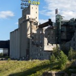
A visit to the Mill City Museum (704 S. Second St.; 612.341.7555), built into the ruins of the old Washburn “A” Mill along the Mississippi River, is a captivating experience, thanks to creative exhibits like the 8-story Flour Tower and great views of the river from the 9th floor observation deck.
Minnehaha Park (4801 S. Minnehaha Park Drive; 612.230.6400) is an oasis within the city, and the place with the 53-foot high falls made famous by Henry Wadsworth Longfellow’s poem, Song of Hiawatha. There are short hiking trails along the falls (with a moderate incline), and a trail you can follow along Minnehaha Creek to the Mississippi River.
The Mississippi National River and Recreation (651.290.4160) runs for 72 miles through the Twin Cities. While the National Park Service owns very little land along the corridor, it has many programs to help connect people to the river. On their website, they have a complete listing of places to enjoy the river. One of the sites they manage is Coldwater Spring (5601 Minnehaha Park Dr. S.), a restored oak savanna and prairie complex that has long been sacred to area Indian nations (the Dakota called it Mni Sni); it also supplied drinking water to For Snelling for about a hundred years. The site now has several walking trails that weave through the prairie.
Riverfront Parks on the West Bank
Minneapolis has several parks along the river (612.230.6400 for info) . From upriver to downriver on the west bank, they include:
- North Mississippi Regional Park (5114 N. Mississippi Dr.)
- Orvin “Ole” Olson Park (2325 W. River Rd.)
- Mill Ruins Park (103 Portland Ave. South)
- Gold Medal Park (2nd St. and 11th Ave. South)
- Bohemian Flats (2200 W. River Parkway); once the site of an immigrant neighborhood.
- Mississippi Gorge Regional Park (W. River Parkway)
- Minnehaha Park (4801 S. Minnehaha Park Dr.); see above
Exploring Near the River: East Bank
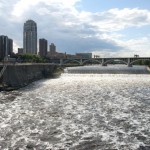
St. Anthony Falls is the only waterfall on the Mississippi, even after it has been greatly altered by engineers. The falls were created some 12,000 years ago when the glaciers melted; it would have been quite a sight then at a half-mile wide and 175 feet tall. The Dakota called the falls, Owahmenah (falling water), while the Ojibwe named it Kakabikah (severed rock). The falls have been retreating about 4 feet a year since they were created. The riverbed in this stretch is formed by a limestone cap that sits atop shale and sandstone. As water finds ways around the limestone, it wears away the sandstone underneath; eventually a gap develops under the limestone, which will cause a chunk of it to break loose and collapse, thus moving the falls a little further upriver. When Father Hennepin named the falls in 1680, they were about 1500 feet downriver from their current location. By the mid-1800s, only 1200 feet of limestone cap remained up river; continued erosion would (will) eventually turn the falls into rapids. As water power from the falls was the city’s lifeblood, industry leaders made an attempt in 1869 to stabilize the falls. Unfortunately, their attempt nearly destroyed the falls they were trying to save, so they asked the federal government for emergency help. The Army Corps of Engineers ended up building a concrete apron over the falls (after three years of failed attempts and $1 million) and that’s what we see today.
The Weisman Art Museum (333 E. River Parkway; 612.625.9494) overlooks the Mississippi River from the east bank of the University of Minnesota campus. The building, designed by celebrity architect Frank Gehry, houses a collection that focuses mostly on modern art.
Riverfront Parks on the East Bank
From upriver to downriver, parks on the east bank include:
- Marshall Terrace Park (2740 Marshall St. NE)
- Gluek Park (2000 Marshall St. NE)
- Sheridan Memorial Park (1300 Water St. NE)
- Boom Island Park (724 Sibley St. NE)
- Nicollet Island Park (40 Power St.)
- Father Hennepin Bluffs Park (420 Main St. SE)
- Water Power Park (204 Main St. SE)
- East River Flats Park (360 E. River Rd.)
- East Sand Flats (E. River Rd., just upriver from the Meeker Island Lock and Dam ruins)
Elsewhere in Minneapolis
Northwest of downtown, the Minnesota African American Heritage Museum & Gallery (1256 Penn Ave. N.) celebrates the art, culture, and lives of African Americans in Minnesota with exhibits (free) and live programs. The gallery is on the fourth floor of the building; free parking is available in the building’s garage.
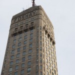
The Foshay Tower (now the W Hotel; 821 Marquette Ave. South) is an Art Deco masterpiece that helped bankrupt its namesake. Inspired by the Washington Monument, multi-millionaire Wilbur Foshay built the 32-story tower to celebrate his success in the utilities business. For the grand opening in 1929, Foshay threw a lavish 3-day party that attracted dignitaries from around the country, at least in part because he paid for their travel. Two months later, the stock market crashed, the Depression began, and Foshay went broke. He was eventually convicted of securities fraud and served time in federal prison. Upon returning to civilian life, he finished his career working for the Chamber of Commerce of Salida, Colorado for $1,800 a year and was by all accounts quite happy to do it. He died on the 28th anniversary of the tower’s dedication in a Minneapolis nursing home. The building is a gem, accented with Italian marble, African mahogany, gold-plated knobs, and many other features. You are welcome to wander around the lobby, and there’s an observation deck with great views of the area (fee).
The Walker Art Center (1750 Hennepin Ave.; 612.375.7600) is a nationally-known museum that showcases contemporary art. Also check out the adjacent Minneapolis Sculpture Garden.
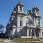
The Basilica of St. Mary (88 N. 17th St.; 612.317.3400) is a grand Beaux Arts structure southwest of downtown. Ground was broken in 1907 and the first mass held in 1914, but the structure wasn’t completed until 1926. The imposing square dome rises about 280 feet above street level.
The Minneapolis Institute of Arts (2400 3rd Ave S; 612.870.3000; free) has an expansive collection that you would require multiple visits to see in its entirety. For art with a river focus, check out the Don and Diana Lee Lucker Gallery for several paintings of the river.
Just down the street from the Minneapolis Institute of Arts, the Hennepin County History Museum (2303 Third Ave. South; 612.870.1329) has several rooms of exhibits on the region’s history and a very good research library.
Birchbark Books (2115 W. 21 St.; 612.374.4023) is an independent bookstore that specializes in offering its customers an intimate experience; they have a good collection of fiction and books by/about Native Americans. The store is owned by accomplished author Louise Erdrich.
Minnesota is home of the largest community of Somalis in the US, so it’s a natural that Minneapolis is where you’ll find the Somali Museum of Minnesota (2925 Chicago Ave.; 612.886.3723). The collections features hundreds of objects of traditional Somali arts, and the museum also hosts cultural programs.
Getting on the River
Paddle Bridge offers guided kayak tours on the Mississippi. They run tours on different segments of the river, each one lasting 2-3 hours.
You can rent a kayak through the PaddleShare program operated by the National Park Service and its partners (Friday-Sunday). In Minneapolis, you can rent from North Mississippi Regional Park and paddle 3.9 miles to Boom Island or rent at Mississippi Watershed Management Organization and paddle 1.7 miles to Boom Island.
Day cruises on the Minneapolis Queen (952.474.8058) depart from Bohemian Flats Park (2150 W. River Parkway S.) for 90-minute sightseeing cruises through Minneapolis. They also offer cruises with a pizza, happy hour, and Mexican food theme.
Take a ride on the solar-powered Minneapolis Water Taxi (612.801.1921). Call ahead to schedule a one-hour tour on the river above St. Anthony Falls.
Tours
Take a narrated walking tour along the riverfront or other parts of the city; contact the Mill City Museum (704 S. Second St.; 612.341.7555) for details and a schedule.
Gray Line runs bus tours around the Twin Cities (612.929.8687), like the 3-hour tour showcasing the highlights of the metro area and the 6-hour Minneapolis experience that includes a cruise on the Mississippi River (seasonal).
Entertainment and Events
Farmers Market
Farmers markets generally operate from May through December:
- Lyndale Market: Daily 6am-1pm (312 E. Lyndale Ave. North)
- Government Center Market: Tuesdays 9am-3pm (300 S. 6th St.)
- Nicollet Mall (downtown): Thursdays 6-6
Festivals
In the Heart of the Beast Puppet and Mask Theater (1500 E. Lake St.; 612.721.2535) combines the spirit of street theater with the art of mask and puppet dramas to create visually and emotionally moving shows.
Arts & Culture
The much-admired Guthrie Theater (818 S. 2nd St.; box office phone: 612.377.2224) occupies a prominent location along the west bank of the Mississippi River in a highly visible building designed by celebrity architect Jean Nouvel. You can walk around the building free of charge when it’s open (don’t miss the Endless Bridge on level 5), but the theater also offers guided tours (usually on weekend mornings; fee charged). It is, of course, a functioning theater, too, with three stages hosting dozens of shows throughout the year; you can even grab a bite to eat or enjoy a drink at a couple places in the building.
Minneapolis has a diverse performing arts scene; many of the theaters are concentrated downtown along Hennepin Avenue in four theaters: the Orpheum Theatre, the New Century Theatre, the State Theatre, and Pantages Theatre. You can check a single website to find out what is being performed at these theaters.
More events and festivals are listed on the Twin Cities Overview page.
**Minneapolis is covered in Road Tripping Along the Great River Road, Vol. 1. Click the link above for more. Disclosure: This website may be compensated for linking to other sites or for sales of products we link to.
Where to Eat and Drink
Minneapolis has more beer than many places have water. Go brewery hopping around the city (but don’t drive yourself around; use taxis or a ride share service like Lyft or Uber). Scan through The Ultimate Guide to All the Breweries in Minneapolis and St. Paul, which lists every craft brewery in Minneapolis and even places them on a map for you.
The Twin Cities have their fair share of foods that come with a heavily local slant. One of the more famous concoctions is the juicy lucy, a hamburger stuffed with cheese. They’ve been serving them here for decades, while the rest of us are Johnny-come-latelies. Jess Fleming, food writer for the St. Paul Pioneer Press, recommends Matt’s Bar (3500 Cedar Ave. S.; 612.722.7022) for a taste of the original (with American cheese) or the Blue Door Pub (3448 42nd Ave. S., 612.315.2470 or 1514 Como Ave. SE; 612.367.4964) if you’re more adventurous (they have many cheese options, including blue cheese); you’ll see it on many menus, though.
If you can’t find a place to satisfy your palate in Minneapolis, then you’re just not trying. For an overview of the local food scene, check out Mpls.St.Paul Magazine. Below are a few places that are either long-time favorites or that offer a predictably good experience.
West Bank
Pyres Brewing Company (1401 W. River Rd. N; 612.787.7937) is right on the Mississippi just upriver of downtown, which makes for a scenic spot to enjoy a locally-brewed beer.
Enjoy a fancy cocktail in the Prohibition Bar (at the W Hotel, 27th floor; 821 Marquette Ave. South; 612.597.2413), the former penthouse of riches-to-rags utilities magnate Wilbur Foshay. The Art Deco ambience is really cool, the drinks delicious (but expensive), the people watching is entertaining, and the views of the city great. Keys at the Foshay (114 S. 9th St.; 612.339.6399) serves up creative comfort food, especially for breakfast, in Art Deco elegance.
AUTHOR’S PICK: Sean Sherman and Dana Thompson offer a dining experience that is both familiar and eye-opening. Owamni by The Sioux Chef (420 1st St. S.; 612.444.1846) prepares food made from ingredients that are indigenous to Native America. You won’t find wheat flour or dairy but instead they feature ingredients such as pheasant and berries. The menu changes regularly. Reservations are a good idea.
Family-owned Murray’s Steakhouse (26 S, 6th Street; 612.339.0909) has been a favorite of locals since the end of World War II; expect classic steakhouse atmosphere at classic steakhouse prices.
Hell’s Kitchen (80 S. 9th St.; 612.332.4700) lurks in the bottom level of a downtown building, but the food is fun and creative and won’t break the bank. For a taste of Minnesota, try the walleye hash or mahnomin (wild rice) porridge.
Immerse yourself in the Old World at Brit’s Pub (1110 Nicollet Nall; 612.332.3908); the food is delicious, portions generous, the beer list is impressive, and the English Garden Park pretty darn cool.
Pizza Luce (downtown location at 119 N. 4th St.) is another long-time favorite in town; you can get a good traditional pizza or go for something new, like the curried coconut butternut squash pizza (in season).
East Bank
The Nicollet Island Inn (95 Merriam St; 612.331.1800) will take you from comfort food to comforting food. Located on the historic Mississippi River island for which it is named, dining at the Nicollet Island Inn is a sumptuous affair, complete with white tablecloths, top-notch service, and succulent food. If you aren’t in the mood for a splurge, go at lunch when the food is still excellent but costs much less.
Ukrainian-born Wasyl and Anna Kramarczuk founded a bakery and sausage shop in Minneapolis that is still going strong 50 years later. Kramarczuk’s East European Deli (215 E. Hennepin Ave.; 612.379.3018) specializes in dishes from eastern Europe, including pierogi and Ukrainian sausage. I love the garlicky Krakowska sandwich. You can dine in the restaurant or visit the deli counter to take something with you.
Al’s Breakfast (413 14th Ave. SE; 612.331.9991) in Dinkytown, the neighborhood next to the University of Minnesota, is a tiny place with a big reputation for good and hearty breakfasts; don’t show up starving, as you’ll likely have to wait a bit for one of the few seats.
The Food Building in northeast Minneapolis (1401 Marshall St. NE) is a dream come true for foodies who live for quality items from small producers. Wander the halls to watch artisan cheese makers, bakers, and salami makers at work.
Where to Sleep
The following places are independently owned and will keep you within easy reach of the river. If the places listed below don’t work out for you, consider booking a place through Airbnb. You can often find a place for less money than a standard hotel room, and you will usually be in the middle of a neighborhood instead of an island of chain hotels.
Downtown hotels are convenient and put you within walking distance of most everything you’ll want to see, but they can be expensive. Most also charge extra for parking, which can run an extra $20-$30 a day. The places below offer a different experience from standard chain hotels.
Bed-and-Breakfasts
If you’d prefer a higher end experience, 300 Clifton Bed & Breakfast near Loring Park (300 Clifton Ave.; 612.281.1550) rents four rooms in a historic mansion in a neighborhood of historic mansions near the Walker Art Center. Rooms include a continental breakfast, but you can upgrade to a four-course gourmet breakfast.
Moderate and up
Located in Minneapolis’s theater district, the Chambers Hotel (901 Hennepin Ave.; 612.767.6900) rents modern rooms in a historic building. Rooms tend to be better a bargain than other downtown hotels.
The Graduate Minneapolis (615 Washington Ave. SE; 612.379.8888), rents affordable rooms with a modern and whimsical twist. The hotel sits in the middle of the University of Minnesota campus and along the METRO light rail Green Line.
The historic Nicollet Island Inn (95 Merriam St.; 612.331.1800) offers luxury accommodations on the island of the same name within walking distance of downtown.
Getting There
See the Twin Cities Overview for information on arriving in the region and getting around.
Where to Go Next
Heading upriver?
- On the west bank check out Brooklyn Center.
- On the east bank check out Fridley.
Heading downriver? Check out the St. Paul guide.
Community-supported writing
If you like the content at the Mississippi Valley Traveler, please consider showing your support by making a one-time contribution or by subscribing through Patreon. Book sales don’t fully cover my costs, and I don’t have deep corporate pockets bankrolling my work. I’m a freelance writer bringing you stories about life along the Mississippi River. I need your help to keep this going. Every dollar you contribute makes it possible for me to continue sharing stories about America’s Greatest River!
Minneapolis Photographs
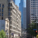
- Downtown Minneapolis
- Mill City Museum
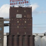
- Old Pillsbury Mill
- The picture everyone takes at the Minneapolis Sculpture Garden
- Basilica of St. Mary
- Minnehaha Falls
- Foshay Tower
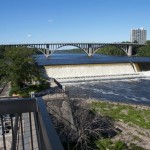
- Ford Dam, Minneapolis
A Song for Minneapolis
Minneapolis by Mark Mallman (2011)
©Dean Klinkenberg, 2024, 2021, 2018,2013,2011
