Introduction
Lake Itasca may be the source of the Mississippi, but the true Headwaters of the Mississippi River is the dense web of lakes and streams in northern Minnesota: Leech Lake, Mille Lacs, Swan River, Big Sandy Lake, Crow Wing River, plus hundreds of other bodies of water. All eventually join with the Mississippi River, feeding it as it grows. For the first three hundred miles of its existence, the Mississippi River is a small stream, sometimes swampy, whose flow passes directly through several lakes:
- Lake Irving
- Lake Bemidj
- Stump Lake
- Big Wolf Lake
- Lake Andrusia
- Cass Lake
- Lake Winnibigoshish
- Little Winnibigoshish Lake
- Blackwater Lake
- Jay Gould Lake
- Rice Lake (at Brainerd)
Some, like Stump Lake, exist because of human engineering, but the rest were around before we built dams, even if many have water levels that are artificially high because of the Mississippi Headwaters Dam Project.
From 1884 to 1912, the US Army Corps of Engineers built dams at six northern Minnesota lakes (Winnibigoshish, Leech, Pokegama, Big Sandy, Gull, and Cross Lake/Pine River), hoping the resulting reservoirs would stabilize water levels on the Mississippi River below Saint Paul. The dams did give a bit of a boost to the Mississippi through the Twin Cities but not further south, a point that became irrelevant after the lock and dam system was built in the 1930s. Even though the dams failed to achieve their original purpose, they are maintained today, primarily because they improve recreational use of these lakes.
The higher water levels, however, had some serious, negative consequences. Not only did the higher water submerge thousands of acres of reservation lands, it also damaged fish populations and the wild rice fields that grew around the edges of the lakes. A century of negotiations and lawsuits were finally resolved (mostly) at the end of the 20th century, the end result of which is that the Corps now manages water levels in a way that is more favorable for wild rice and for fish.
Visitors who follow the Mississippi River through the lakes region will find plenty to do and see. There’s no reason to stay in your car or room when you visit this part of the state. In summer, there are many opportunities for fishing, hiking, boating, biking, and mosquito-swatting. In winter, cross-country skiing, snowshoeing, snowmobiling, ice fishing, and complaining about people who complain about the cold are popular activities. There are many places to camp and a few remaining resorts, but mostly you’ll find an area of wide open spaces and big lakes with few permanent residents that can nonetheless get surprisingly busy with visitors during July and August. It’s a great place to get in some nature time without having to go totally rustic.
Lake Irving to Stump Lake
Visitor Information
This stretch has three lakes and includes the city of Bemidji. You’ll find travel information in the Bemidji post. Incidentally, the Mississippi River reaches its most northerly point about five miles east of Bemidji.
The Lakes
Lake Irving
Surface Area: 613 acres
Maximum Depth: 19 feet
Fish species: crappie, bluegill, largemouth bass, walleye, northern pike, sunfish, rock bass, perch, muskie, perch.
Lake Bemidji
Surface Area: 6,420 acres
Maximum Depth: 76 feet
Fish species: crappie, walleye, northern pike, sunfish, perch, muskie.
Stump Lake
Surface Area: 290 acres
Maximum Depth: 24 feet
Fish species: panfish, walleye, northern pike, yellow perch, largemouth bass, muskie.
Stump Lake was created when the power dam was completed.
Stump Lake to Cass Lake
Much of the land in this section is either part of Chippewa National Forest or the Leech Lake Band of Ojibwe reservation.
The Lakes
Big Wolf Lake
Surface Area: 1,107 acres
Maximum Depth: 55 feet
Fish species: muskie, crappie, walleye, northern pike, largemouth bass, rock bass, bluegill, and perch.
Andrusia Lake
Surface Area: 1600 acres
Maximum Depth: 60 feet
Fish species: muskie, crappie, walleye, northern pike, largemouth bass, rock bass, and perch.
Cass Lake
Surface Area: 15,596 acres
Maximum Depth: 120 feet
Fish species: walleye, northern pike, perch, bass
The Ojibwe called this lake Gaa-miskwaawaakokaag (red cedar lake) but early Europeans named it for Lewis Cass, who led a group of explorers to this spot in 1818 when he was Governor of the Michigan Territory. Cass believed, incorrectly, that this lake was the source of the Mississippi River. On the western side of the lake, Star Island is an island within a lake that has its own lake: 199-acre Lake Windigo. The island has been a sacred spot to Native Americans for at least 1,500 years. Today, most of the island is part of the Chippewa National Forest. Knutson Dam maintains water levels in Cass Lake chain.
Exploring the Area
A surveyor’s error left a 40-acre section of virgin forest untouched by the logging industry. This tract is preserved today at Chippewa National Forest as The Lost Forty. You can hike through the tract and explore the varied ecosystem where a few old red and white pines mix in with deciduous trees and lush undergrowth of ferns and Solomon’s seal. The tract is northwest of Wirt, about two miles north of the intersection of county roads 29 and 26.
The Village of Cass Lake
The village of Cass Lake (2010 population = 770) is on the southern tip of the lake. It has a long history. The French built a trading post here in 1761 that was later taken over by the Hudson Bay Company; Jacob Astor’s American Fur Company bought it in 1821. Cass Lake was part of the Red Lake-Leech Lake Trail, an old water route used by Native Americans, fur traders, and trappers. The Great Northern Railroad arrived in 1898 and kicked off a logging boom. The tribal headquarters for the Leech Lake Band of Ojibwe is located in the village.
Lyle’s Logging Camp has impressive replicas of a 19th century logging camp, with buildings that include a bunkhouse and a dining hall. The Cass Lake Museum, housed in an old railroad depot, presents an overview of the village’s history. The Supervisor’s Office for Chippewa National Forest is also located in Cass Lake. Aside from a good place to get information on the forest, the building itself—constructed in 1935 from native materials like red pine—is worth a tour.
Entertainment and Events
Several times a year, the village hosts a pow wow, usually around Memorial Day, July 4th, and Labor Day.
Where to Eat
Canal House (at Stony Point Resort near the village of Cass Lake) serves freshly prepared meals at reasonable prices.
Where to Stay
Camping
Chippewa National Forest maintains several campgrounds. All sites are basic, meaning there are pit toilets and no electricity or showers, unless otherwise noted:
- Bimijiwan (formerly Knutson Dam:) Recreation Area 14 sites
- Norway Beach: four loops of forested, moderately sized sites; some lakeside sites in Wanaki and Cass Lake loops; the only electric sites are in the Chippewa loop; all loops have showers.
- Winnie Campground; off-the-beaten path on the western shore of Lake Winnie, but one of the few with blacktop all the way to it; some sites on the water; deep forest cover; large rustic sites.
Resorts
Oak Haven Resort is a full-service resort on the Mississippi River between Big Wolf Lake and Lake Andrusia.
Cass Lake is surrounded by resorts, but Norway Beach Resort stands out for the way it has maintained the look and feel of early 20th century resort (it was founded in the 1920s) while modernizing the inside of its ten one- to three-bedroom cabins, all while offering plenty of things to do. Most of the cabins are on Cass Lake, but the few that are set further back still have good views.
If you want to stay on the Mississippi River, there are three resorts clustered together on the river between Cass Lake and Lake Winnie.
- McArdle’s Resort dates to 1925; they have 23 cabins in a range of sizes (one bedroom to seven bedrooms) and styles from small and simple to large with many amenities; they also have four basic motel rooms with a shared bath.
- Four Seasons; 17 cabins and 7 condos that range from two to four bedrooms; all are well-maintained and modern; meals can be arranged; good view of where the Mississippi enters Lake Winnie.
- Becker’s Resort and Campground; a quaint and quiet resort with 16 updated cabins, many covered with sparkling white wood siding that range from two to four bedrooms plus a six-bedroom, four-bathroom house.
Cass Lake to Blackwater Lake
This stretch is sparsely populated. Bena and Ball Club are small villages within the Leech Lake reservation; Deer River offers more options for things to do.
The Lakes
Lake Winnibigoshish
Surface Area: 56,470 acres
Maximum Depth: 70 feet
Fish species: walleye, northern pike, muskie, perch, crappie, and bass.
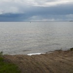
The Ojibwe must have felt deep affection for this lake, given that its name translates as something like “miserable dirty water lake.” Winnie (as it’s known up here) can have its own weather. Minor winds can stir up water into waves that can easily capsize a small boat. Wind patterns can change without warning. Don’t underestimate its power. Keep your life jackets on, and, if you are in a canoe, paddle near shore instead of trying to cross open water. But don’t take my word for it. Ask the people who live around the lake. When it was completed in 1884, the Lake Winnie Dam raised water levels several feet.
Little Winnibigoshish Lake
Surface Area: 945 acres
Maximum Depth: 28 feet
Fish species: bluegill, northern pike, rock bass, walleye, yellow perch.
Blackwater Lake
Surface Area: 674 acres
Maximum Depth: 72 feet
Fish species: walleye, bluegill, northern pike, muskie, perch, crappie, and largemouth bass, sunfish, rock bass.
Exploring the Area
Schoolcraft State Park is on the Mississippi River just southwest of Grand Rapids. You can explore the two miles of hiking trails or take your boat on the Mississippi River. The park feels isolated and is typically a quiet place.
The Village of Deer River
First called Itasca City, Deer River (2010 population = 930) was also once known as “a hole in the swamp” and the “longest whiskey row in the state.” After coming to life as a trading post operated by Frank Vance, the city was literally carved out of the forest in the late 19th century. In its early life, it had a couple of hotels, a general store, and plenty of saloons. The city’s dirt streets were dusty in summer, muddy in spring, and drifted with snow in winter. Elevated wooden sidewalks allowed residents to walk around town above the swamp; they were replaced by cement sidewalks in 1914.
Logging was the early lifeblood of Deer River. Nearby White Oak Lake was often used as a holding area for cut timber before the logs were driven down the Mississippi River to Minneapolis for processing. The Itasca Lumber Company had 17 camps employing 3,000 men in the area; most of the workers were French Canadian and Scandinavian. One million feet of pine logs were driven downriver during a typical year.
After the forests were harvested, some of the land was sold cheaply by the lumber company to former workers who bought plots and settled on them. Some of those plots were converted to farms, but northern Minnesota is a tough place to make a living from agriculture. Logging remains a major industry in the area, but the harvesting of tress is managed differently. Rajala Timber Company is still one of the biggest employers in the area. Tourism also accounts for a significant chunk of the local economy.
Where to Eat
Gosh Dam Place is the place to go to brag about your catch or share the misery of a catchless day. They have a big menu of standard bar food (burgers, steak, fish, pizza) that is a bit pricey but tastes good.
Where to Stay
Camping
Chippewa National Forest manages many campsites in this region, too. The sites are in wooded areas with mature trees and spacious. All sites are rustic with vault toilets, no showers, and no electricity unless otherwise noted.
- Deer Lake: two campground loops; swimming beach.
- East Seelye Point: smaller campground with most sites near the water; swimming beach.
- Mosomo Point: attractive sites, many with water views.
- O-Ne-Gum-E: next to the highway; a popular campground; some electric sites.
- West Seelye Bay: 22 sites.
- Williams Narrows: 17 sites.
- Tamarack Point Campground: 31 attractive sites in wooded areas with room to spread out; on Lake Winnie.
- Winnie Dam Recreation Area: 22 large, wooded sites with electricity.
- Mississippi and Leech Access: primitive camping; boat ramp.
Schoolcraft State Park has 28 rustic, spacious sites among tall trees; sites 6-14 are closest to the river; there are also two canoe-in sites.
Budget Lodging
Gosh Dam Place has 13 medium-sized rooms that are simple and well-tended; each has a microwave and small fridge; there is a store on-site, as well as a bar and restaurant.
Resorts
Big Winnie Resort is easy to spot, with its historic building painted in bright shades of red, white, and blue. They have two cozy, fully updated cabins open all year; the bathroom is a short walk outside to the main building. There is also a general store on-site.
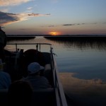
High Banks Resort has it all: 12 updated cabins and a small campground on an actual high bank with great views of Lake Winnie—especially at sunset—an onsite bar/restaurant, recreation opportunities galore, and a rich history that dates to the 1920s.
Little Winnie Resort is on a scenic location on Little Winnie Lake, which otherwise has no development around it. Most cabins have been updated; all are cozy and attractive.
Moderate and up
White Oak Inn and Suites, just down the road a piece from the casino of the same name, has 49 hotel-style rooms, each with microwave, coffee, and small fridge.
Blackwater Lake to Grand Rapids
Visitor Information
See the Grand Rapids post for travel information.
The Lakes
Jay Gould Lake
Surface Area: 537 acres
Maximum Depth: 33 feet
Fish species: walleye, black crappie, bluegill, largemouth bass, northern pike, rock bass, yellow perch.
Grand Rapids to Brainerd
Visitor Information
For travel information on this section, see the posts for Sandy Lake, Aitkin, the Cuyuna Iron Range, and Brainerd.
The Lakes
Rice Lake (at Brainerd)
Surface Area: 322 acres
Maximum Depth: 25 feet
Fish species: Black crappie, bluegill, largemouth bass, northern pike, rock bass, smallmouth bass, walleye, yellow perch.
Community-supported writing
If you like the content at the Mississippi Valley Traveler, please consider showing your support by making a one-time contribution or by subscribing through Patreon. Book sales don’t fully cover my costs, and I don’t have deep corporate pockets bankrolling my work. I’m a freelance writer bringing you stories about life along the Mississippi River. I need your help to keep this going. Every dollar you contribute makes it possible for me to continue sharing stories about America’s Greatest River!
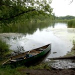
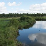
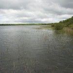
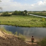
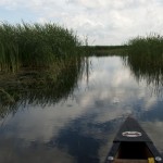
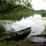
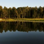
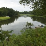
Photographs from the Land Between the Lakes
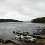
- Mississippi River near Little Winnie Lake
- Mississippi River at Little Winnie Lake inlet
- Lake Winnie
- Mississippi River at Lake Winnie inlet
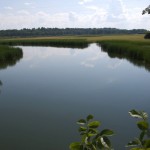
- Mississippi River east of Bemidji
- Mississippi River at Cass Lake outlet
- Mississippi River near Wolf Lake
- Mississippi River near Wolf Lake
- Happiness: Mississippi River east of Bemidji
- Hanging out on the upper, upper Mississippi River
- Mississippi River east of Bemidji
- Mississippi River at its most northerly point
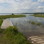
- Mississippi River at Lake Bemidji outlet
- Mississippi River at Lake Bemidji outlet
A Song for the Land Between the Lakes
Ten Thousand Lakes by Kid Dakota (2004)
©Dean Klinkenberg, 2024, 2021, 2018,2013,2011
